 Metadata catalogue
Differential Global Positioning System receivers
Type of resources
Available actions
Topics
INSPIRE themes
Keywords
Contact for the resource
Provided by
Years
Formats
Representation types
Scale
Resolution
-
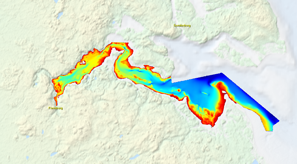
High resolution composite DTM based on multi beam surveys in Flensburg Bay. All data acquired in the years 2012-2013.
-
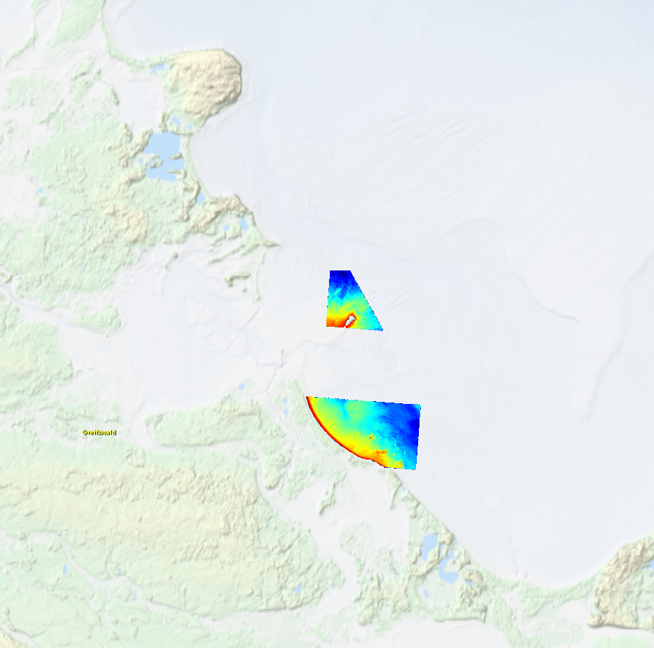
High resolution composite DTM based on multi beam surveys in German Bodden waters. All data acquired in 2016.
-
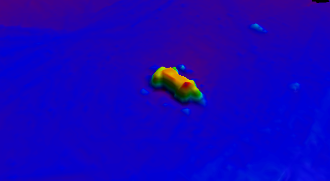
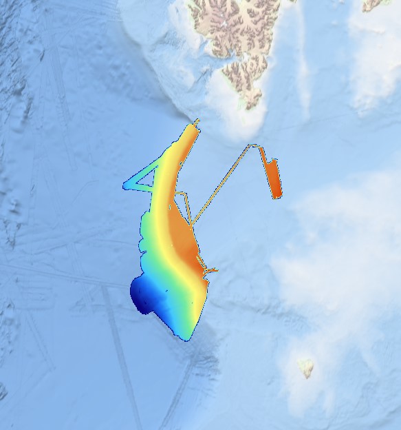
BalticSea_Maritime_Administration_Latvia Wreck found using MBES technique
-
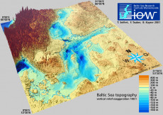
The data sets presented here provide a digitised topography of the Baltic Sea. Land heights and water depths have been calculated for two regular spherical grids from available data. Data set "iowtopo2" covers the whole Baltic Sea from 9° to 31° East and from 53°30’ to 66° North by (660 x 750) grid cells, see Fig. 1. The resolution is 2 minutes with respect to longitude, and 1 minute to latitude. This is approximately 1 nautical mile, or 2 km resp. The region of the Belt Sea from 9° to 15°10’ East and from 53°30’ to 56°30’ North, see Fig 2, is comprised within data set "iowtopo1" with a twofold higher resolution (1 minute in longitude and 0.5 minutes in latitude corresponding to approx. 1 km). The data specify a representative average of the water depth or the land height of each grid cell, counted by negative and positive values in meters. Some statistical parameters allow a rough estimate of the reliability of the data. (Please be aware that data are rather uncertain in regions where strong gradients of the bottom relief occur, esp. the northern parts of the Baltic. There is an urgent need of further bathymetry data to become available for the Baltic beyond 59° North.) Since a common average of land heights and water depths lead to rather unsatisfying results with respect to the gridded shoreline, a landmask is proposed in both data sets. The landmasks were derived from the global high resolution shorelines GSHHS and RANGS, and used to get a "naturally looking" composite topography (z_topo see below). Citation: T. Seifert, F. Tauber, B. Kayser: 2001: "A high resolution spherical grid topography of the Baltic Sea – 2nd edition", Baltic Sea Science Congress, Stockholm 25-29. November 2001, Poster #147,
-
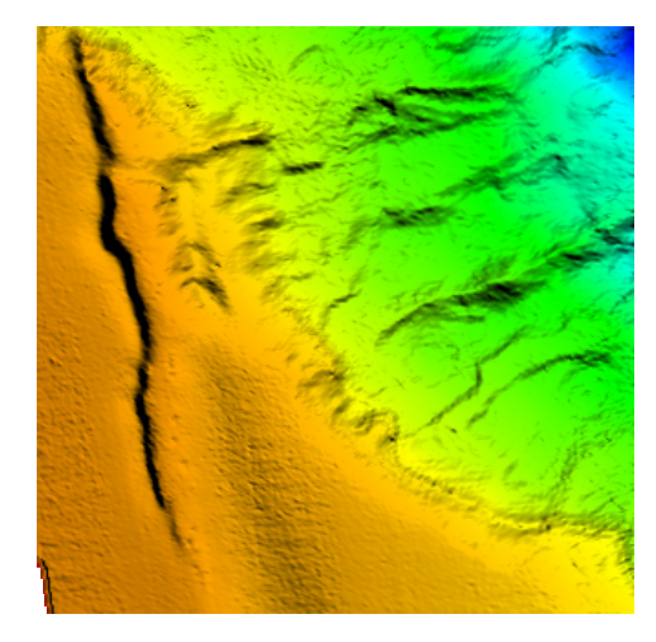
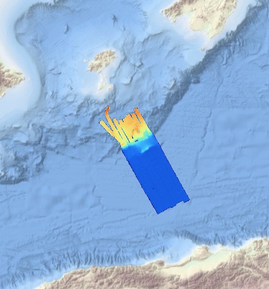
The data were acquired with a Simrad EM710 Multi Beam echosounder onboard the R/V Urania in order to cover the outer Malta Plateau and upper Malta Escarpment for a geological survey in the framework of EU FP7 project EUROFLEETS. The data were published in: Micallef, A., Georgiopoulou, A., Le Bas, T., Mountjoy, J.J., Huvenne, V., Lo Iacono, C., 2013. The Malta-Sicily Escarpment: Mass Movement dynamics in a sediment-undersupplied margin, in: Krastel, S., Berhmann, J.H., Volker, D., Stipp, M., Berndt, C., Urgeles, R., Chaytor, J.D., Huhn, K., Strasser, M., Harbitz, C.B. (Eds.), Submarine Mass Movements and Their Consequences. Springer International Publishing, Switzerland, pp. 317-328.
-
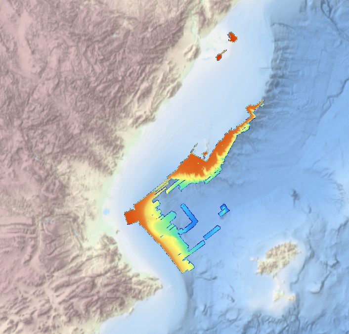
Grid processed for the purpose of the HR DTMs layer of EMODnet Bathymetry HRSM, October 2020
-
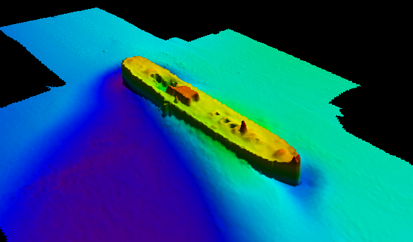
BalticSea_Maritime_Administration_Latvia Wreck found using MBES technique
-
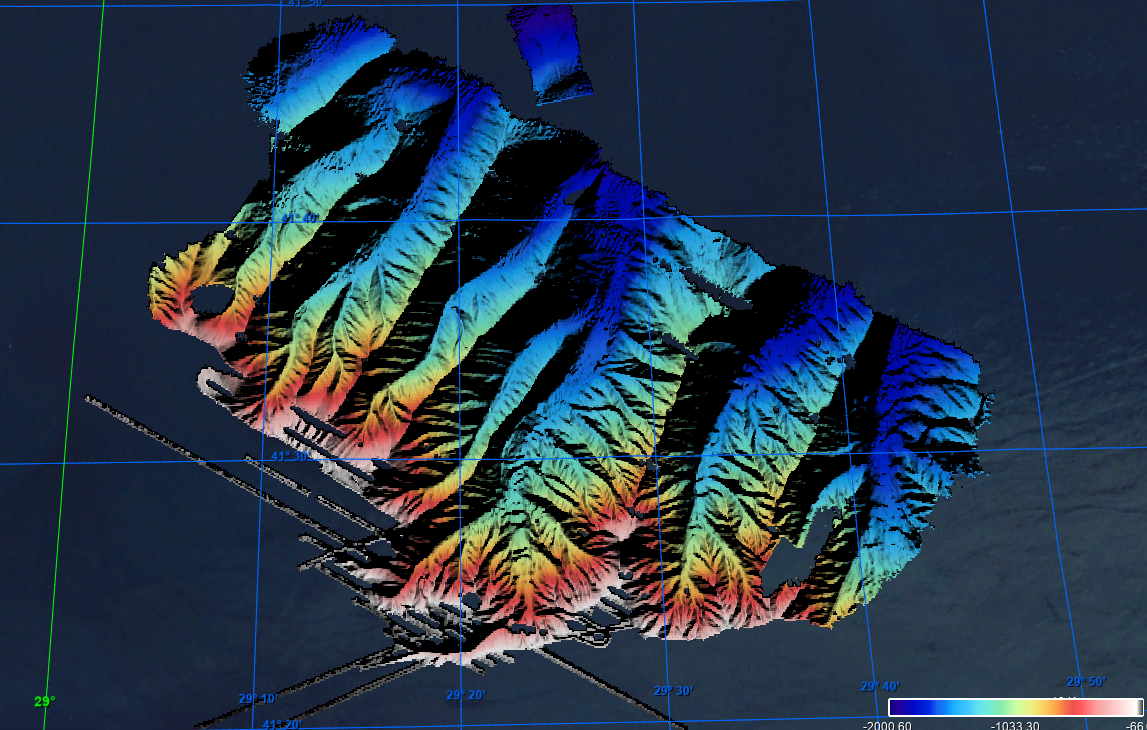
This composite Digital Terrain Model (cDTM) is a high resolution bathymetry dataset that covers CASCADES-I, CASCADES-II, COSTEM-1, COSTEM-2, COSTEM-3, COSTEM-4, FORMED-2, FORMED-4 and FORMED-6 cruises. Multibeam data acquired in 2008, 2009, 2010, 2011, 2013, 2014 and 2015 on board the R/V Sarmiento de Gamboa and the R/V García del Cid with an Atlas Hydrosweep DS-3 and an Elac Seabeam 1050D echo-sounder.
-
This composite Digital Terrain Model (cDTM) is a high resolution bathymetry dataset that covers SALTFLU cruise. Multibeam data acquired in 2012 on board the R/V OGS Explora with a Reason 8150 echo-sounder
-
Multibeam data acquired in 2007 during the SVAIS cruise on board the R/VHespérides with a Simrad EM12 echo-sounder