 Metadata catalogue
D6: Sea-floor Integrity
Type of resources
Available actions
Topics
INSPIRE themes
Keywords
Contact for the resource
Provided by
Representation types
Update frequencies
status
Scale
-
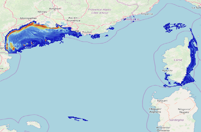
Data on physical impact intensity caused by trawling (bottom otter trawl, twin bottom otter trawl, dredges) estimated from VMS (Vessel Monitoring System) data cross-referenced with the Community Fishing Fleet Register and, for French vessels, with the landing data between 2008 and 2020. The data is constituted of 14 rasters in a resolution of 1’x1’ (13 annual abrasion rasters between 2008 and 2020 and 1 raster representing the 90th percentile of inter-annual abrasion). The abrasion is expressed in swept area ratio per year for each layer. This work enabled the study of the trawling impact on benthic communities in the Gulf of Lions and Corsica. The objective was to better describe the spatial and temporal repartition of trawling in this area and its potential impact on benthic habitats.
-
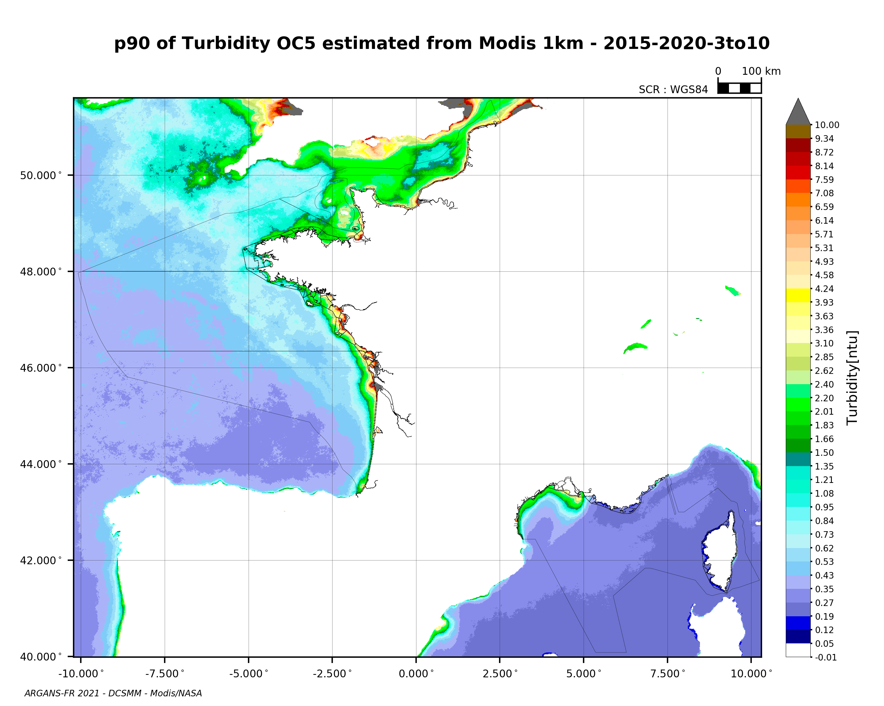
90th percentile of turbidity calculated during the productive period of the WFD (March-October) from 2015 to 2020, from the MODIS algorithm processed by OC5 IFREMER/ARGANS (Gohin et al 2002, Gohin 2011).
-
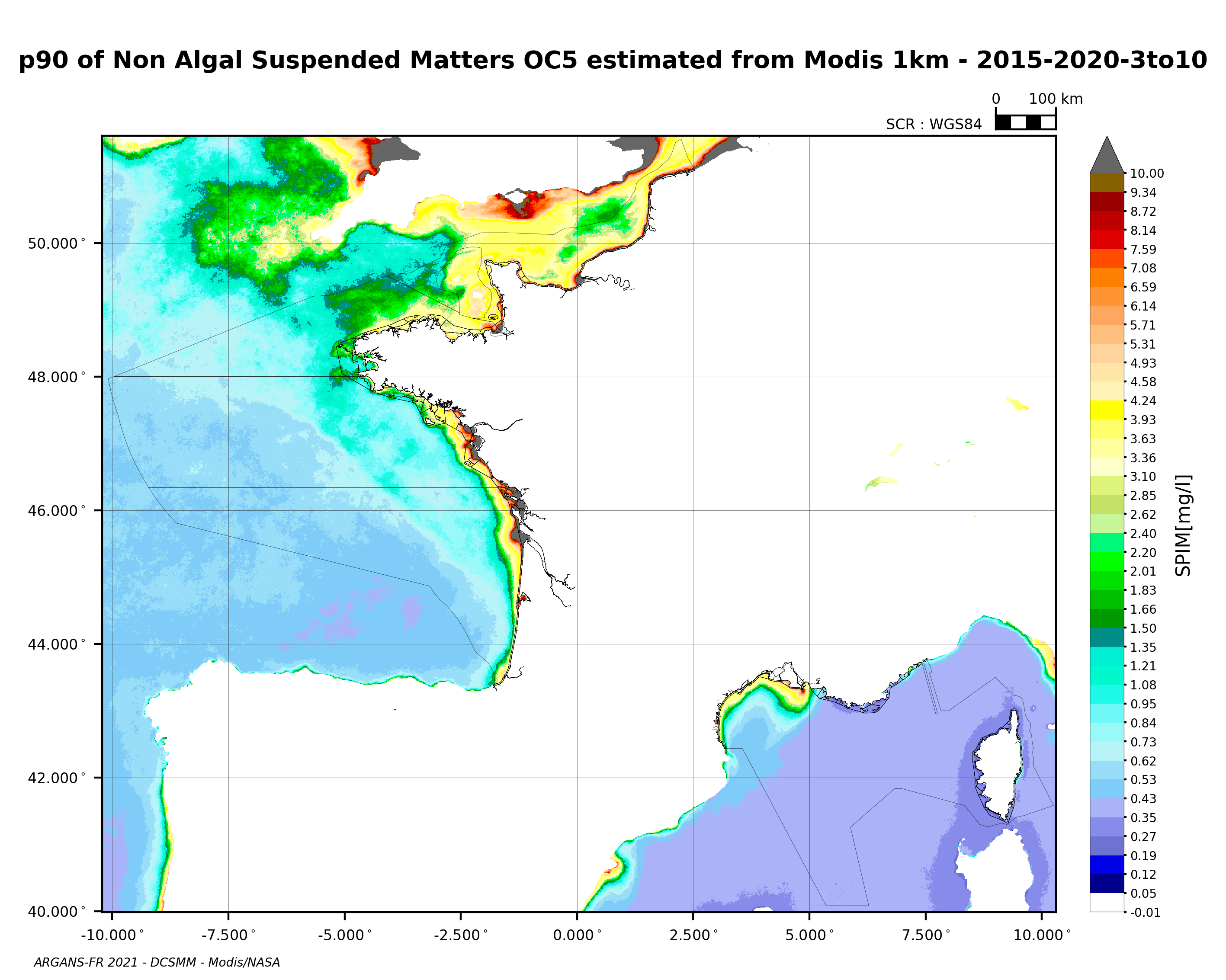
90th percentile of non-algal suspended matter calculated during the productive period of the WFD (March-October) from 2015 to 2020, from the MODIS algorithm processed by OC5 IFREMER/ARGANS (Gohin et al 2002, Gohin 2011).
-
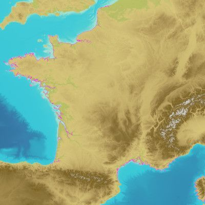
The land-sea limit corresponds to the Highest Astronomical Tide (HAT) in the case of a tide of coefficient 120 and under normal meteorological conditions (no offshore wind and mean atmospheric pressure of 1013 hPa). This geometric line is naturally defined as the intersection of a HAT model (extended to the coast and the top end of the upper estuary) based on the available Bathyelli surfaces, and a high-resolution digital terrain model of the coastal area. It corresponds to the highest limit of the intertidal area and takes into account, when they exist, the 3 administrative maritime limits which are: the transversal limit of the sea (LTM), the salt water limit (LSE) and the limit of maritime jurisdiction (LAM). This limit is measured (quoted) in relation to the local hydrographic chart datum and to the levels of reference for France (IGN69 and IGN78 for Corsica). Relations to other levels of reference (mean sea level and ellipsoid) are known. The land-sea limit product, mainly results from the exploitation of the two products Litto3D®/RGEALTI® and Bathyelli, and represents, with a metric resolution (1 to 5 metres), this theoretical entity by a set of 2D polylines describing the nature of the coast (artificial or natural, rocky or sandy, steep or flat, etc.). The method used for calculating the land-sea limit makes it possible to produce a continuous, homogeneous and spatially coherent limit on the entire French metropolitan coastal area.
-
DATRAS North Sea Bottom Trawl Survey