 Metadata catalogue
Currents
Type of resources
Available actions
Topics
Keywords
Contact for the resource
Provided by
Years
Formats
-
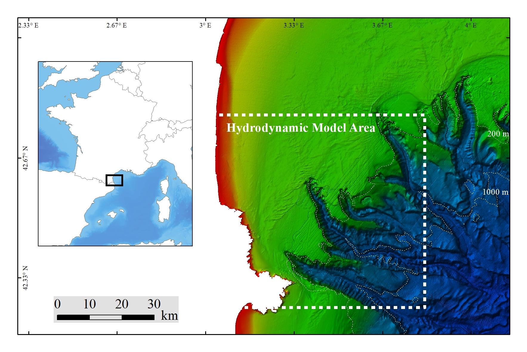
Extreme percentiles (1%, 5%, 95%, 99%) of bottom temperature and salinity, as well as (95%, 99%) of bottom currents, were modeled using SYMPHONIE on a numerical domain covering 65 × 60 km at a resolution of 80 m. The 10-m bathymetry used inside the Lacaze-Duthiers Canyon was collected during the CALADU_2021 cruise (https://doi.org/10.17600/18001575). Statistics of extreme values were derived from hourly fields simulated between November 1, 2012, and April 15, 2014. This period includes two contrasting winters: the winter of 2012–2013, which was cold with dense water cascading, and the winter of 2013–2014, which was warm. This dataset was produced to assess the probable distribution of habitats (habitat suitability modeling) for cold-water corals in the Lacaze-Duthiers Canyon at different resolutions as part of the European H2020 project REDRESS (Restoration of Deep-Sea Habitats to Rebuild European Seas, https://redress-project.eu/, Grant Agreement No. 101135492). SYMPHONIE is a component of the national service SIROCCO (research infrastructure ILICO). This dataset is related to the article "Mapping and Conservation of Cold-Water Corals in the Lacaze-Duthiers Canyon for Transboundary Management", submitted to Mediterranean Marine Science by Fabri et al. in 2025.
-
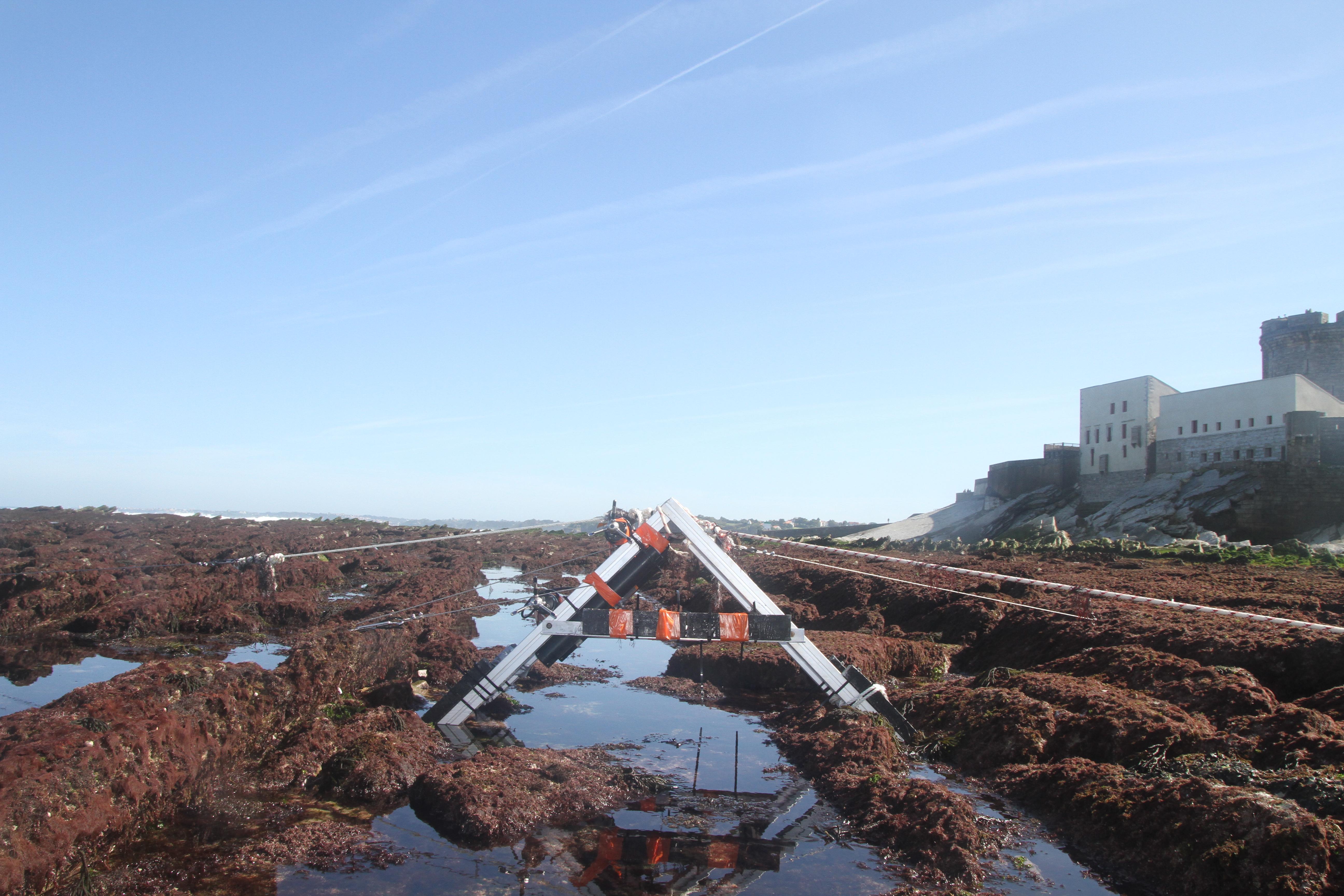
The database displays the field measurements recover during a one-week experiment in October 2021 on the Socoa's rocky platform, France. The general objective of the study was to evaluate the momentum balance over the rocky platform, in particular to quantifiy the combined effect of high seabed roughness and waves on the coupling between circulation, wave force and mean water level. The analysis is performed along a single cross-shore transect. The data include: - the cross-shore bathymetric profile - the time-series of integrated wave parameters, local mean water depth and wave-averaged currents over successive 30-min bursts - the depth- and wave-averaged momentum fluxes following the formulation proposed by Smith 2006 and Bruneau et al. 2011. The fluxes are median values obtained over significant wave height to depth ratio bins
-
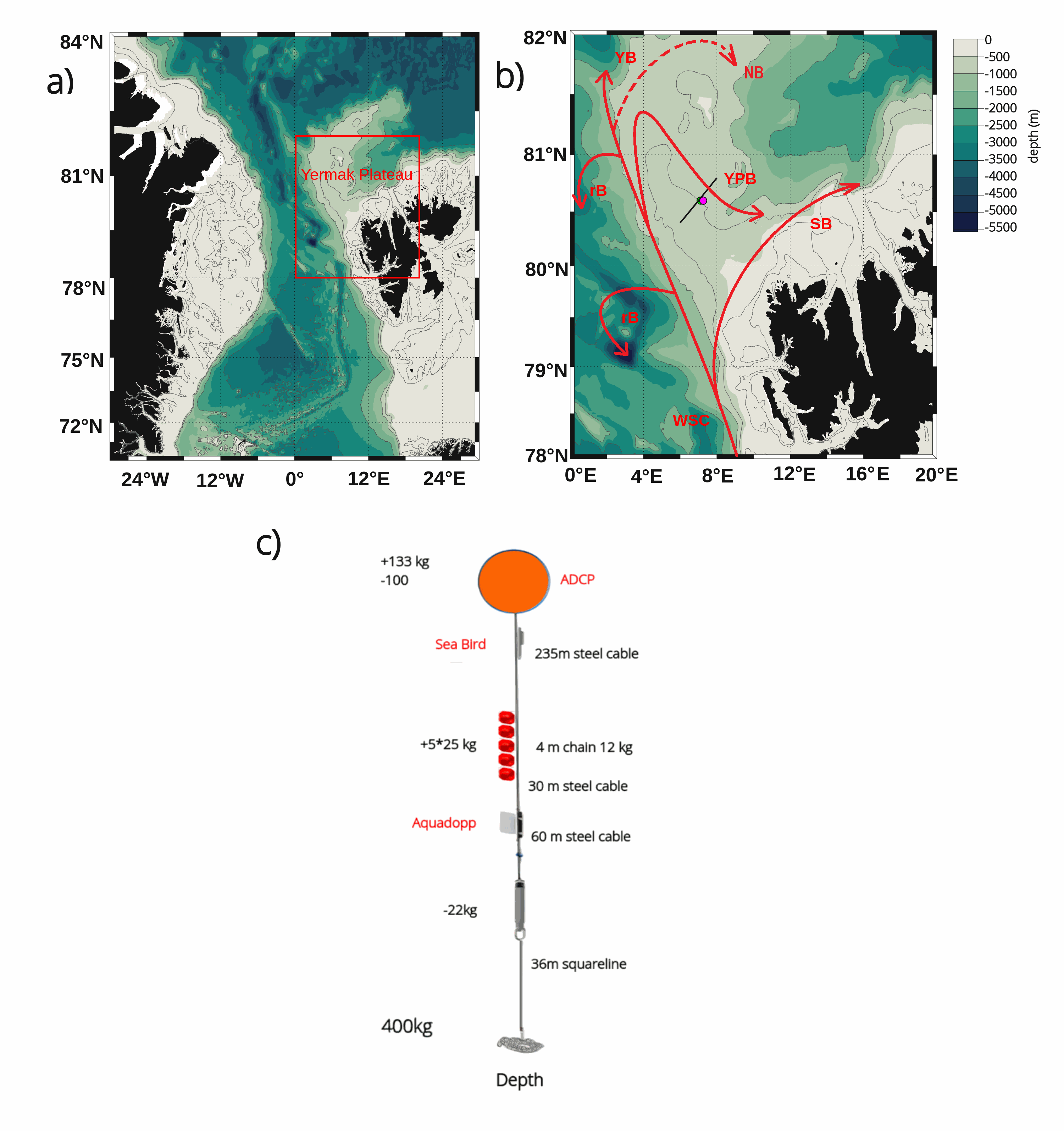
The mooring was deployed on 15 September 2017 from Norwegian Research Vessel Lance at 80.6°N and 7.26°E (depth of 730 m) in the Yermak Pass over the Yermak Plateau north of Svalbard. It comprised 3 instruments: an upward-looking RDI 75kHz, a Long Ranger Acoustic Doppler Current Profiler (ADCP) at 340 m with 16 m vertical resolution (25 bins of 16 m each) and a 2-hour sampling time; a Seabird SBE37 measuring temperature, salinity and pressure at 348 m with 10-minute sampling time; and an Aquadopp current meter at 645 m with a 2-hour sampling time. The mooring was retrieved on the 19 July 2020 by Norwegian Icebreaker K.V. Svalbard. The present dataset features: (i) the ADCP 50-hour smoothed daily velocities, conservative temperature and pressure time series interpolated every 10 meters within the 20-330m layer, (ii) the Aquadopp 50-hour smoothed daily velocities and pressure time series at 645 m; and (iii) the SBE37 50-hour smoothed daily conservative temperature, absolute salinity and pressure time series at 348 m.