 Metadata catalogue
Continental shelf
Type of resources
Available actions
Topics
Keywords
Contact for the resource
Provided by
Years
Formats
Representation types
Update frequencies
status
Scale
-
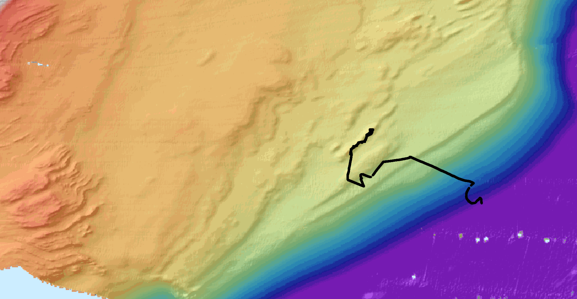
ROV3G scientific cruise is dedicated to the morpho-tectonic study of the ligurian shelf, through the acquisition of bathymetric data and optical images with HROV Ariane. This cruise took place on R/V Europe in october 2021, and constituted a pedagogic project for the students of Master 3G Recherche, Géologie et Géophysique, of Université Côte d'Azur (UCA), attached to Géoazur lab. The M2 students were in charge of the scientific project, they determined the goals of the cruise, took part in the acquisition and interpretation of the data. During the 3 days cruise, we acquired bathymetric data at shallow depth on the continental shelf offshore Santo Stefano al Mare and San Lorenzo al Mare, along the Ligurian coast. The bathymetry on the continental shelf exhibits morphologies that are probably related to the Flyschs formation that is outcroping onshore (Stani et al., 2010), and that is partially capped by late quaternary deposits (as identified in seismic data and interpreted in Bozzano et al., 2006). Ridges identified as paleo-shorelines (paleo-beaches?) have been investigated with HROV ariane whose navigation is also published here. Videos are available on video.ifremer.fr Here we publish two bathymetric grids at high-resolution, calculated from the ME70 multibeam echosounder of R/V Europe, using GLOBE software (Poncelet et al., 2022). The shallowest part of the plateau is gridded in a 5 m digital elevation model (DEM), while the entire survey area is gridded at 10m resolution. The back-scatter maps, gridded at 6 m, produced with Sonarscope software (Augustin et al., 2022), are also available (raw and compensated). All grids are in WGS84 (EPSG:4326). The cruise report (written in french) is also available.
-
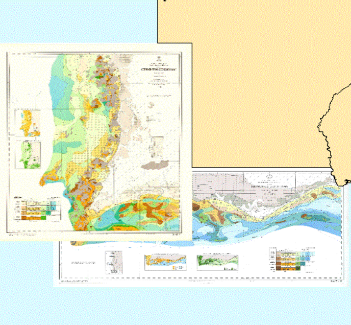
The "Map of the Superficial Sediments of the Portuguese Continental Shelf" is a publication of the Portuguese Hydrographic Institute (IH-PT), funded entirely by the Ministry of National Defence. This cartography, related to the “Sedimentological Series”, consists of 8 sheets at the scale 1:150000, and their explanation notes: SED 1 - De Caminha a Espinho (1.ª edição), SED 2 - De Espinho ao Cabo Mondego (1.ª edição), SED 3 - Do Cabo Mondego ao Cabo Carvoeiro (1.ª edição), SED 4 - Do Cabo Carvoeiro ao Cabo da Roca (1.ª edição), SED 5 - Do Cabo da Roca ao Cabo de Sines (1.ª edição), SED 6 - Do Cabo de Sines ao Cabo de S. Vicente (1.ª edição) e SED 7/8 - Do Cabo de S. Vicente ao Rio Guadiana (2.ª edição). To date, all of the 8 sheets have been published, but only the SED 7/8 sheet has its explanation note produced and edited. The oceanographic campaigns, carried out by The Portuguese Hydrographic Institute, under the SEPLAT Program, allowed the collection of twelve thousand samples from the seabed surface, covering the continental shelf off mainland Portugal down to 500m of depth. These sediment samples were collected according to an approximately rectangular sampling mesh with 1 nautical mile of average spacing. The collected sediment samples were subsequently processed in the sedimentology laboratory, providing the necessary information for the sediment classification and mapping. The classification adopted in the "Map of Superficial Sediments of the Portuguese Continental Shelf" is based on particles grain size and calcium carbonate content. The reference coordinate system used was Mercator Projection - International Ellipsoid - Datum Lisboa.