 Metadata catalogue
Adjumani
Type of resources
Available actions
Topics
Keywords
Contact for the resource
Provided by
Years
Formats
Representation types
Update frequencies
status
Scale
Resolution
-

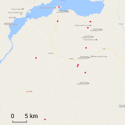
The shapefile represents the administrative divisions of Adjumani district in the North of Uganda as of December 2001. The shapefile divides Adjumani district into 1 county. The county is subdivided into 5 subcounties and one town council. These, in turn have 15 subdivisions that are called parishes. The parishes are further subdivided into 73 villages. We digitized the administrative units from paper maps that we have received from Uganda Bureau of Statistics in Entebbe. The associated population size on village level represents the provisional result of the Uganda census 2002.
-
This dataset holds different soil samples from the refugee area Adjumani in the North of Uganda. We collected and analyzed the samples during the project Framework for Assessing, Monitoring and Evaluating the environment in refugee-related operations (FRAME) in 2001.
-

Image Spot 4 panchromatique et multispectrale, acquise le 5 février 1999, copie du CD d'origine avec la licence, les points de callage et une composition colorée 321 en ECW compression de 25%.