 Metadata catalogue
/Physical oceanography/Water column temperature and salinity
Type of resources
Topics
INSPIRE themes
Keywords
Contact for the resource
Provided by
Years
Representation types
-
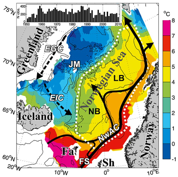
Climate variability in the Norwegian Sea was investigated in terms of ocean heat and freshwater contents of Atlantic water above a reference surface, using hydrographic data during spring 1951–2010. The main processes acting on this variability were examined and then quantified. The area-averaged water mass cooled and freshened, but a deepening of the reference surface resulted in a positive trend in the heat content of 0.3 W m−2. Air-sea heat fluxes explained about half of the interannual variability in heat content. The effect of the advection of Atlantic and Arctic waters on the variability varied with time, apparently due to large-scale changes in the ocean circulation. The data are consistent with the explanation that changing wind patterns caused buffering and then release of Arctic water in the Iceland Sea during the late 1960s to early 1970s, and this caused large hydrographic changes in the Norwegian Sea.
-

The Joint WMO-IOC Technical Commission for Oceanography and Marine Meteorology Observing Programmes Support Centre, provides technical coordination at international level for the sustained elements of the Global Ocean Observing System. The Centre monitors in real-time the status of the observing networks and provides a toolbox to evaluate their performance and optimize their implementation and data flow. Currently JCOMMOPS monitors the Argo profiling floats, the DBCP surface drifters, coastal and tropical moorings, ice buoys, tsunami buoys, the OceanSITES moorings time-series, the GO-SHIP hydrographic reference lines, the SOT mat/ocean ship based observations and the GLOSS sea level tide gauges. A number of other observing systems are being added gradually, including ocean gliders, polar systems, marine mammals and potentially HF radars.
-
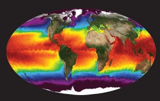
NASA's Physical Oceanography Distributed Active Archive Center (PO.DAAC) is located at NASA's Jet Propulsion Laboratory in Pasadena, California. PO.DAAC manages and provides tools and services for NASA's oceanographic and hydrologic data (satellite, airborne, and in-situ) to enable a greater understanding of the physical processes and conditions of the global ocean. Measurements include gravity, ocean winds, sea surface temperature, ocean surface topography, sea surface salinity, and circulation. The data support a wide range of applications including climate research, weather prediction, resource management, policy, and the stewardship of ocean data resources.
-
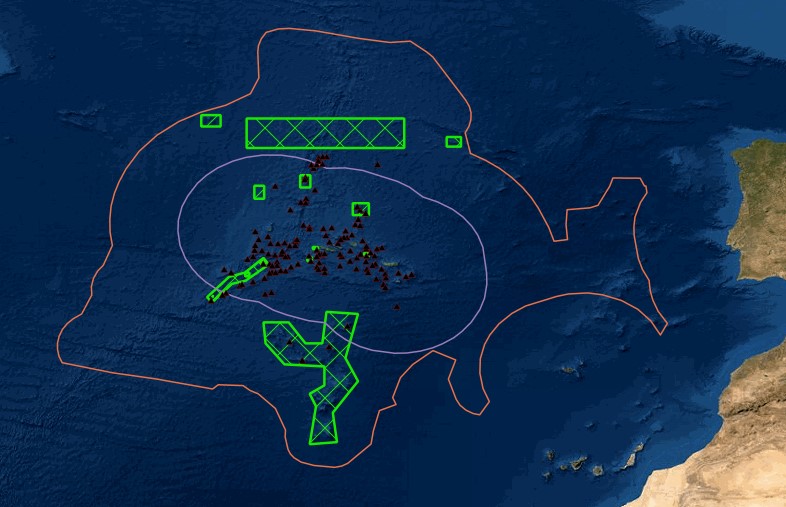
Portal of Maritime Spatial Planning of the Azores which hosts several GIS layers, such as: - Fishing areas and aquaculture production areas - Bathymetry - Mineral resources: Deep seabed polymetallic nodules - Hydrothermal vents - Distribution of seamount extracted, 2008 - Seafloor geomorphologic classification - Ocean environmental variables mean between the years 2002 and 2013: Sea Surface Temperature, Chlorophyll-a Concentration, Particulate Organic Carbon and Particulate Inorganic Carbon, Photosynthetically, Available Radiation, Ocean Productivity - Maerl habitats - Predictive distribution modelling for 26 cold-water coral species - Coldwater corals - Legal issues - Infrastructure and equipment - Underwater cultural heritage - Aggregate extraction - Tourist maritime activities