 Metadata catalogue
/Physical Environment/Bathymetry
Type of resources
Available actions
Topics
INSPIRE themes
Keywords
Contact for the resource
Provided by
Years
Representation types
Resolution
-
Bathymetry and seafloor variables at 10-m resolution in the Lacaze-Duthiers Canyon, below130 m depth
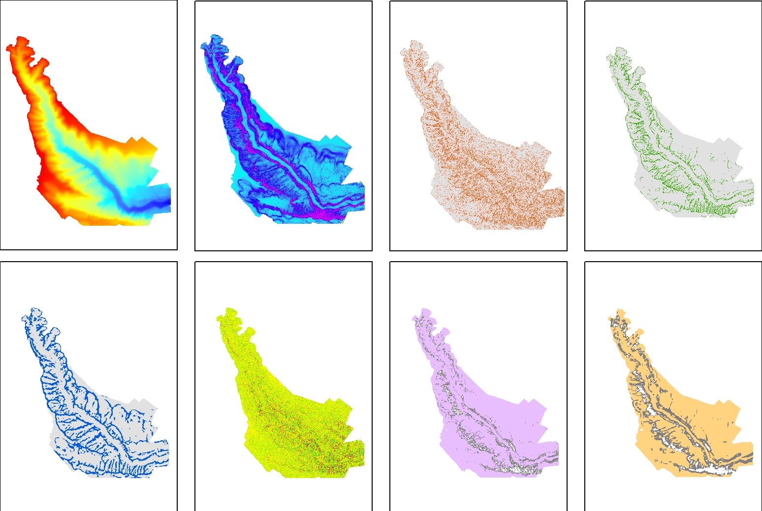
Seafloor variables were derived from the digital terrain models (DTMs) at a 10-m resolution for the entire canyon. The Lacaze-Duthiers Canyon was first delineated, and only data below 130 m depth were retained. The dataset is composed of 12 variables : Bathymetry; Slope; Aspect; Curvature; Surface area to Planar area; Vector Ruggedness Measure (VRM) computed using 9, and 25 pixels; and Bathymetric Position Index (BPI) calculated using windows of 3, 9, 25, 49, and 123 pixels. This dataset was produced to assess the probable distribution of habitats (habitat suitability modeling) for cold-water corals in the Lacaze-Duthiers Canyon at different resolutions as part of the European H2020 project REDRESS (Restoration of Deep-Sea Habitats to Rebuild European Seas, https://redress-project.eu/, Grant Agreement No. 101135492). This dataset is related to the article "Mapping and Conservation of Cold-Water Corals in the Lacaze-Duthiers Canyon for Transboundary Management", submitted to Mediterranean Marine Science by Fabri et al. in 2025.