 Metadata catalogue
/Imagery/Satellite Imagery
Type of resources
Available actions
Topics
INSPIRE themes
Keywords
Contact for the resource
Provided by
Formats
Representation types
Update frequencies
status
Scale
-
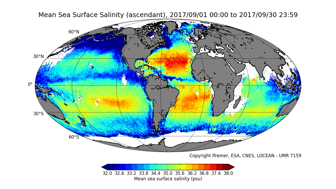
This product contains average 10 days & monthly salinity field based on L2P products, ascending and descending orbits being processed separately. ** This product is no longer available, see below **
-
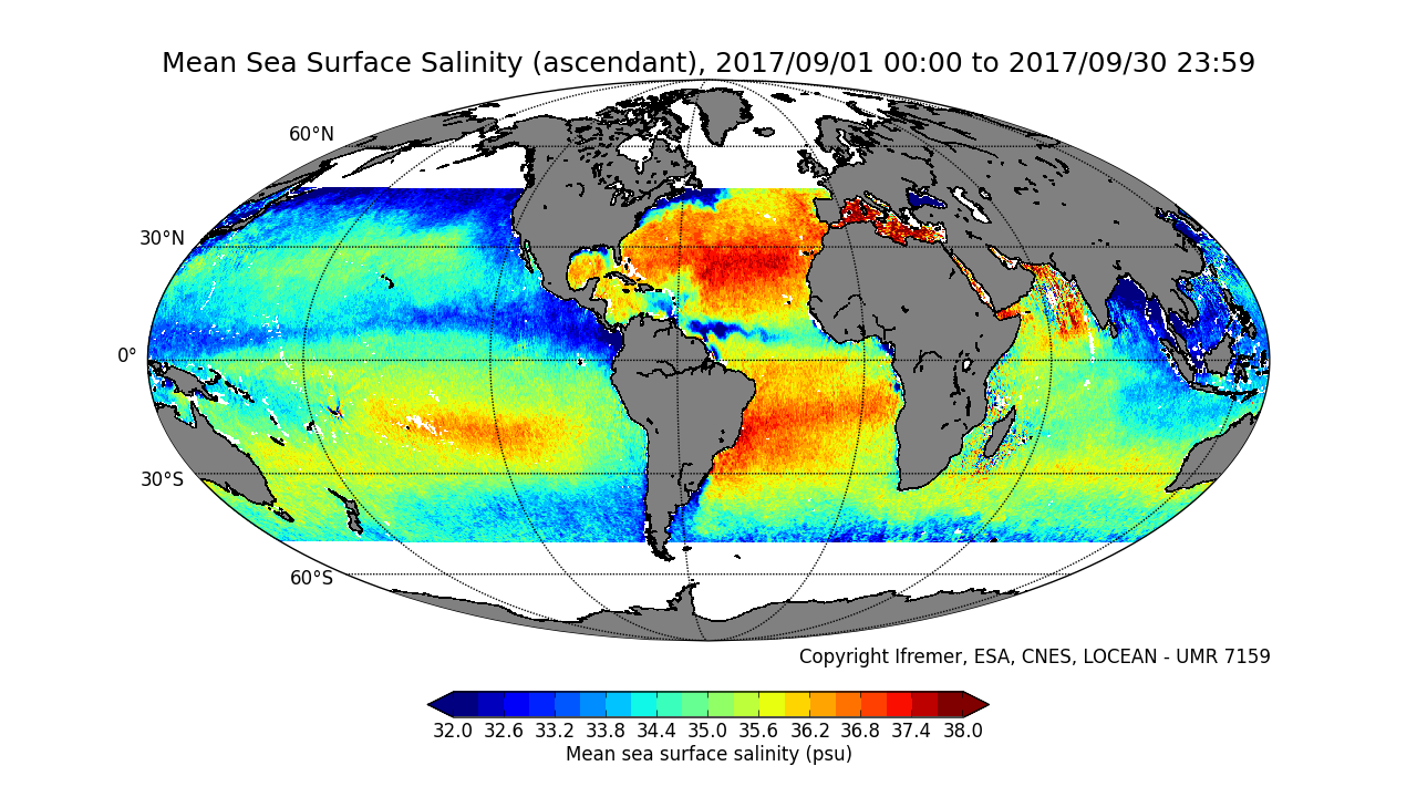
This product contains average 10 days & monthly salinity field corrected from land-sea contamination and latitudinal bias, based on L2Q products, ascending and descending orbits being processed separately. ** This product is no longer available, see below **
-
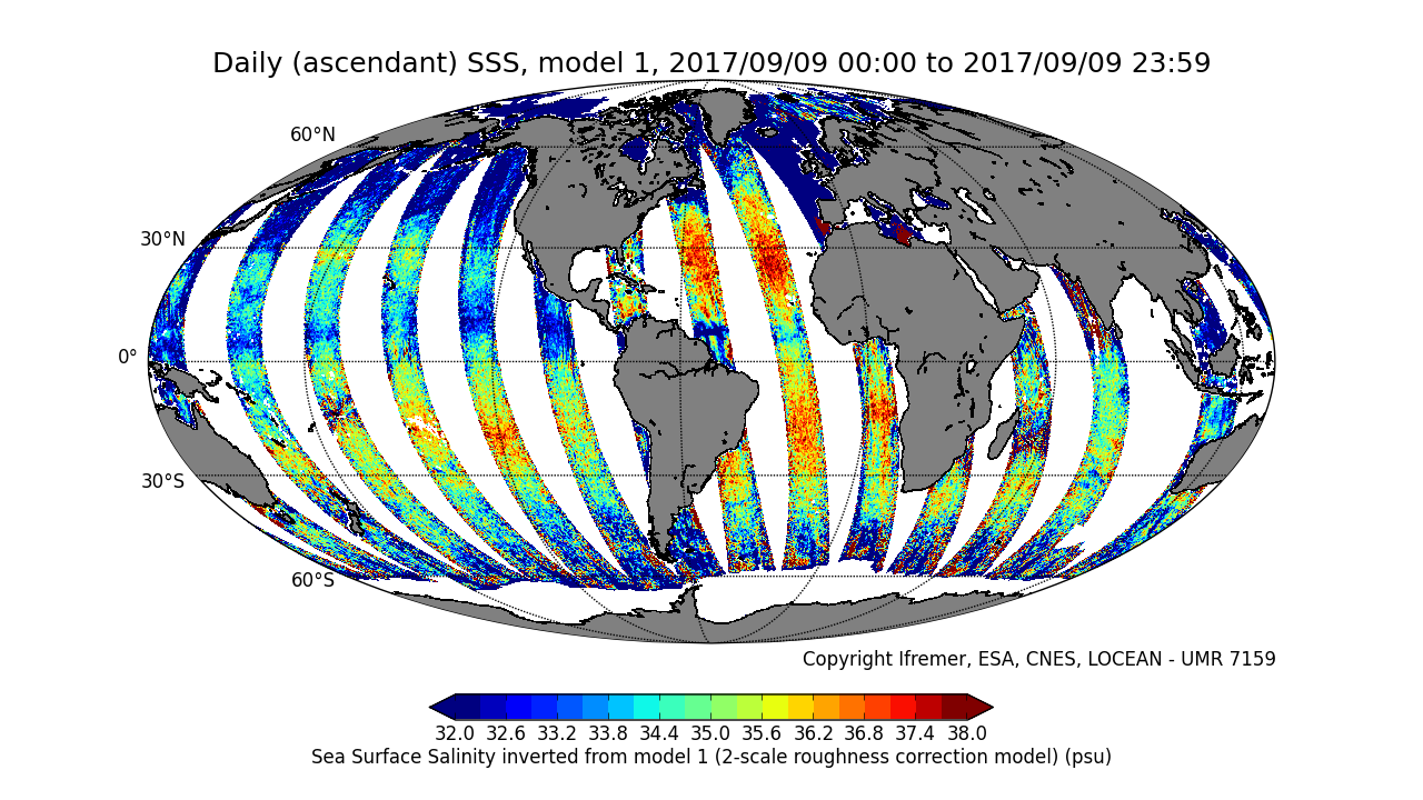
This product is an intermediate product, that provides, in daily files, SSS with qualification flags (associated confidence classes) which allow selecting valid data before averaging. Ascending and descending orbits are processed separately ** This product is no longer available, see below **
-
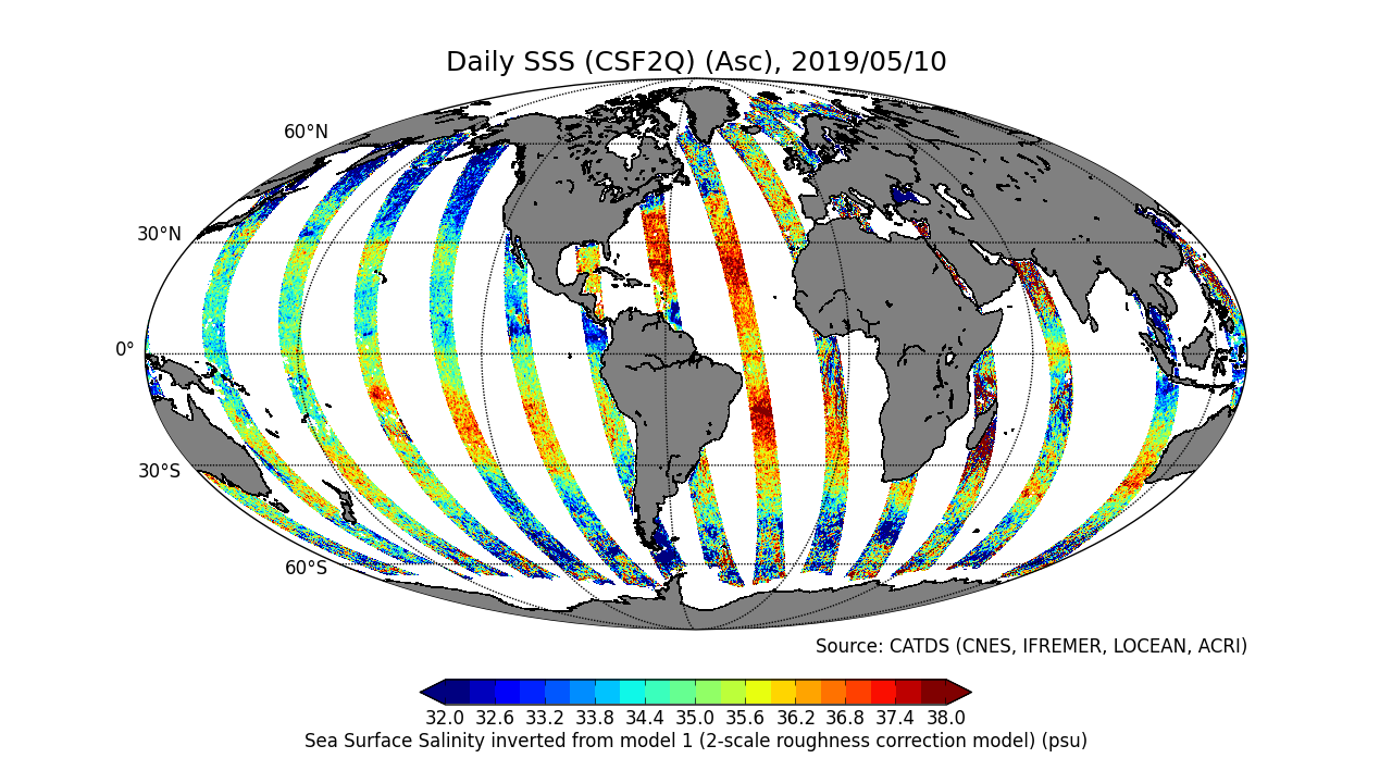
This product is an intermediate product, that provides, in daily files, SSS corrected from land-sea contamination and latitudinal bias. Ascending and descending orbits are processed separately
-
This product contains average 10 days & monthly salinity field based on L2P products, mixing ascending and descending orbits. ** This product is no longer available, see below **
-
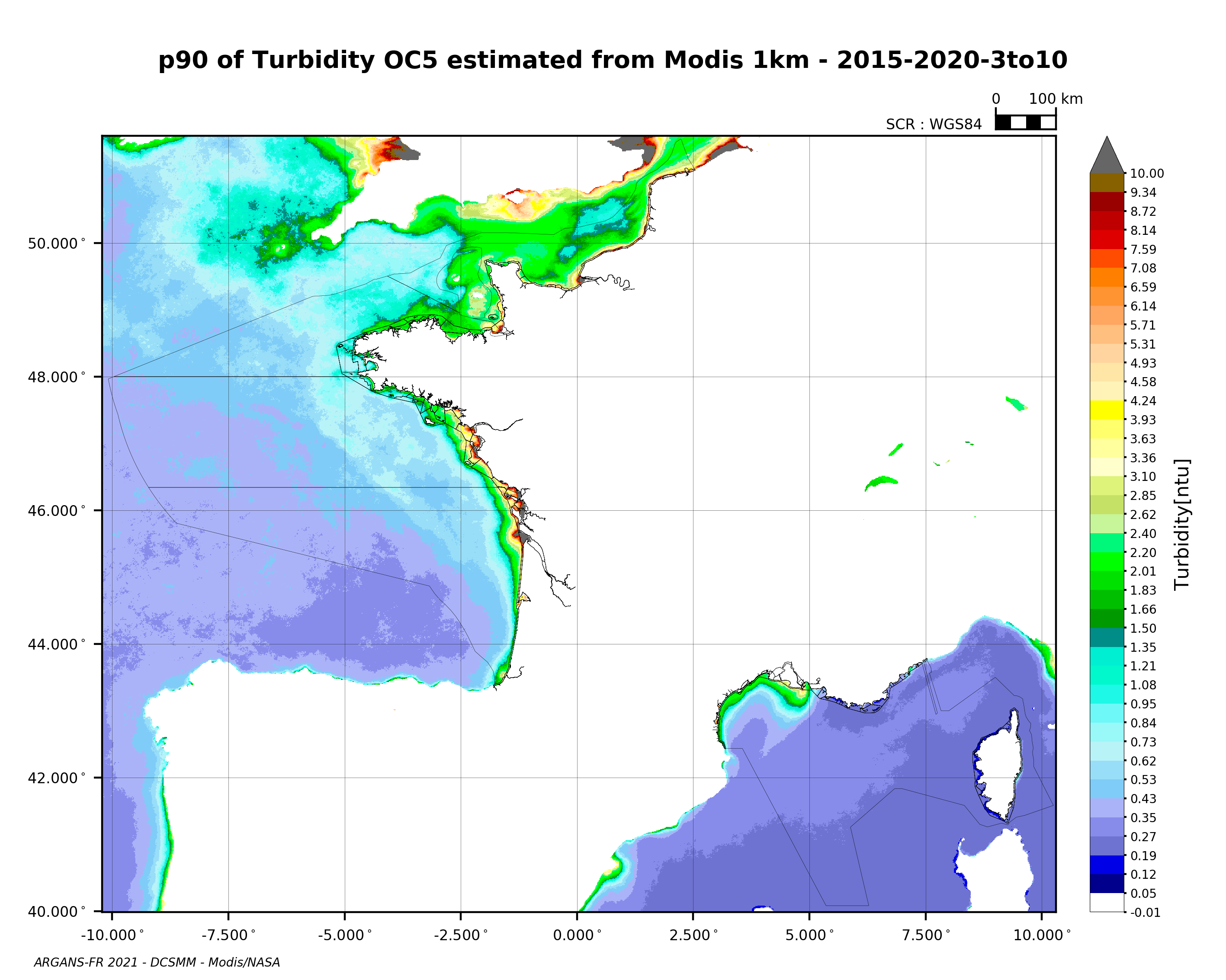
90th percentile of turbidity calculated during the productive period of the WFD (March-October) from 2015 to 2020, from the MODIS algorithm processed by OC5 IFREMER/ARGANS (Gohin et al 2002, Gohin 2011).
-
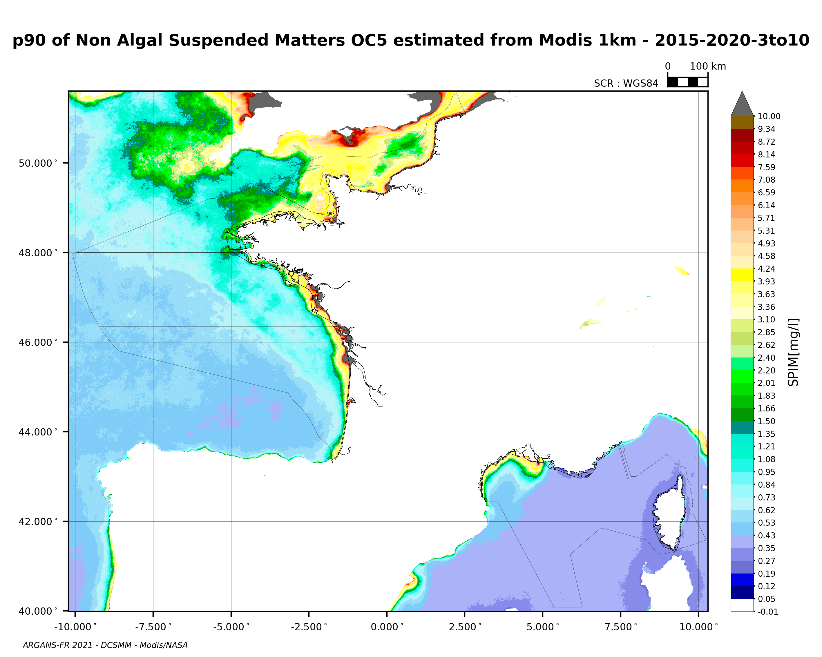
90th percentile of non-algal suspended matter calculated during the productive period of the WFD (March-October) from 2015 to 2020, from the MODIS algorithm processed by OC5 IFREMER/ARGANS (Gohin et al 2002, Gohin 2011).
-
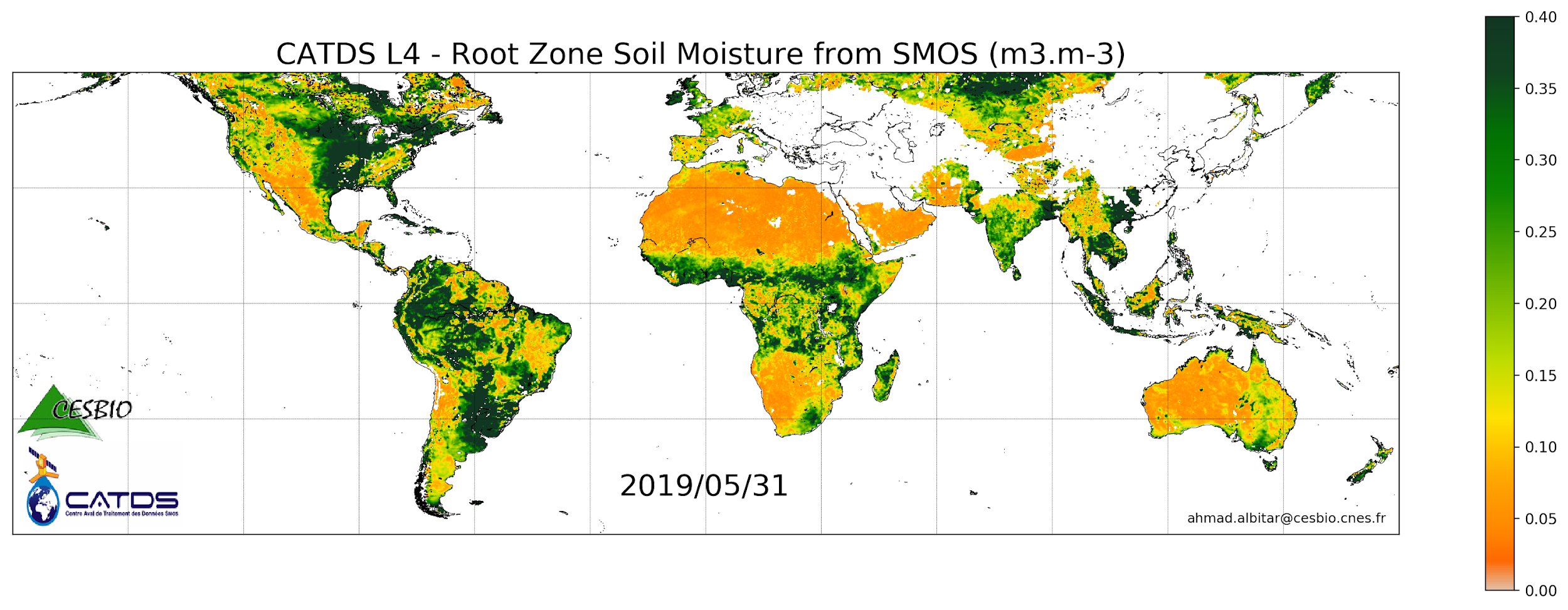
This product is a daily product of root zone soil moisture representative of the 0-1 m depth of the soil. Only descending orbits are processed.