 Metadata catalogue
/Biological Environment/Habitats
Type of resources
Available actions
Topics
INSPIRE themes
Keywords
Contact for the resource
Provided by
Years
Representation types
Update frequencies
status
Scale
Resolution
-
Data represents percentage cover of kelp forest. The Habitat model was generated from kelp forest presence/absence determined from acoustic surveys of laminarial algae. KdPar, sea surface temperature, depth and current speed were used as predictive variables. Habitat model represents only the areas where kelp forests may occur, not the areas confirmed in field observations.
-
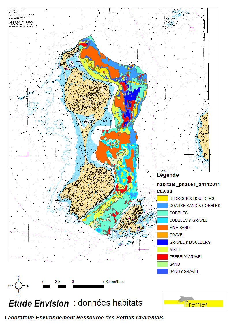
These data were collected during the 2007 and 2011 ENVISION-Ifremer campaigns to sustain a R & D project focusing on the Pectinid aquaculture development. This project was co-funded by the Saint Pierre et Miquelon public body and ODEADOM. This work aims to assess and select new potential rearing areas for the King scallop Placopecten magellanicus by using bottom type data resulting from 2 mapping campaigns carried out in 2007 and 2011 on the Eastern coast of Saint Pierre et Miquelon archipelago.
-
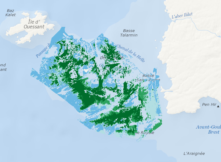
Data represents percentage cover of kelp forest as well as biomass of the 2 main species: L. digitata and L. hyperoborea. The used approach consists in firstly establishing surveys and appropriate processing methods in order to provide a detailed underwater topography of the area and to accurately delineate hard substrates (bedrock) potentially colonized by kelp. Secondly, a habitat suitability model is fitted for each species on some carefully selected field stations, measuring kelp presence/absence and biomass. Predictive maps are produced, based on hard substrate areas previously delineated.
-
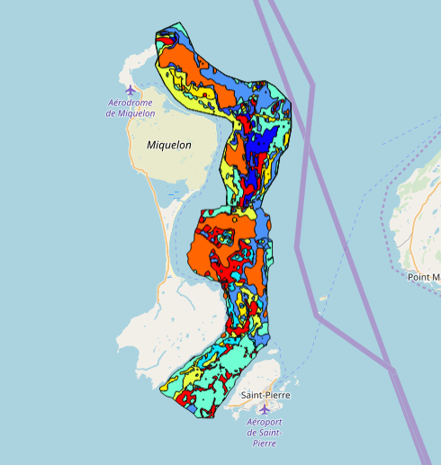
This data set was collected during 2 ENVISION-IFREMER field campaigns carried out in 2007 and 2011 to sustain a Pectinid aquaculture project. This was co-funded by ODEADOM and the public collectivity of Saint Pierre et Miquelon. This work aims to assess new seeding and rearing areas for the King scallop Placopecten magellanicus through a site selection process using the bottom type mapping data set obtained during the 2 ENVISION-IFREMER field campaigns. Furthermore, new estimates of potental scallop production is produced by this data treatment.
-
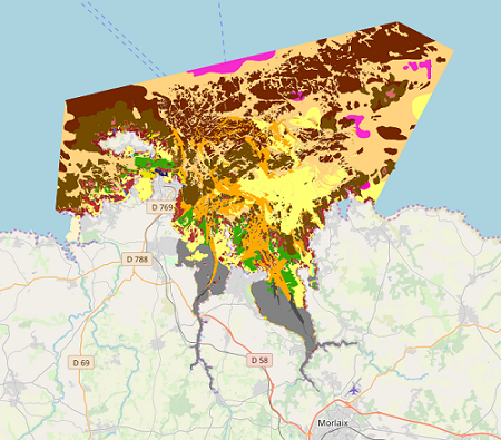
Map of benthic habitat synthesis of the Natura 2000 site FR5300015 - Bay of Morlaix is the result of the fusion and harmonization of five cartographic data. They were generated according to mapping strategies, interpretation scales and on the basis of different cartographic supports.
-
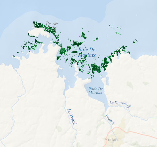
Data represents presence-absence prediction of kelp forest. Biological ground truth data were integrated with high resolution environmental datasets to develop statistical model that accurately predict the structure of Laminaria forests within the Bay of Morlaix. As a direct management output, high-resolution map (25 m2 grid) was produced.
-

Observations of live Tursiops truncatus from different datasets collected in France and the United Kingdom were compiled to generate Maxent presence-only habitat suitability models in the CHARM3 study area. The data span from 2002 - 2011 and come from both dedicated and opportunistic surveys from land, sea, or air.