 Metadata catalogue
xyz
Type of resources
Available actions
Topics
INSPIRE themes
Keywords
Contact for the resource
Provided by
Years
Formats
Representation types
Update frequencies
Scale
Resolution
-
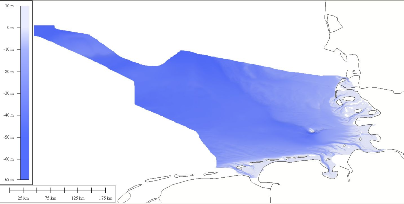
DTM data source was received from the data center (Bathymetrisches Datenzentrum) of the German Hydrographic Office (Bundesamt für Seeschifffahrt und Hydrographie) at a variable resolution. The data was then processed by ATLIS b.v. using the ATLIS SENS software suite and compiled into an EMODnet regional DTM. Although the resolution varied throughout the dataset, no interpolation was required to create a geographic grid of 0.0041667 degrees resolution.
-
Geodynamic monitoring - 1) of surface movements based on GNSS observations at permanent station NKOS in Nový Kostel and in the form of repeated campaigns in the network of 26 points; 2) groundwater fluctuations in West Bohemia from permanent measurements in three wells in Cheb region.
-
Digital records of the gravity field changes in Greece (Nisyros, Thira) observed from repeated annual measuring campaigns in gravity network.
-

Modèle numérique de terrain des lits fluviaux de la Bruche et de la Sauer réalisés à partir de levers topographiques LIDAR. Seule l'emprise des fichiers produits est disponible sous forme géographique.