 Metadata catalogue
XYZ Ascii
Type of resources
Available actions
Topics
INSPIRE themes
Keywords
Contact for the resource
Provided by
Years
Formats
Representation types
Scale
Resolution
-

Digital Terrain Model built from processed multibeam bathymetry collected in three sea campaigns ( 2018 to 2019) by IPMA.
-

Data extracted from the Hydrographic Office of the Polish Navy (HO) database. Cells in a 200m grid has been populated.
-
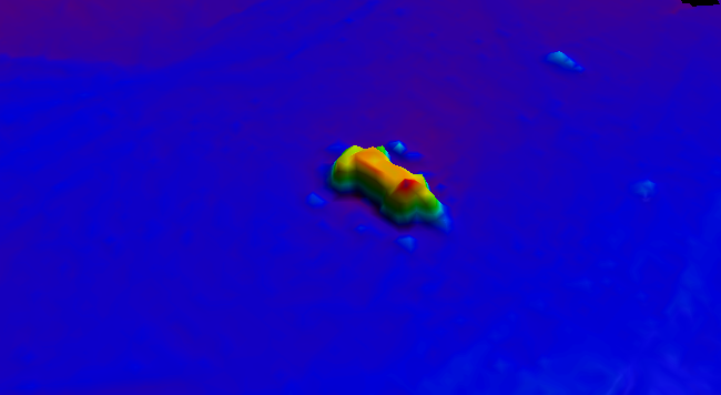
BalticSea_Maritime_Administration_Latvia Wreck found using MBES technique
-
The data were acquired with a Simrad EM710 Multi Beam echosounder onboard the R/V Urania in order to cover the outer Malta Plateau and upper Malta Escarpment for a geological survey in the framework of EU FP7 project EUROFLEETS. The data were published in: Micallef, A., Georgiopoulou, A., Le Bas, T., Mountjoy, J.J., Huvenne, V., Lo Iacono, C., 2013. The Malta-Sicily Escarpment: Mass Movement dynamics in a sediment-undersupplied margin, in: Krastel, S., Berhmann, J.H., Volker, D., Stipp, M., Berndt, C., Urgeles, R., Chaytor, J.D., Huhn, K., Strasser, M., Harbitz, C.B. (Eds.), Submarine Mass Movements and Their Consequences. Springer International Publishing, Switzerland, pp. 317-328.
-
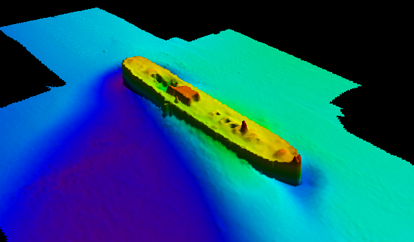
BalticSea_Maritime_Administration_Latvia Wreck found using MBES technique
-
Joint composite of SI Survey Bathymetry dataset (composite of 3 surveying years within 2007-2009).
-
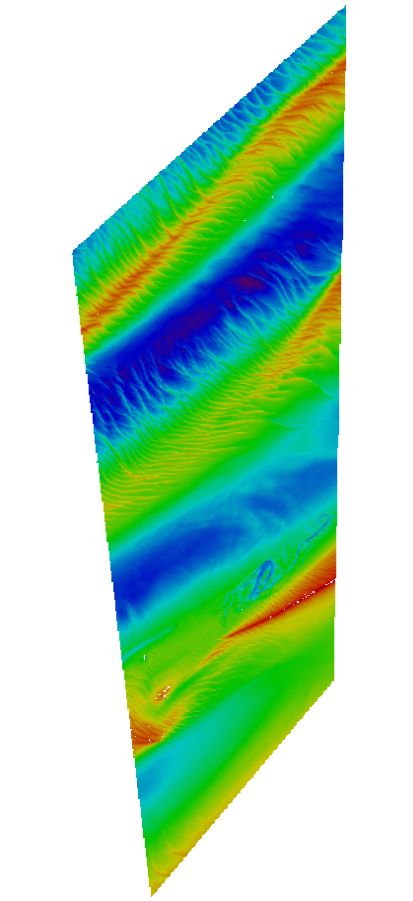
Maas West Outer Vlissingen, South part. There are sand waves. Surveyed by one of the Hydrographic Survey Vessels of the Royal Netherlands Navy.
-

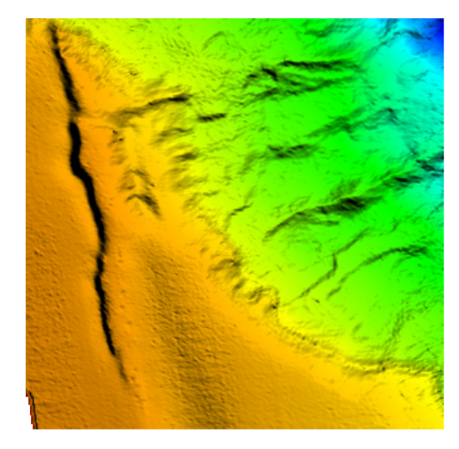
The composite Digital Terrain Model of the Central Bulgarian Black Sea Slope is a result of processing and compilation of multibeam echosounder data gathered under several projects: the Caucasus on-line cable route survey (2007); The South Stream pipeline route survey (2009-2012); CBC Programme “MARINEGEOHAZARD” (2012). The DTM at a source resolution of approximately 55 meters was compiled for inclusion into the EMODnet HRSM dataset. The area embraces 2675 square kilometers from the shelf break to the abyssal plain in the center of the Bulgarian EEZ of the Black Sea.
-

Bathymetric data resulting from hydrographic surveys for cartographic purposes and/or port management. Surveys carried out in accordance with the IHO S-44 standard.
-

Bathymetry data was acquired during R/V MARIA S. MERIAN cruise MSM44 in the northeastern Baffin Bay between 30.06.2015 and 30.07.2015. The cruise carried out multidisciplinary research in order to investigate the deglaciation history of the Greenland Ice Sheet (GIS). To research the involved ocean, cryosphere and climate processes and feedbacks and to address the complex spatial and temporal distribution patterns of the marine GIS terminations in the northeast Baffin Bay, RV MARIA S. MERIAN visited sites in the Davis Strait, the Uumannaq Trough, and the Melville Bay during expedition MSM44. The objectives were to systematically search for and map glacigenic seafloor features providing information on the maximum extend and retreat histories of ice sheets since the last glacial maximum and during the Holocene. Extensive mapping was conducted due to the fact, that several huge parts of Greenland’s coast are only insufficiently mapped or completely uncharted and thus are barely reliable in concern of navigation and interpretation towards glacigenic features of the last ice ages. CI Citation: Paul Wintersteller (seafloor-imaging@marum.de) as responsible party for bathymetry raw data ingest and approval.