 Metadata catalogue
VIDEO
Type of resources
Available actions
Topics
Keywords
Contact for the resource
Provided by
Years
Formats
-
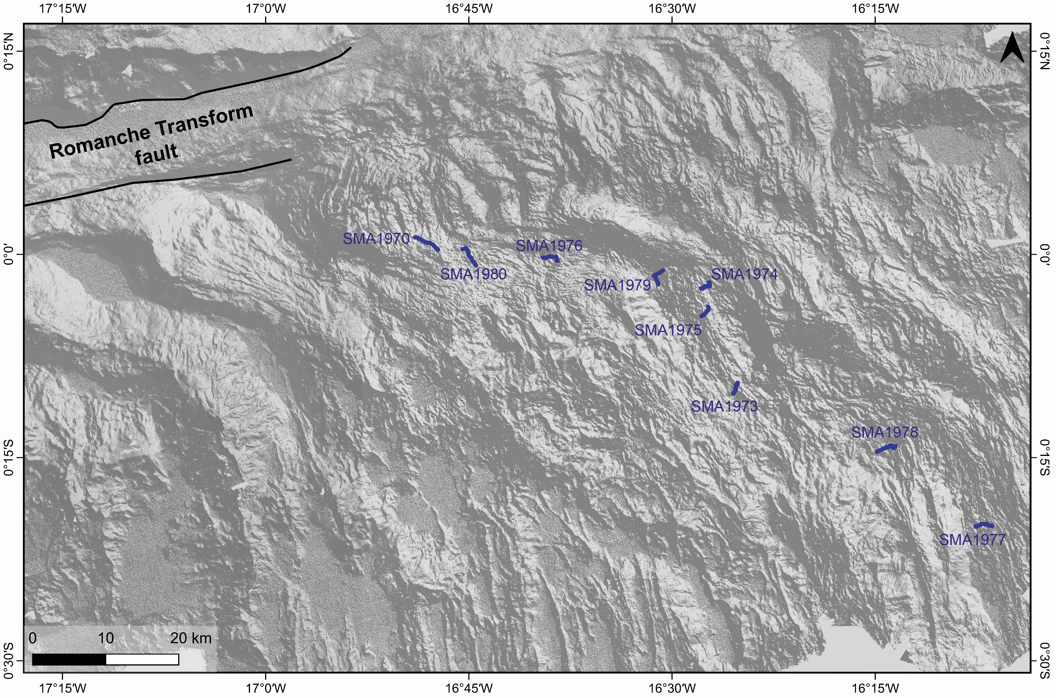
Videos recorded during the SMARTIES cruise with the Nautile cameras (fixed and mobile) during dives along the axial domain of the Mid-Atlantic Ridge south of Romanche transform fault. The following dives are part of this datatset: - SMA-1970 - SMA-1973 - SMA-1974 - SMA-1975 - SMA-1976 - SMA-1977 - SMA-1978 - SMA-1979 - SMA-1980 These videos illustrate different volcanic structures along the neo-volcanic zone of the ridge axis. The dives explored two non-transform discontinuities and two ridge segments between Romanche and Chain transform faults (RC-2 and RC-3). Dives SMA-1970 , SMA-1976 and SMA-1980 explored volcanic formations inside a large non-transform discontinuity between segments RC-1 and RC-2. Dive SMA-1978 explored the floor of the discontinuity between segments RC-2 and RC-3. Dives SMA-1973, SMA-1974, SMA-1975 and SMA-1979 explored different parts of the neo-volcanic ridge of segment RC-2. Dive SMA-1977 explored volcanic formations in the northern part of segment RC-3. The detailed study of these videos were published in Grenet et al., 2023 associated paper.
-
Submarine fault scarp and traces of earthquake (Roseau Fault, French Antilles): 3D scene and imagery
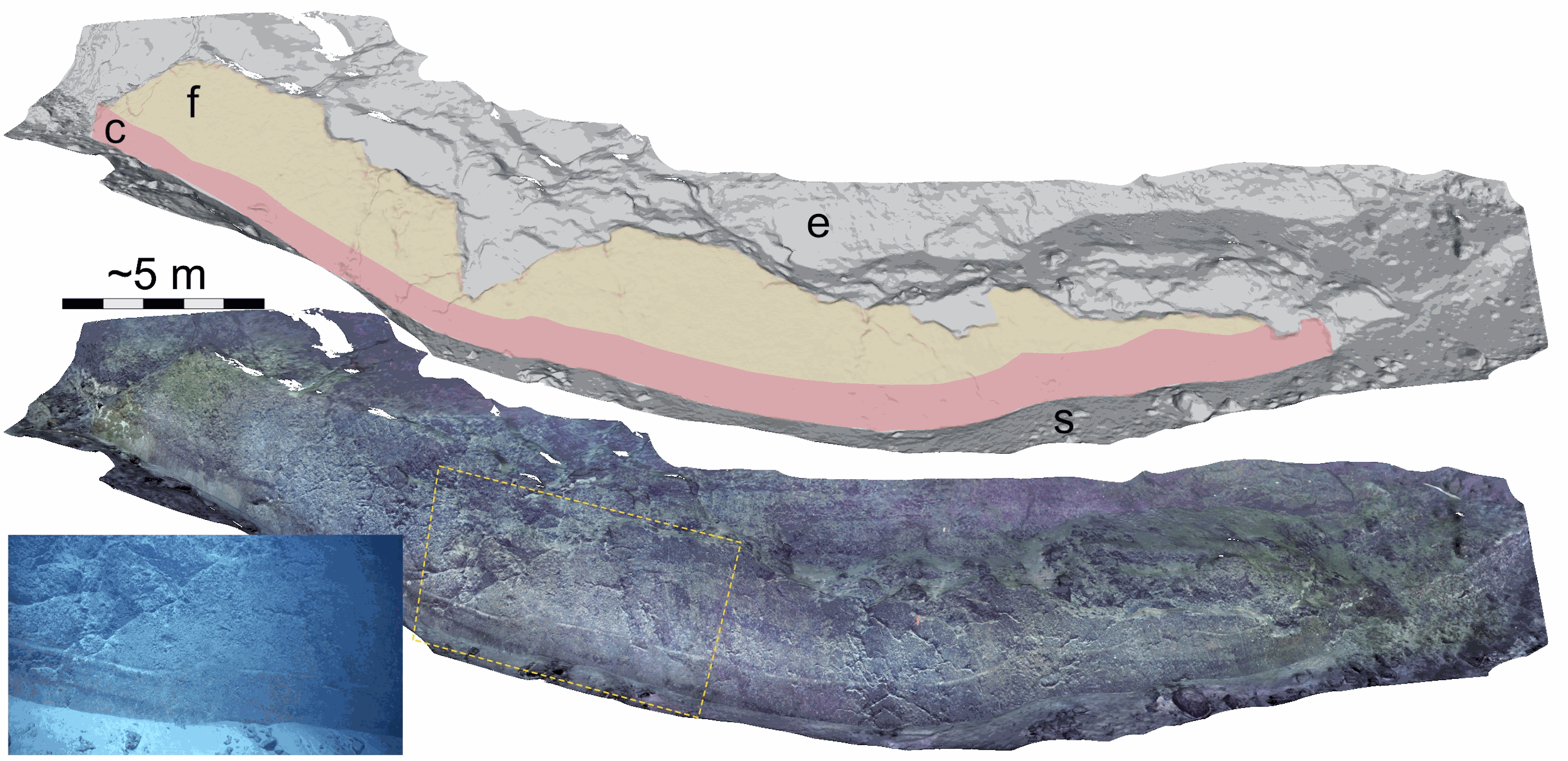
Fault scarp along the Roseau normal fault between Les Saintes and Dominica (French Antilles), at a water depth of 1100 m. This fault scarp is sub-vertical and at its base displays a marker that corresponds to the exposed fault plane during the 2004 Les Saintes Earthquake. The model shows here a coseismic displacement of ~1 m. This scarp was one of several surveyed along the Roseau Fault rupture during the Subsaintes cruise (https://doi.org/10.17600/17001000), with ROV Victor 6000 equipped with an HD Video camera. Two datasets are provided. First, the survey imagery, with a video (mp4 format) and an associated navigation file in txt format. Second, a 3D textured model of the site (obj format), together with the a kml file for georeferencing, and a geotiff orthomosaic. This dataset is one of several sets released with a paper by Arnaubec et al. (submitted March 2021, Computer and Geosciences) presenting the Matisse image processing software, and the 3DMetrics Visualization and analysis software (ref Github to come).