 Metadata catalogue
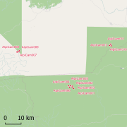
Text
Type of resources
Available actions
Topics
INSPIRE themes
Keywords
Contact for the resource
Provided by
Years
Formats
Representation types
Update frequencies
status
Service types
Scale
Resolution
-

DTM data source was created by taking contour lines and spot soundings from Norwegian Electronic Navigational Charts. NOTE: Data east of appr.
-

This data set reports woody plant species abundances in a network of 96 sampling sites spread across 22000 km² in central Western Ghats region, Karnataka, India . The database stores abundance and girth data for 76813 trees and lianas of 446 species collected in 96 sampling sites during 1996-1997. A total of 61965 individuals >10 cm girth at breast height (gbh) were recorded in 96 1-ha macroplots, while 14848 individuals <10 cm gbh but >1 m height were sampled in three 0.1-ha microplots located within each macroplot. Additional data regarding the stand structure (average canopy height, percent canopy cover, number of strata) and the level of degradation are available for the macroplots, along with environmental data derived from other sources and analyses, such as soil types, rainfall, length of the dry season, and altitude. These data have been used to produce ecological research papers as well as to elaborate conservation value maps and recommendations toward sustainable management of the forests of the central Western Ghats region. We have migrated the initial database available at http://esapubs.org/Archive/ecol/E091/216/default.htm to DataManager during the Pl@ntGhats project.
-

Data set on demography of trees monitored over 20 years in Uppangala permanent sample plot (UPSP) in undisturbed, old-growth wet evergreen Dipterocarp forest located within the Pushpagiri Wildlife Sanctuary in India's Western Ghats biodiversity hotspot. During 1989–1990, all trees ≥30 cm girth at breast height (gbh) were sampled in five north–south transects 20 m wide and 180–370 m long covering a total area of 3.12 ha. In 1992–1993, additional rectangular plots were established, bringing the total area sampled to 5.07 ha. In all, 3870 trees were identified, tagged, mapped, and provided with permanent dendrometer bands. Since then, the sampled area has been regularly censused at 3–5-year intervals, recording tree recruitment, mortality, and growth. We present data from censuses conducted in 1990–1993, 1994, 1997–1998, 2001–2002, 2007, and 2010. These data have been used to study the natural forest dynamics and to calibrate spatially explicit simulation models.
-

The aerial laser scanning (ALS) dataset, acquired in 2004, covers three plots of Counami site in French Guiana. The laser recorded last reflected pulse. Ground points data where not delivered by ALTOA.
-
Africadiv is a network of 1-ha forest monitoring plots spread across the moist forests in central Africa. The Cameroonian site of Mindourou II is composed of 12 1-ha forest plots. The following data are available for the different plots at this site: Structure - DBH of all trees ≥ 10 cm DBH : n = 5 598 Structure - Tree height : n = 920 Structure - Trunk height : n = 667 Structure - Crown diameter : n = 233 Identification rate - species-level : 56.4 % Identification rate - genus-level : 26.2 % Identification rate - family-level : 11.7 % Identification rate - unidentified : 5.7 % Soil samples & analyses available : YES Geolocation : GPS points and laser measurements (distance, vertical & horizontal angles) every 20 m on the contour of the plot. These data are routinely collected and used by AMAP research unit (IRD) and partners (LaboSyst, Yaoundé 1 University). Scientific collaboration are welcomed, please get in touch with a Point of contact.
-

This dataset gathers the description of primary occurrences of harvestmen (Opiliones) across French Guiana. The database holds 768 georeferenced records. All of the species are identified at least to the family level. Some species are identified to the genus or species level........ (Continue with the description)
-
The Scottish Radiocarbon index shows the location of archaeological sites in Scotland where radiocarbon dating has been undertaken. The spatial index includes a link to the relevant record on the Canmore database (https://canmore.org.uk/) listing all recorded radiocarbon determinations with hyperlinks leading to individual results. The database excludes those results that cannot be linked to an identifiable site record in Canmore. It does not represent a complete record of all radiocarbon determinations undertaken across Scotland but is relatively complete up to 2005.
-

Geographical database that was used to create the Atlas of endemics of the Western Ghats: distribution of tree species in the evergreen and semi-evergreen forests. There are 352 endemic tree species present in the database spreaded over around 2500 locations, More information about the database is available at http://www.ifpindia.org/ecrire/upload/digital_database/Site/Endemic_Tree_Species/html/main.htm. We have migrated the database into DataManager during the Pl@ntGhats project.
-
Africadiv is a network of 1-ha forest monitoring plots spread across the moist forests in central Africa. This dataset holds the biomass calculated from plot inventory data......
-
Africadiv is a network of 1-ha forest monitoring plots spread across the moist forests in central Africa. This dataset holds general physical and chemical parameters for soil samples taken in Mindourou II site in Cameroun. Samples were collected between 2013 and 2014 across 1-ha forest monitoring plots. Soil cores were taken to a depth of 1 metre and divided into 15 centimetre (cm) depth increments. General soil physical and chemical parameters were measured at each depth increment for most of the sites.