 Metadata catalogue
SEG-Y
Type of resources
Available actions
Topics
Keywords
Contact for the resource
Provided by
Years
Formats
Representation types
Update frequencies
status
Scale
-
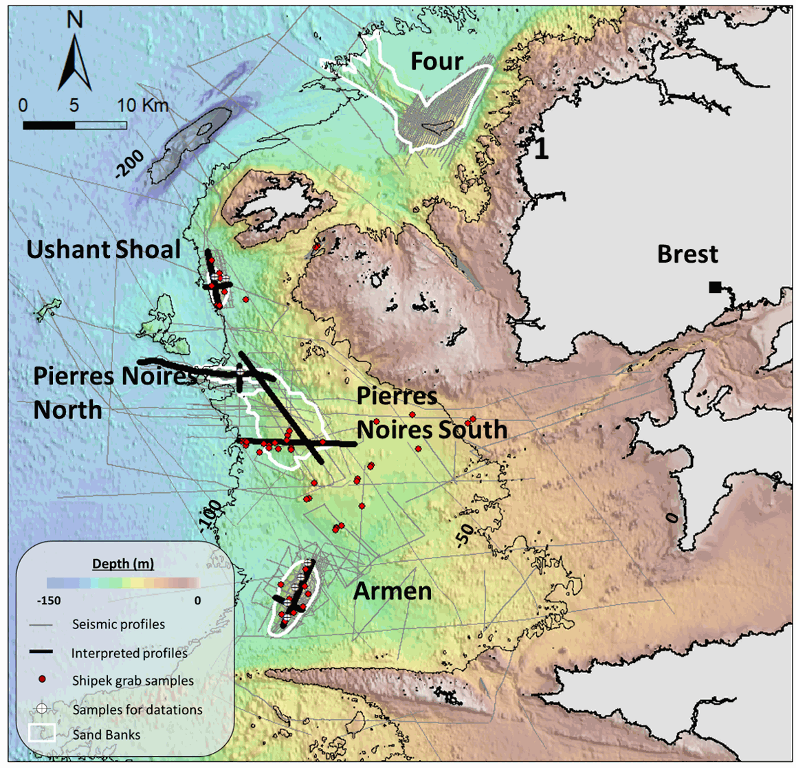
This seismic dataset came from surveys carried out by the “Institut Universitaire Européen de la Mer” (IUEM, UBO) and the Ifremer, on the Iroise Sea platform, (Western Brittany, France). Two main files are provided here: -The first one is composed of the 10 seismic profiles described in the article "Long term evolution of deep banner banks offshore Western Brittany (Iroise Sea, France): indications of a paleo-coast line and of the interaction between hydrodynamics and seafloor morphology", with tiff and SEG Y / NAV data. The second is composed of SEGY files over the whole platform from several research cruises (GEOBREST (11, 12, 13, 14,15, 19), SpeeDunes, Bankable, SABASETI). .Nav files are the XY coordinates of each seismic line. For each SEGY fil there is both a non-corrected and a corrected version (name of the file finishing by PRC).Each data file is accompanied by other files with the same name (for example .GEO .PRM ...) that are necessary to open the corrected version. An integrated approach combining seismic, bathymetry and sediment analyses acquired over the last 10 years aims to understand the main factors driving the sand banks growth and internal architecture, as well as their anchoring and stability at a depth of almost -100m since the last deglaciation.
-
This database (SDE) contains state-paid seismic profiles measured in the Czech Republic. Reflection seismic profiles, digitaly registrated, are stored in the SEGY format.The database of this type of profiles contains about 1,000 items. Information about refraction seismic, deep seismic profilling and analogue registred reflection seismic can be found in CGS archieve reports (AGGI).
-
This database (SDE) contains state-funded downholes seismic (check-shooting) survey measured in the Czech Republic in 1968-1994 (1998).