LAZ
Type of resources
Available actions
Topics
INSPIRE themes
Provided by
Years
Formats
Representation types
Update frequencies
status
Resolution
-

Ce jeu de données correspond au nuage de points issu du lever LiDAR à l'origine du Modéle Numérique de Terrain (MNT) - Puy-en-Velay. Le lever a été réalisé simultanément à la prise de vue aérienne réalisée en 2010 par la société TopoGeodis pour le CRAIG. La densité native des points altimétriques est de 0,5 points au m². Les données sont téléchargeables depuis le catalogue au format LAZ (36 fichiers pour 5.5Go). Projet co-financé par l'Union européenne - fonds européen de développement régional FEDER - L'Europe s'engage en Auvergne
-

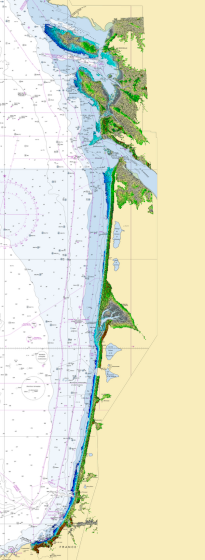
Litto3D provides 3D, continuous sea-land description of French coastal areas. Data is acquired by airborne topo-bathymetric LiDARs. Litto3D products come in 3D point clouds and digital terrain models formats. The product "Litto3D - Nouvelle-Aquitaine 2020-2022" covers the geographical area from the Charente-Maritime to the Spanish border. For the maritime part, the data produced by Shom extend offshore down to signal extinction, approximatively 20 depth when environmental conditions are optimal. On land, the data are truncated at a limit that ensures the product retain its coastal character.
 Metadata catalogue