 Metadata catalogue
IMAGE
Type of resources
Available actions
Topics
Keywords
Contact for the resource
Provided by
Years
Formats
-
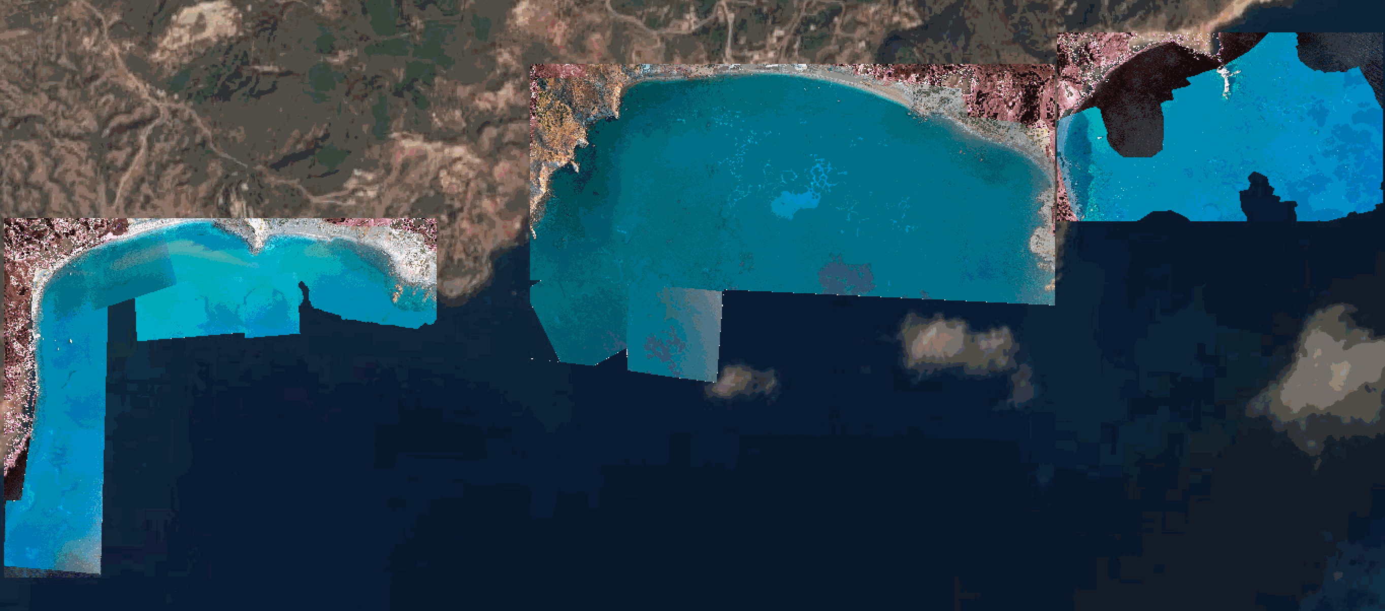
Swath bathymetry along a stretch of coast near the etruscan settlement of Pyrgi, Santa Severa, Italy
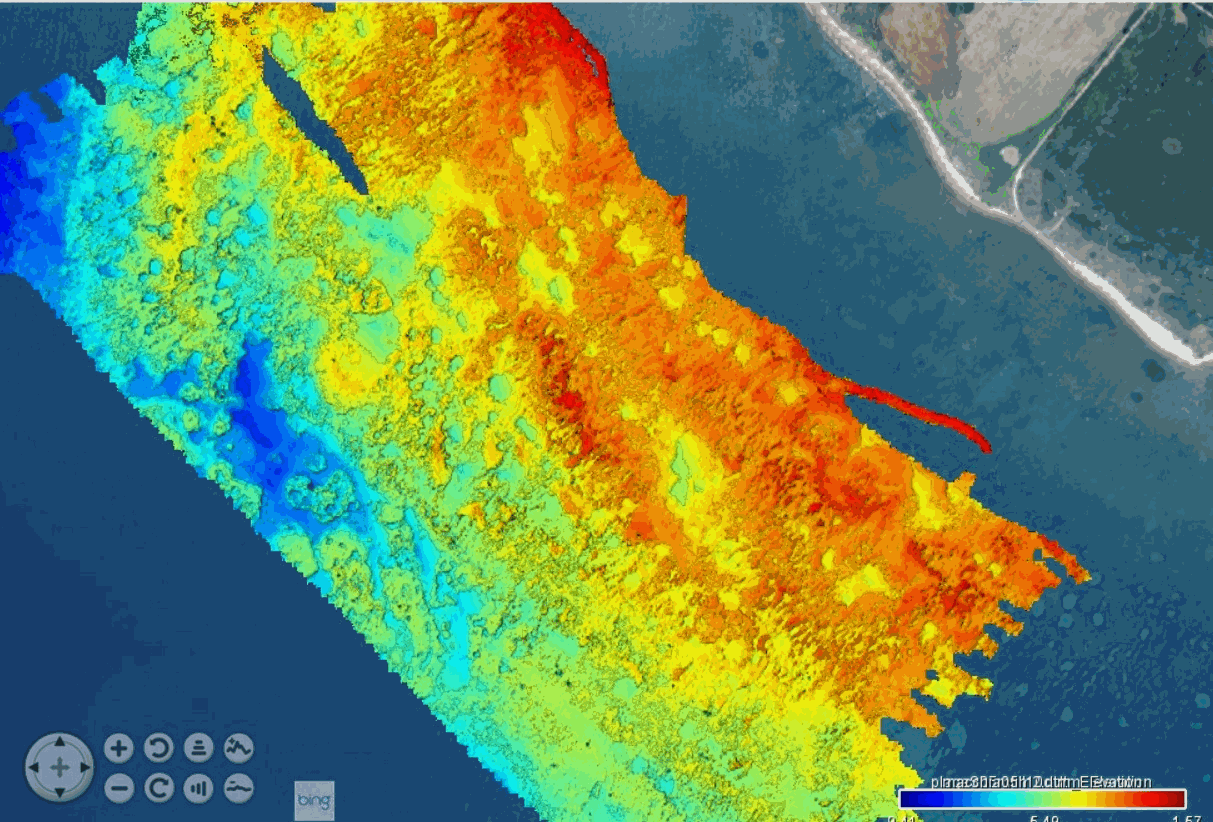
These bathymetric data were produced using the interferometric side-scan sonar onboard the Haliotis Research Vessel, Operated by Genavir, for the French Oceanographic Fleet, in September 2022, during the oceanographic campaign HISOPE (l'Haliotis pour l’Imagerie Sismique d’Orbetello et Pyrgi Etrusques). The investigated area is located in front of the prominent archeological site of Pyrgi, the etruscan harbor of Cerveteri. At the site, next to the sea, is found a series of etruscan temples, surrounded by an etruscan city largely destroyed by coastal erosion. A roman castrum dating back to the 3rd century BCE covers part of the site and is also partly eroded by the sea. Above the castrum is built a fortified medieval village as well as a large renaissance castle (Santa Severa), built over a submerged lava dome (the Massicciata reef). In 2019, foundations of an etruscan monument were discovered 150 m offhshore, over a larger reef located south of the archeological site (the Secche di Macchiatonda). The goal of this campaign was to map the seafloor along this stretch of eroded coastline, in order to determine the location of the coastline in Etruscan time, such as to better understand the geography of the site when the harbor was settled. One of the main questions is why this specific site was chosen to develop a port, despite its exposure to waves. Acquisition took place under stormy conditions, such that only 1.5 day of acquisition was possible over the 7 days planned. Geoswath mapping was conducted under heavy swell conditions along the sandy coast, north of of the castle of Santa Severa, then in front of the sandy coast, south of the castle, and finally over the extensive Secche di Macchiatonda reef in the south. Data were acquired by eng. Quentin Layahe, Genavir, onboard the Haliotis, piloted by Serge Garcia, and post-processed using the software Globe, developed by the IFREMER, by Dr.Gilles Brocard (Archéorient, University of Lyon 2, France) and Alessandro Conforti, research engineer at the CNR (Italian national center for research) at Orosi, Sardinia.
-
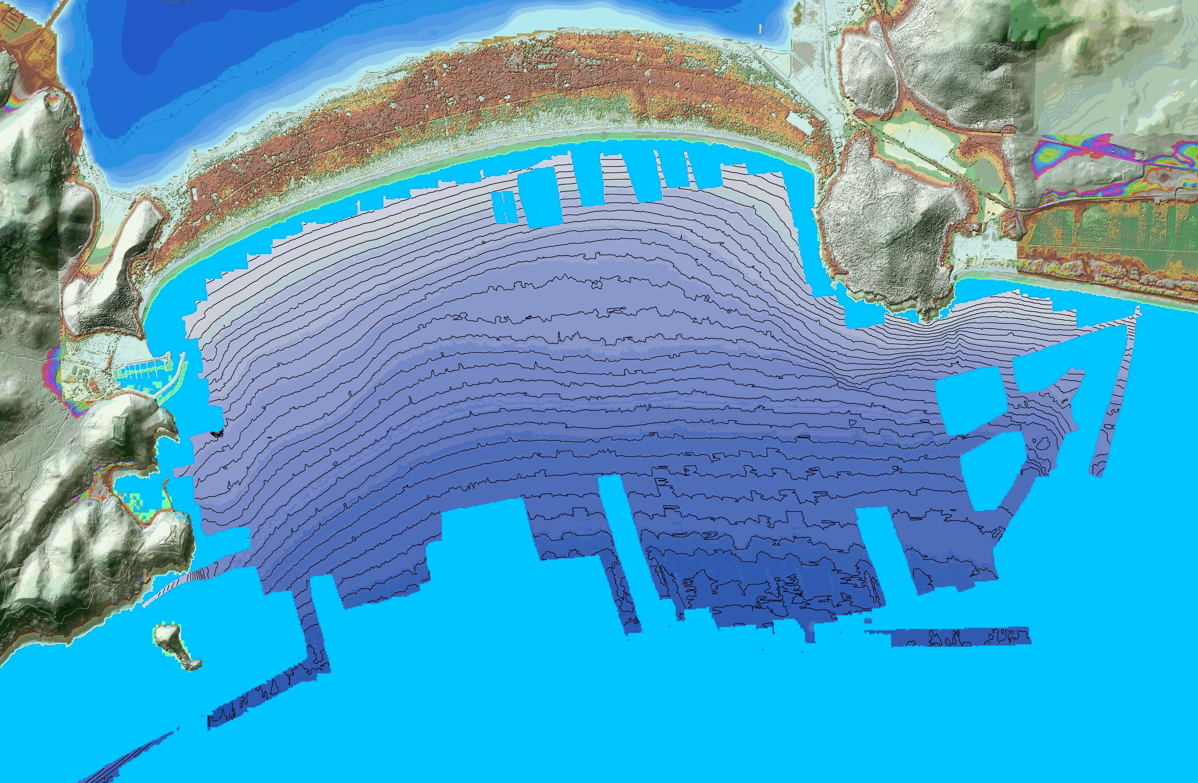
These bathymetric data were produced using the interferometric side-scan sonar onboard the Haliotis Research Vessel, Operated by Genavir, for the French Oceanographic Fleet, in October 2022, during the oceanographic campaign HISOPE (l'Haliotis pour l’Imagerie Sismique d’Orbetello et Pyrgi Etrusques). The investigated area is located in front of the tombolo di Feniglia, in the Gulf of Porto Ercole. The goal of the campaign was to image the sedimentary architecture of the Tombolo di Feniglia Acquisition took place from October 1st to October 6th 2022. Data were acquired by eng. Quentin Layahe, Genavir, onboard the Haliotis, piloted by Serge Garcia, and post-processed using the software Globe, developed by the IFREMER, by Dr.Gilles Brocard (Archéorient, University of Lyon 2, France) and Alessandro Conforti, research engineer at the CNR (Italian national center for research) at Orosi, Sardinia.
-
ODEMAR cruise: ROV Victor photomosaics - French Antilles - GEOTIFFS (blended & renavigated, UTM 20N)
Photomosaics acquired by ROV Victor during ODEMAR cruise, Dive #563, with OTUS camera (B&W) vertically mounted. Track follows the Roseau Fault (French Antilles, off Les Saintes islands). GEOTIFFS projected in WGS84 UTM Zone 20N.
-
2D seismic lines from Haiti-sis 1&2 cruises. Processed and interpreted lines.
-
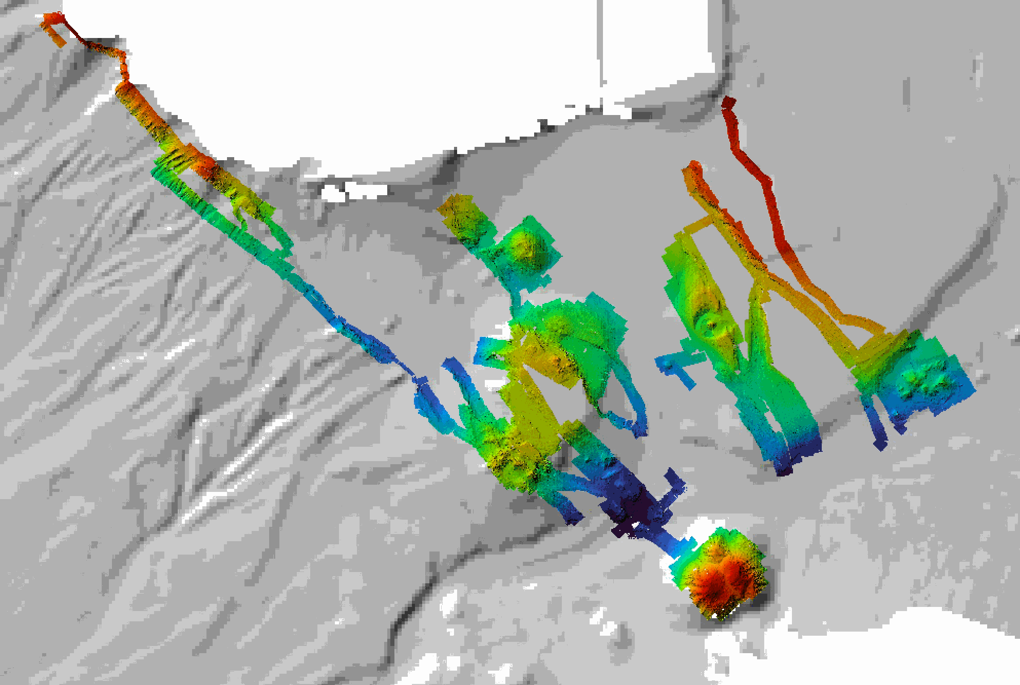
Multibeam bathymetry acquired by AUV Abyss (GEOMAR), during the ODEMAR Cruise off Les Saintes ilsnads (French Antilles). Data is processed and gridded at 2 m resolution.
-
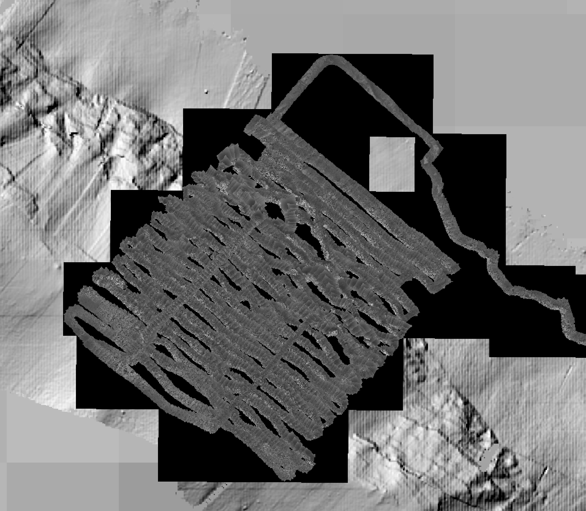
Photomosaics acquired by ROV Victor during dives #653, #654, #655, and #658, along the Roseau Fault (French Antilles). The images, acquired with the ROV vertical camera, were positioned and scales using ROV navigation only (no feature matching, renavigation and reprojection). Images are corrected for uneven illumination. Photomosaics are presented in folders for each dive, and include a Geotiff (.tif) and a location file (.tfw). All photomosaics are in projection WGS84 UTM 20N.
-
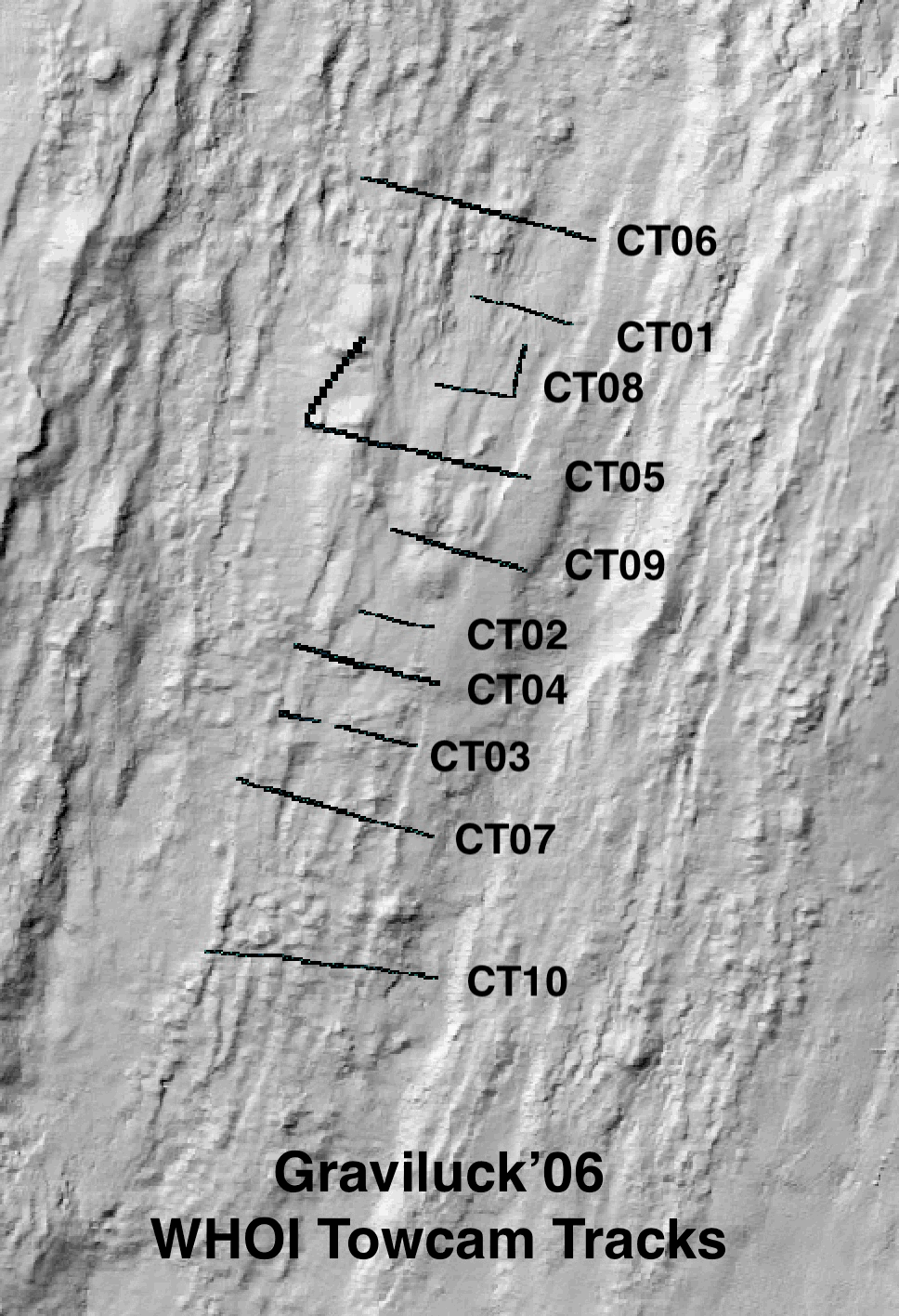
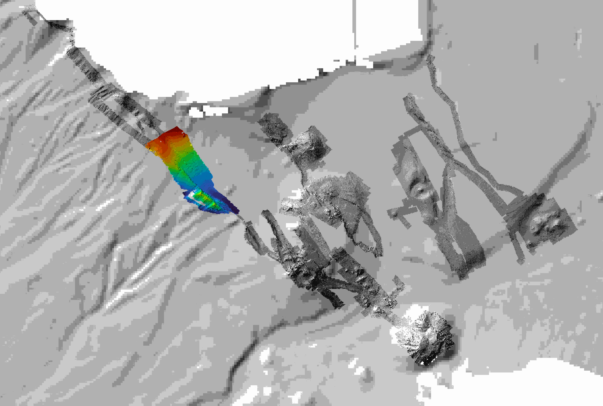
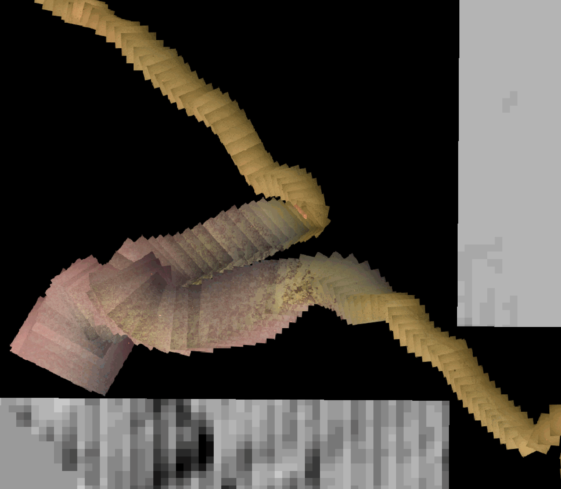
Colour seafloor photomosaics along towed camera tracks crossing the axis of the Lucky Strike ridge segment (Mid Altantic Ridge). Images were acquired with the WHOI TowCam system (https://www.whoi.edu/what-we-do/explore/underwater-vehicles/towed-vehicles/towcam/), during the Graviluck 2016 cruise. Images are process for colour and illumination correction. Images are placed and photomosaiced based on USBL navigation of the TowCam, altitude, and orientation. The datasets include geotiffs for each of the tracks. To be cited: cited: Gini et al. (submitted); Escartin et al. (2008; 2014).
-
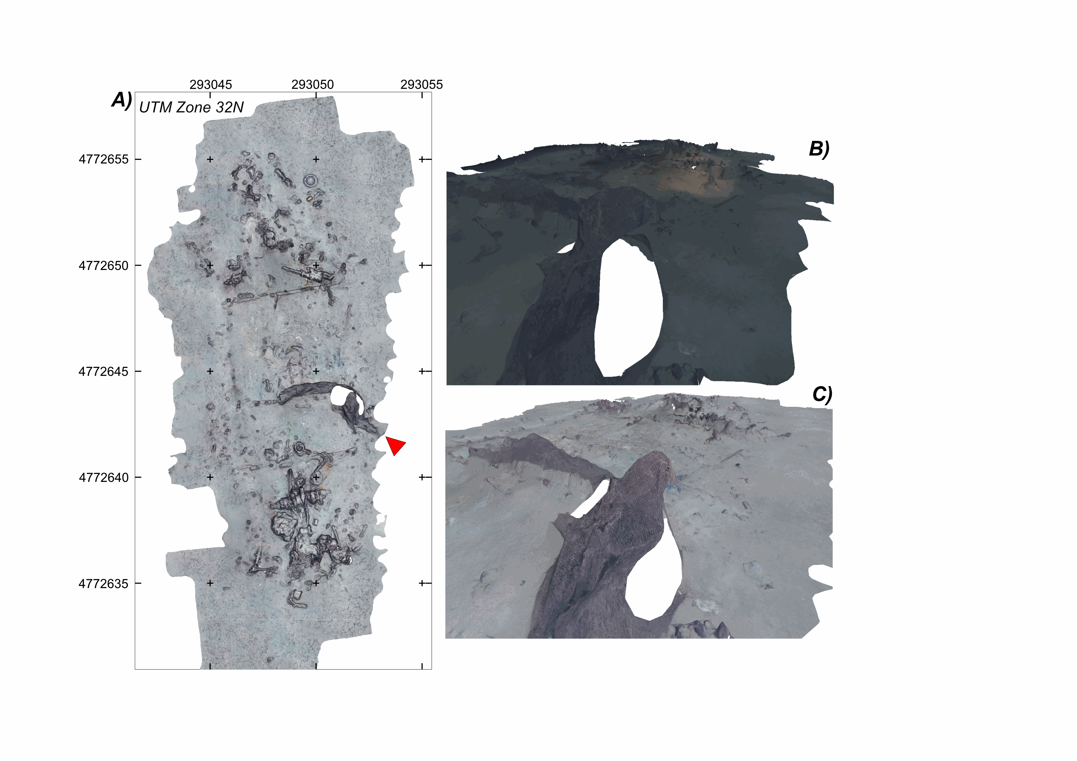
Litter site at the seafloor, off the southern French Mediterranean coast (43.078°N;6.458°E), at a water depth of ~600 m This litter field was surveyed using the HROV Arianne in 2017, deployed from N/O L’Europe, and equipped with a vertical electronic still camera. Two datasets are provided. First, the survey imagery, under a folder named carthorov_dump, that consists of 303 images (jpeg format) and an associated navigation file in dim2 format. Second, 2 folders with 3D textured models of the site (obj format), each with a kml file for georeferencing, and an geotiff orthomosaic. A first model is the result of processing imagery without data correction (folder WithoutAnyCorrection). A second model is processed with image colour correction (folder WithColorAndIlluminationCorrection). This dataset is one of several released with a paper by Arnaubec et al. (submitted March 2021, Computer and Geosciences) presenting the Matisse image processing software and the 3DMetrics Visualization and analysis software and released as open source (ref Github to come). Ref: Arnaubec, A., J. Escartín, J. Opderbecke, M. Matabos, N. Gracias, submitted, Underwater 3D terrain reconstruction from video or still imagery: Processing and exploitation software (MATISSE \& 3DMETRICS), in prep., Computers and Geosciences.
-
Milos Shallow Water Hydrothermal System: Drone seafloor photomosaics (July/September 2019 fieldwork)
Drone photomosaics of the seafloor at the shallow-water Milos hydrothermal system. Photomosaics were acquired with a Phantom and a Mavic Pro drone. Images were acquired in July and September 2019. Photomosaics are provided as geotiffs (UTM Zone 35).
-
Near-bottom multibeam bathymetry acquired at the French Antilles volcanic arc between Les Saintes et Dominica islands. High-resolution bathymetry data (1 m/pixel) were acquired by the autonomous underwater vehicle (AUV) AsterX, deployed during the 2017 Subsaintes cruise (https://doi.org/10.17600/17001000. The dataset consists of dives #394 through #404, after renavigation of the veichile. This dataset includes both grids of individual dives (bathymetry and backscatter, in GRD format), and mosaics combining these dives in 3 larger grids (GEOTIFF). All grids are provided in WGS 84 projection.