 Metadata catalogue
GeoPackage
Type of resources
Available actions
Topics
INSPIRE themes
Provided by
Years
Formats
Representation types
Update frequencies
Scale
-

The « Maritime Spatial Planning » product contains 2D areas vector objects representing the extent of the maritime spatial plan (« MSP Spatial Plan » layer) and the extent of the corresponding vocation zones (« MSP Zoning Element » layer), defined in each strategic façade document.
-
Levantamento georreferenciado de entidades associadas aos Sistemas de Saneamento de Águas Residuais do Concelho de Lagoa que é composto pela rede de saneamento das águas residuais – descarga, drenagem, elevação, transporte, tratamento e rejeição de águas residuais e de águas pluviais. Inclui entidades como: caixas de visita, câmaras cegas, câmaras de retenção, sarjetas e sumidouros, bacias de retenção, câmaras de ligação ao rama, pontos de descarga, estações elevatórias, fossas sépticas, ETAR´s, ramais e coletores.
-
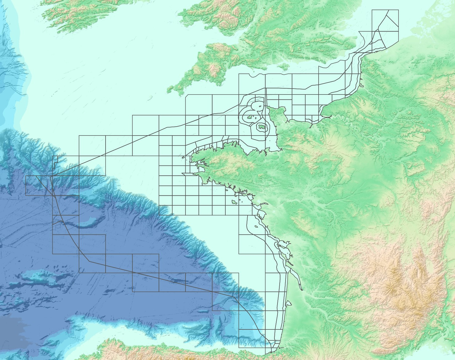
The “French sub-rectangles of the ICES fishery statistical rectangles” product contains 2D areas vector objects representing a sub-rectangle division of ICES statistical rectangles. Each product polygon belongs to an unique ICES rectangle. This subdivision enables distinction between overlapping areas in two or more EEZs, areas of functional interest and areas of regulatory interest.