 Metadata catalogue
2500
Type of resources
Available actions
Topics
INSPIRE themes
Keywords
Contact for the resource
Provided by
Years
Formats
Representation types
Update frequencies
status
Scale
Resolution
-

Fish larvae were collected by the continuous plankton recorder (CPR, operated by SAHFOS) all year long between 1951 and 2005 along transects in the Celtic Sea and English Channel. The CPR is towed by ships of opportunity at speeds of 15 to 20 knots, at an approximate depth of 10 m. Water enters the recorder through an aperture of 1.27 cm2, and is filtered through a continuously moving band of silk with an average mesh size of 270 μm.
-

Location of Upper and Lower Coralline Limestone aquifer.
-
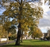
Tree Preservation Orders are made by a Planning Authority under Section 160 of the Town and Country Planning (Scotland) Act 1997 as amended by the Planning etc (Scotland) Act 2006 and within the procedures set out in the Town and Country Planning (Tree Preservation Order and Trees in Conservation Areas) (Scotland) Regulations 2011. They are an effective means of protecting individual trees, groups of trees or woodlands whose removal would have significant impact on the public amenity of an area. Where protection is given by a TPO, prior consent in writing is required from the Council to carry out any work on the trees. It is an offence to cut down, lop, top, uproot or wilfully damage or destroy a protected tree without the Council¿s permission. An owner wishing to carry out work on a tree must apply online at the Scottish Government¿s e-planning system at https://eplanning.scotland.gov.uk/WAM/.
-

The Listed Building Dataset comprises the statutory addresses and supplementary information for listed buildings in Scotland. Listing is the recognition through the Planning (Listed Buildings and Conservation Areas) (Scotland) Act 1997 that a building or structure is of ‘special’ interest. Historic Environment Scotland lists buildings on behalf of Scottish Ministers.
-

Fish larvae were collected by the continuous plankton recorder (CPR, operated by SAHFOS) all year long between 1951 and 2005 along transects in the Celtic Sea and English Channel. The CPR is towed by ships of opportunity at speeds of 15 to 20 knots, at an approximate depth of 10 m. Water enters the recorder through an aperture of 1.27 cm2, and is filtered through a continuously moving band of silk with an average mesh size of 270 μm.
-

Biologic data have been expressed in abundance (numbers or density values (nbr/km²)) and always required to be log-transformed using a log10(x+1) transformation.
-
The Properties in Care dataset comprises information on properties in the care of Historic Environment Scotland on behalf of Scottish Ministers and others. The properties in care estate is a collection of monuments, which define significant aspects of Scotland's history, brought into care for their long term preservation and public benefit through the Ancient Monuments and Archaeological Areas Act 1979. The dataset identifies the approximate location of properties and sites.
-

World Heritage Sites are described by UNESCO as exceptional places of ‘outstanding universal value’ and ‘belonging to all the peoples of the world, irrespective of the territory on which they are located’. The United Nations Educational, Scientific and Cultural Organization (UNESCO) seeks to protect and preserve such sites through an international treaty called the Convention concerning the Protection of the World Cultural and Natural Heritage, drawn up in 1972 Scottish Ministers identify and put forward sites to the Department for Culture, Media and Sport for nomination. This dataset includes both the legal designation and buffer zone boundaries of the World Heritage Sites in Scotland enscribed by UNESCO as well as non-statutory sensitive areas for planning advice. Once a World Heritage Site is inscribed, under the Convention, member states have a duty to protect, conserve and present such sites for future generations.
-

The defining of Conservation Areas is governed by the Planning (Listed Buildings and Conservation Areas) (Scotland) Act 1997; an update from previous Acts relating to such areas. Conservation Areas are designated by local planning authorities and can play an important role in environmental enhancement, economic and community regeneration (e.g. Townscape Heritage Initiatives and Conservation Areas Regeneration Schemes). Councils review conservation areas from time to time in order to assess the need for alteration of boundaries for areas for which special planning considerations apply, e.g. Article 4 directions. Many conservation areas now have character appraisals to explain what it is that should be preserved and what can be enhanced.