 Metadata catalogue
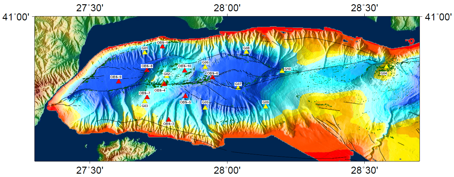
Ocean Bottom (OBS) data from Ifremer’s temporary network deployed in the Sea of Marmara in 2014 (2 months)
|
|
Citation proposal
BATSI Evangelia (Ifremer, France) - GELI Louis (Ifremer, France) - PELLEAU Pascal (Ifremer, France) - Nurcan Meral Özel (KOERI) (2017) . Ocean Bottom (OBS) data from Ifremer’s temporary network deployed in the Sea of Marmara in 2014 (2 months). https://services.mspdata.eu:/geonetwork/srv/api/records/seanoe:49656 |
Simple
- Date ( Publication )
- 2017-05
- Date ( Revision )
- 2021-05-12
- Other citation details
-
Batsi Evangelia, Geli Louis, Pelleau Pascal, Nurcan Meral Özel (2017). Ocean Bottom (OBS) data from Ifremer’s temporary network deployed in the Sea of Marmara in 2014 (2 months). SEANOE. https://doi.org/10.17882/49656
In addition to properly cite this dataset, it would be appreciated that the following work(s) be cited too, when using this dataset in a publication :
Batsi Evangelia, Lomax Anthony, Tary Jean-Baptiste, Klingelhoefer Frauke, Riboulot Vincent, Murphy Shane, Monna Stephen, Ozel Nurcan Meral, Kalafat Dogan, Saritas Hakan, Cifci Gunay, Cagatay Namik, Gasperini Luca, Geli Louis (2018). An Alternative View of the Microseismicity along the Western Main Marmara Fault. Bulletin Of The Seismological Society Of America, 108(5A), 2650-2674. https://doi.org/10.1785/0120170258
Author
Author
Publisher
- Keywords ( Theme )
-
- Marine geology
- Keywords ( project )
-
- FP7 MARSITE (Agreement: 308417)
- ODATIS aggregation parameters and Essential Variable names ( Theme )
-
- Bathymetry
- SeaDataNet Parameter Disciplines ( parameter )
-
- Marine geology
- Type de jeux de donnée ODATIS ( Theme )
-
- Observational data
- Use constraints
- Other restrictions
- Other constraints
- Date ( Publication )
- 2020
Publisher
Author
Author
Author
Author
Author
Author
Author
Author
Author
Author
Author
Author
Author
- Association Type
- Cross reference
- Initiative Type
- Study
- Date ( Publication )
- 2020
Publisher
Author
Author
Author
Author
Author
Author
- Association Type
- Cross reference
- Initiative Type
- Study
- Date ( Publication )
- 2019
Publisher
Author
Author
Author
Author
Author
Author
Author
Author
Author
- Association Type
- Cross reference
- Initiative Type
- Study
- Date ( Publication )
- 2019
Publisher
Author
Author
Author
Author
- Association Type
- Cross reference
- Initiative Type
- Study
- Date ( Publication )
- 2018
Publisher
Author
Author
Author
Author
Author
Author
Author
Author
Author
Author
Author
Author
Author
Author
- Association Type
- Cross reference
- Initiative Type
- Study
- Date ( Publication )
- 2021
Publisher
Author
Author
Author
Author
Author
- Association Type
- Cross reference
- Initiative Type
- dataset
- Date ( Publication )
- 2021
Publisher
Author
Author
Author
Author
Author
Author
Author
- Association Type
- Cross reference
- Initiative Type
- dataset
- Association Type
- Cross reference
- Initiative Type
- Platform
- Metadata language
- English
- Topic category
-
- Oceans
- Distribution format
-
- SAC ( )
- CSV ( )
- OnLine resource
-
Quality controlled data
OBS1 - 3 GB
- OnLine resource
-
Quality controlled data
OBS3 - 3 GB
- OnLine resource
-
Quality controlled data
OBS4 - 3 GB
- OnLine resource
-
Quality controlled data
OBS5 - 3 GB
- OnLine resource
-
Quality controlled data
OBS6 - 3 GB
- OnLine resource
-
Quality controlled data
OBS7 - 3 GB
- OnLine resource
-
Quality controlled data
OBS8 - 3 GB
- OnLine resource
-
Quality controlled data
OBS9 - 3 GB
- OnLine resource
-
Quality controlled data
OBS10 - 1 GB
- OnLine resource
-
Quality controlled data
OBS11 - 1 GB
- OnLine resource
-
Quality controlled data
OBS12 - 1 GB
- OnLine resource
-
Table of coordinates and operation period of the temporary OBS stations of Ifremer in 2014 - 627 bytes
Table of coordinates and operation period of the temporary OBS stations of Ifremer in 2014 - 627 bytes
- OnLine resource
- DOI of the product
- OnLine resource
- Seanoe
- Hierarchy level
- Dataset
- Statement
Metadata
- File identifier
- seanoe:49656 XML
- Metadata language
- English
- Character set
- UTF8
- Hierarchy level
- Dataset
- Date stamp
- 2021-05-12
- Metadata standard name
- ISO 19115:2003/19139
- Metadata standard version
- 1.0
Point of contact
Overviews
Provided by
