Metadata catalogue
SADOGEOROB 1 2007 Geophysical Campaign
This project aims to characterize the evolution of the coastline during the Quaternary and discern what were the contributions to this evolution: 1) neotectonic, 2) eustatic variations and 3) sedimentary transport; for this purpose was selected as study area the coastal stretch between Cabo da Roca (~ 38 46'N) and the village of Comporta (~ 38 20'N).
|
|
Citation proposal
. SADOGEOROB 1 2007 Geophysical Campaign. https://services.mspdata.eu:/geonetwork/srv/api/records/e6facb0f-5300-4f92-9662-fb7cfbc2d5b7 |
Simple
- Date ( Revision )
- 2015-04-26
- Identifier
- http://ipma.pt/observations/cruises/cdg / 6238dd05-9635-47ae-98a6-1df1b0e69f9d
- Identifier
- seadatanet_sadogeorob12007
- Identifier
- SeaDataNet / urn:SDN:CSR:LOCAL:BSH20153077
- Credit
- LNEG - Laboratório Nacional de Energia e Geologia
- Credit
- IH - Instituto Hidrográfico
Point of contact
Instituto Português do Mar e da Atmosfera, I.P. (IPMA, I.P.)
-
Prof. Dr. Pedro Terrinha
Rua C do Aeroporto s/n
Lisboa
1749-077
Portugal
- Maintenance and update frequency
- Conforme Necessário As needed
- GEMET - INSPIRE themes, version 1.0 ( Theme )
-
- Características oceanográficas
- Thesaurus SNIMar v.1.0 ( instrument )
-
- Sonar de varrimento lateral
- Thesaurus SNIMar v.1.0 ( instrument )
-
- Sondador de feixe simples
- Thesaurus SNIMar v.1.0 ( Discipline )
-
- Batimetria e Geomorfologia Marinha
- Thesaurus SNIMar v.1.0 ( parameter )
-
- Batimetria
- Thesaurus SNIMar v.1.0 ( parameter )
-
- Sísmica de reflexão
- Thesaurus SNIMar v.1.0 ( Discipline )
-
- Geofísica marinha
- Keywords
-
- IPMA, I.P.
- Use limitation
- Sem restrições
- Access constraints
- Outras Restrições Other restrictions
- Use constraints
- Outras Restrições Other restrictions
- Other constraints
- Licença SeaDataNet
- Spatial representation type
- Vetorial Vector
- Spatial representation type
- Matricial Grid
- Denominator
- -1
- Metadata language
- Português Portuguese
- Character set
- utf8 UTF8
- Topic category
-
- Geoscientific information
- Oceans
N
S
E
W
))
- Reference system identifier
- EPSG / http://www.opengis.net/def/crs/EPSG/0/4258
- Reference system identifier
- EPSG / http://www.opengis.net/def/crs/EPSG/0/4326
- Distribution format
-
- SHP (não se aplica )
- SEGY (não se aplica )
- ASCII Grid (não se aplica )
- Hierarchy level
- Série Series
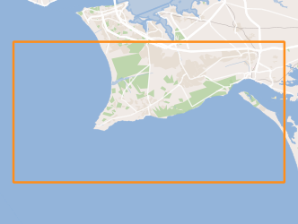
Extent
No information provided.
- Dataset
- 6238dd05-9635-47ae-98a6-1df1b0e69f9d
- Dataset
- seadatanet_sadogeorob12007
- Dataset
- urn:SDN:CSR:LOCAL:BSH20153077
Conformance result
- Date ( Publication )
- 2010-12-08
- Explanation
- Ver a especificação citada.
- Pass
- false
- Statement
- The data centres apply standard data quality control procedures on all data that the centres manage. Ask the data centre for details.
Metadata
- File identifier
- e6facb0f-5300-4f92-9662-fb7cfbc2d5b7 XML
- Metadata language
- Português Portuguese
- Character set
- utf8 UTF8
- Hierarchy level
- Série Series
- Date stamp
- 2017-04-10
- Metadata standard name
- Perfil SNIMar
- Metadata standard version
- v.0.9.3
Point of contact
Instituto Português do Mar e da Atmosfera, I.P. (IPMA, I.P.)
Rua C do Aeroporto s/n
Lisboa
1749-077
Portugal