Metadata catalogue
AMI-Wind on ERS -1/-2 Weekly Arctic Level 3 Sea-Ice Maps on 25km Polar Grid
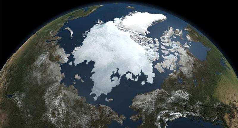
Sea Ice Arctic
|
|
Citation proposal
. AMI-Wind on ERS -1/-2 Weekly Arctic Level 3 Sea-Ice Maps on 25km Polar Grid. https://services.mspdata.eu:/geonetwork/srv/api/records/c0742fab-f733-4122-8494-cbb8ea261b36 |
Simple
- Date ( Creation )
- 1991-08-08
- Unique resource identifier
- Credit
-
CERSAT
Point of contact
Centre Bretagne - ZI de la Pointe du Diable - CS 10070 - 29280 Plouzané
Brest
France
Point of contact
Centre Bretagne - ZI de la Pointe du Diable - CS 10070 - 29280 Plouzané
Brest
France
- Centre de données ODATIS Centre de données ODATIS ( Theme )
-
-
CDS-SAT-CERSAT
-
- Keywords
-
-
Sea Ice
,
-
- Variables ODATIS Variables ODATIS ( Theme )
-
-
/Physical Oceanography/Sea Ice
-
- Type de jeux de donnée ODATIS Type de jeux de donnée ODATIS ( Theme )
-
-
/Télédétection
-
- Thèmatiques ODATIS Thèmatiques ODATIS ( Theme )
-
-
Remote sensing
-
- Use limitation
-
Aucune condition ne s’applique
- Access constraints
- Other restrictions
- Use constraints
- Copyright
- Other constraints
- Spatial representation type
- Grid
- Metadata language
- French
- Character set
- UTF8
- Topic category
-
- Oceans
))
- Geometric object type
- Complex
- Distribution format
-
- ()
- OnLine resource
- CERSAT Catalogue
- Hierarchy level
- Dataset
- Statement
-
This level 3 product contains arctic polar sterographic 25 km resolution grids of backscatter coefficient over sea-ice from AMI-Wind scatterometers onboard ERS at different incidence angles. The grids are derived from weekly averaged 50 km resolution swath sigma-naught data (from WNF product distributed at CERSAT) and spatially interpolated by a kriging method. The ERS radar backscattering properties enable the monitoring of sea-ice extent and edges (by discriminating open water from sea-ice) but also the categorization of polar sea-ice as : multi-year ice, consolidated first-year ice, or marginal ice. The product includes for each pole the following maps : sea-ice backscatter at 40° and 50° incidence, backscatter derivative at 28° and sea-ice/water mask. The dataset covers the complete ERS-1/-2 mission.
Metadata
- File identifier
- c0742fab-f733-4122-8494-cbb8ea261b36 XML
- Metadata language
- French
- Character set
- UTF8
- Hierarchy level
- Dataset
- Date stamp
- 2018-01-18T13:16:39
- Metadata standard name
-
ISO 19115:2003/19139 - SEXTANT
- Metadata standard version
-
1.0