Metadata catalogue
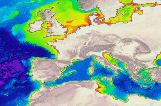
Bathymetry and Elevation | Sea-floor depth (below mean sea level) {bathymetric depth} | EMODnet Secretariat | EMODnet Bathymetry
|
|
Citation proposal
. Bathymetry and Elevation | Sea-floor depth (below mean sea level) {bathymetric depth} | EMODnet Secretariat | EMODnet Bathymetry. https://services.mspdata.eu:/geonetwork/srv/api/records/a1e02c36-a9c8-46d4-b298-da7742731e5d |
Simple
- Alternate title
- EMODnet Bathymetry
- Date
- Identifier
- Bathymetry and Elevation | Sea-floor depth (below mean sea level) {bathymetric depth} | EMODnet Secretariat | EMODnet Bathymetry
- Other citation details
- EMODnet Bathymetry
- Purpose
- To show the distribution of seabed substrates of the European marine areas including (e.g. the Baltic Sea, the Greater North Sea, the Celtic Sea, the Iberian Coast, and the Mediterranean Sea within EU waters) at 1: 250 000 scale (250k)
- Credit
Originator
edmo
- Maintenance and update frequency
- As needed
- Used by challenges ( Theme )
-
- Atlantic - CH07 - Fisheries Impact
- Environmental matrix ( Theme )
-
- Seabed - Riverbed
- Production mode ( Theme )
-
- Delayed
- Visibility ( Theme )
-
- Search via reference catalogue (e.g. MyOcean, GEOSS Geoportal…)
- Policy visibility ( Theme )
-
- There is detailed information provided to understand data policy
- Readyness ( Theme )
-
- Format not proprietary and content clearly specified (e.g. autodescriptive like ODV, NetCDF CF) or at least with appropriate document describing the content
- Parameter Discovery Vocabulary (P02) ( parameter )
-
- Bathymetry and Elevation
- GEMET - INSPIRE themes, version 1.0 ( Theme )
-
- Hydrography
- Processing level of characteristics ( Theme )
-
- High level analyzed
- Data delivery mechanisms ( Theme )
-
- Online discovery + downloading + viewing services (Advanced services)
- Parameter Usage Vocabulary (P01) ( parameter )
-
- Sea-floor depth (below mean sea level) {bathymetric depth}
- Parameter Usage Vocabulary (other) ( Theme )
-
- Bathymetric depth
- Agreed Parameter Groups (P03) ( parameter )
-
- Gravity, magnetics and bathymetry
- Service extent ( Theme )
-
- The datasets are provided through an EU Inspire catalogue service (OGC)
- Reliability ( Theme )
-
- Validation ( Theme )
-
- Submitted
- Access constraints
- Other restrictions
- Other constraints
- Unrestricted
- Use limitation
- Open and Free. No charge
- Spatial representation type
- vector Vector
- Distance
- 125 meter
- Metadata language
- French
- Character set
- utf8 UTF8
- Topic category
-
- Oceans
- Environment description
- To spatially resolve seabed habitats in relation to fished areas in European waters to quantify the impact on vulnerable habitats.
N
S
E
W
))
Vertical extent
- Minimum value
- 0
- Maximum value
- 4800
- Supplemental Information
- Unique resource identifier
- Codespace
- Version
- Dimension name
- Time
- Transformation parameter availability
- true
- Checkpoint Availability
- true
- Distribution format
-
- GeoTIFF ()
- OnLine resource
- EMODnet Bathymetry Portal
- OnLine resource
- EMODnet Bathymetry
- Hierarchy level
- Dataset
Domain consistency
- Name of measure
- Responsiveness
Quantitative result
- Value
- Online downloading (i.e. a few hours or less) for release
Domain consistency
- Name of measure
- Reliability
Quantitative result
Metadata
- File identifier
- a1e02c36-a9c8-46d4-b298-da7742731e5d XML
- Metadata language
- English
- Character set
- UTF8
- Hierarchy level
- Dataset
- Hierarchy level name
- Atlantic - CH07 - Fisheries Impact
- Date stamp
- 2017-05-04T11:42:37
- Metadata standard name
- ISO 19115-3 - Emodnet Checkpoint - Upstream Data
- Metadata standard version
- 1.0