 Metadata catalogue
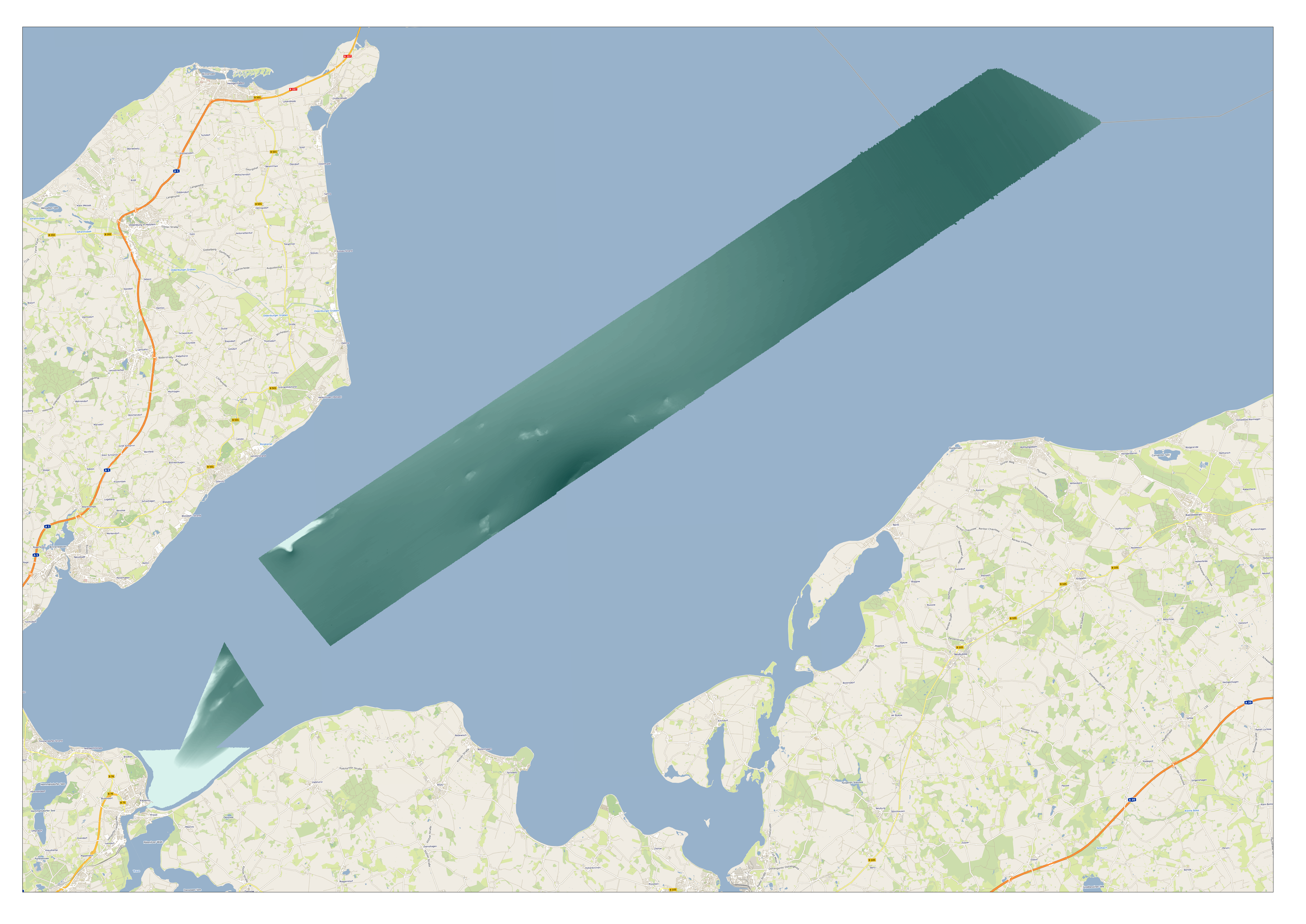
1850 HRDTM 1/256 Lübeck approach
High resolution composite DTM based on multi beam surveys. All data acquired in the years 2014-2018.
|
|
Citation proposal
Federal Maritime and Hydrographic Agency. 1850 HRDTM 1/256 Lübeck approach. https://services.mspdata.eu:/geonetwork/srv/api/records/SDN_CPRD_1850_hrdtm_luebeck_approach |
Simple
- Alternate title
- Date ( Creation )
- 2022-10-25
- Date ( Revision )
- Identifier
-
hrdtm_luebeck_approach
Originator
Custodian
- Project name ( Theme )
-
-
EMODnet HRSM
-
- SeaDataNet device categories ( Theme )
-
-
single-beam echosounders
,multi-beam echosounders
-
- http://vocab.ndg.nerc.ac.uk/ ( Stratum )
-
- Parameter Discovery Vocabulary (P02) ( parameter )
-
-
Bathymetry and Elevation
-
- GEMET - INSPIRE themes, version 1.0 ( Theme )
-
-
Hydrography
-
- SeaDataNet depth measurement reference planes ( Theme )
-
- Use limitation
- Access constraints
- Creative Commons Attribution 4.0 International
- Use constraints
- Other restrictions
- Other constraints
-
DO NOT USE FOR NAVIGATION
- Use limitation
- Spatial representation type
- Grid
- Denominator
- 5000
- Distance
- 0.0019531 Metres (m)
- Metadata language
- English
- Character set
- UTF8
- Topic category
-
- Oceans
))
- Unique resource identifier
- Description
-
Map projection parameters, values and units :
Axes units :
- Unique resource identifier
- Codespace
-
EPSG
- Version
-
7.4
- Reference system identifier
-
EPSG
/WGS 84 (EPSG:4326)
/7.4
- Number of dimensions
- 3
- Dimension name
- Column
- Dimension size
- 54684
- Dimension name
- Row
- Dimension size
- 19383
- Dimension name
- Time
- Dimension size
- 1
- Cell geometry
- Point
- Transformation parameter availability
- false
- Checkpoint Availability
- false
- Point in Pixel
-
- Center
- Distribution format
-
-
()
- Specification
-
()
Distributor
Distributor
- Protocol
-
WWW:LINK
- Name
- Description
- Function
- Information
- OnLine resource
- EMODnet Bathymetry WMTS service
- OnLine resource
- EMODnet Viewer
- OnLine resource
- hrdtm_luebeck_approach
- Hierarchy level
- Dataset
Vertical extent
- Minimum value
- 1.10
- Maximum value
- 27.46
Vertical CS
Vertical datum
- Statement
-
no information
- Hierarchy level
- Feature
- Dataset
-
accuracy
Gridded data positional accuracy
- Name of measure
-
horizontal accuracy
- Measure identification
-
horizontal accuracy of coordinate
- Measure description
- Evaluation method description
Quantitative result
- Value type
- horizontal accuracy
Quantitative attribute accuracy
- Name of measure
-
depth
- Measure identification
-
depth accuracy
- Measure description
- Evaluation method description
Quantitative result
- Value
- not defined
Conformance result
- Date
- Explanation
- Hierarchy level
- Software
- Description
- Other
-
software
- Hierarchy level
- Property type
- Description
-
parameters of data processing
- Attributes
- Statement
-
Source of the DTM are multiple 1m grids which have been transformed and resampled to 1/256 arc minutes in WGS84.
- Description
-
CDIs:
105180103_T,105180102_T,105180101_T,1061801_T,106170101_T,106170102_T,106170103_T,106170104_T,106170205_T,106170201_T,106170202_T,106170203_T,106170204_T,106170305_T,106170303_T,106170304_T,106170302_T,106170301_T,106171103_T,106171102_T,106171101_T,106170501_T,106170502_T,106170401_T,106170601_T,106170402_T,106170403_T,106170404_T,106170602_T,106170603_T,106170604_T,106170605_T,106170703_T,106170704_T,106170702_T,106170701_T,106170705_T,106160804_T,106160805_T,106160803_T,106160801_T,106160905_T,106160904_T,106160903_T,106160902_T,106160901_T,106161001_T,106161002_T,106161003_T,106161004_T,106161005_T,106160802_T,5061401
- Hierarchy level
- Dataset
Absolute external positional accuracy
- Name of measure
-
emodnet-bathymetry.QI.Horizontal
- Value
- 3 - < 20 m
Absolute external positional accuracy
- Name of measure
-
emodnet-bathymetry.QI.Vertical
- Value
- 4 - MBES High frequency (higher that 100kHz) (1+0.5%d)
Domain consistency
- Name of measure
-
emodnet-bathymetry.QI.Purpose
- Value
- 3 - Hydrographic survey or compatible with hydrographic standards
Metadata
- File identifier
- SDN_CPRD_1850_hrdtm_luebeck_approach XML
- Metadata language
- English
- Character set
- UTF8
- Hierarchy level name
-
Product record
- Date stamp
- 2023-05-05T08:20:31.236Z
- Metadata standard name
-
ISO 19115:2003/19139 - EMODNET - BATHYMETRY
- Metadata standard version
-
1.0
Author
Overviews
Provided by
