 Metadata catalogue
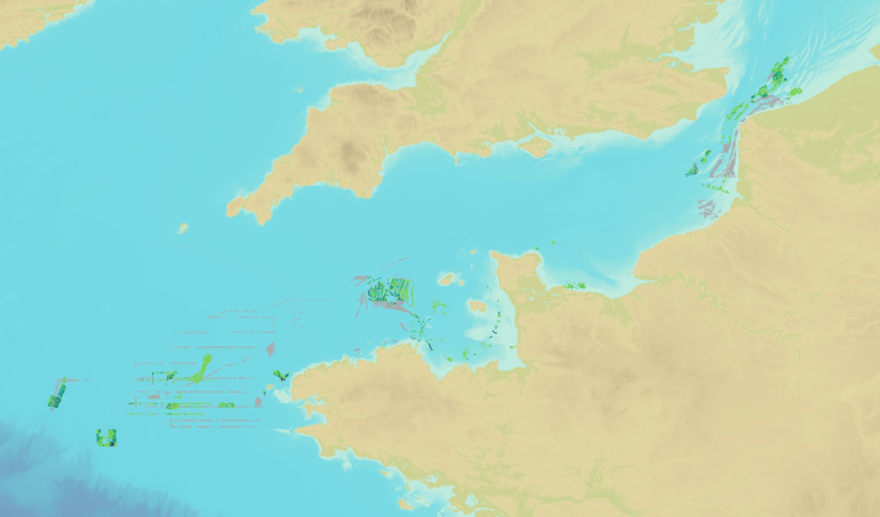
Distribution of submarine dunes over the French continental shelf
The product "Distribution of the submarine dunes of the French continental shelf" contains digital vector data provided as 2D linear objects representing the crest of submarine dunes digitized from bathymetric surveys conducted by the Shom.
When several surveys have been carried out on the same area or dune, the product contains the information from all the surveys. However, the data displayed on data.shom.fr is limited to the information from the most recent survey.
|
|
Citation proposal
Shom (2021) . Distribution of submarine dunes over the French continental shelf. https://services.mspdata.eu:/geonetwork/srv/api/records/HOM_GEOL_DUNES.xml |
Simple
- Date ( Publication )
- 2021-10-26
- Identifier
- http://www.shom.fr/HOM/GEOL_DUNES
Author
- Maintenance and update frequency
- As needed
- Maintenance note
- Les nouvelles acquisitions à la mer et les levés des autres régions seront intégrés progressivement dans le cadre des mises à jours annuelles.
- Keywords ( Theme )
-
- geology , dunes , submarine dunes , Product
- GEMET - INSPIRE themes, version 1.0 ( Theme )
-
- Géologie Geology
- Use limitation
- Data free of use by acknowledging its source. Open licence Etalab v. 2.0 avril 2017.
- Use limitation
- Do not use for navigation.
- Use limitation
- Data free of use by acknowledging its source. Open licence Etalab v. 2.0 avril 2017.
- Access constraints
- License
- Use constraints
- Other restrictions
- Other constraints
- Open licence Etalab v. 2.0 avril 2017.
- Access constraints
- Other restrictions
- Other constraints
- Pas de restriction d'accès public. No public access restrictions.
- Classification
- Unclassified
- Spatial representation type
- Vector
- Denominator
- 10000
- Metadata language
- fre French
- Character set
- utf8 UTF8
- Topic category
-
- Oceans
))
- Distribution format
-
- SHP (inapplicable )
- GML (3.2 )
Point of contact
- OnLine resource
-
Shom Geoportal
Shom Geoportal
- OnLine resource
-
GE.GeomorphologicFeature.Natural.SubMarineDunes
Access point Access Point
- OnLine resource
-
DUNES_BDD_WMSV
Access point / Répartition des dunes du Plateau continental français - WMS Vecteur Access Point / Distribution of submarine dunes over the French continental shelf - WMS
- OnLine resource
-
DUNES_BDD_WFS:dunes_3857
Access point / Répartition des dunes du Plateau continental français Access point / Distribution of submarine dunes over the French continental shelf
- OnLine resource
- Download service / Distribution of submarine dunes over the French continental shelf
- OnLine resource
- Portail de diffusion du Shom
- Hierarchy level
- Dataset
Conformance result
- Date ( Publication )
- 2010-11-23
- Explanation
- Information sur la conformité au règlement d'interopérabilité des séries et des services de données géographiques.
- Pass
- true
Conformance result
- Date ( Publication )
- 2013-02-04
- Explanation
- Information sur la conformité de la ressource à une spécification.
- Pass
- true
- Statement
-
This product was developed by the Shom sedimentology department during the Dunes I project (2006-2010). Its development was taken up in the Dunes II project (2013-2017), and then in the ANR project (10-IEED-0006-33) DUNES (2019-2022).
The information used for the development of this product comes from the processing of side-scan sonar data and multibeam echosounder (MBS) data surveyed, digitized manually and integrated into the product from 2006 to 2022.
Metadata
- File identifier
- HOM_GEOL_DUNES.xml XML
- Metadata language
- fre French
- Character set
- UTF8
- Hierarchy level
- Dataset
- Hierarchy level name
- Produit
- Date stamp
- 2022-09-23T11:44:43
- Metadata standard name
- ISO 19115:2003/19139
- Metadata standard version
- 1.0
Point of contact
Overviews
Provided by
