Metadata catalogue
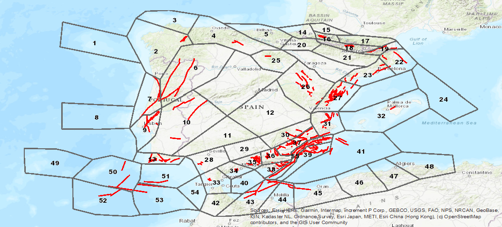
Visualization Service (WMS) of the Seismogenic Database of Spain
Database visualization service of seismogenic zones of the Iberian Peninsula and territories of influence for the calculation of seismic hazard in Spain (ZESIS)
|
|
Citation proposal
. Visualization Service (WMS) of the Seismogenic Database of Spain. https://services.mspdata.eu:/geonetwork/srv/api/records/ESPIGMESERVICIOZESIS20190703 |
Simple
Identification info
- Date ( Creation )
- 2007-01-01
- Identifier
- ESPIGMESERVICIOZESIS20190703
- Purpose
- On-line availability of the database of seismogenic zones of the Iberian Peninsula and territories of influence for the calculation of seismic hazard in Spain (ZESIS).
Point of contact
- Tesauro IGME Tesauro IGME ( Theme )
-
- IGME , ZESIS , Seismogenic Zoning of Iberia , Seismogenic Zones , Seismic hazard , QAFI , Quaternary , Fault , Iberia , Earthquake , Paleoseismology , Tectonics , Spain , Portugal
-
- ,
- Ámbito espacial
-
- Nacional
- Keywords
-
- EGDI
- Keywords
-
- EGDI-selection
- Keywords
-
- WMS
- REGLAMENTO (CE) No 1205/2008 DE LA COMISIÓN de 3 de diciembre de 2008 por el que se ejecuta la Directiva 2007/2/CE del Parlamento Europeo y del Consejo en lo que se refiere a los metadatos
-
- Servicio de acceso a mapas
- Especificaciones de Servicios Web ( Theme )
-
- OGC (Open Geospatial Consortium) , WMS (Web Map Service) , WMS 1.3.0 , OGC , WMS
- ISO - 19119 geographic services taxonomy ( Theme )
-
- infoMapAccessService
- INSPIRE_SpatialDataServicesClassification
-
- Servicio de acceso a mapas , Servicio de gestión de modelos/información geográficos
- Access constraints
- otherRestrictions Other restrictions
- Use constraints
- otherRestrictions Other restrictions
- Other constraints
- LICENCIA DE USO: Condiciones de uso público y difusión de la información para la reutilización de los datos IGME http://www.igme.es/Ayuda/CondiUso.htm
- Service Type
- view
N
S
E
W
))
- Coupling Type
- Tight
Contains Operations
- Operation Name
- GetCapabilities
- Distributed Computing Platforms
- Web services
Contains Operations
- Operation Name
- GetMap
- Distributed Computing Platforms
- Web services
Contains Operations
- Operation Name
- GetFeatureInfo
- Distributed Computing Platforms
- Web services
- Operates On
- Distribution format
-
- image/png (not applicable )
- image/jpeg (not applicable )
- image/tiff (not applicable )
- image/gif (not applicable )
- image/bmp (not applicable )
Distributor
Instituto Geológico y Minero de España (IGME)
Geological Survey of Spain (IGME)
C/. Rios Rosas, 23
Madrid
28003
España
- Website
- http://www.igme.es
- Hierarchy level
- Service
- Other
- Servicio web de datos espaciales. Servicio de visualización
Conformance result
- Date ( Publication )
- 2014-12-31
- Pass
- false
Conformance result
- Date ( Publication )
- 2008-12-03
- Pass
- true
Conformance result
- Date ( Publication )
- 2008-12-03
- Explanation
- Consultar el reglamento mencionado
- Pass
- true
Metadata
- File identifier
- ESPIGMESERVICIOZESIS20190703 XML
- Metadata language
- spa Spanish; Castilian
- Character set
- utf-8 UTF8
- Hierarchy level
- service Service
- Hierarchy level name
- Servicio
- Date stamp
- 2020-06-24
- Metadata standard name
- Reglamento (CE) Nº 1205/2008 de Inspire, "Perfil IGME"
- Metadata standard version
- 2.0
Point of contact
Geological Survey of Spain (IGME)
-
Margarita Gómez Sánchez
C/Ríos Rosas, 23
Madrid
Madrid
28003
España
- Website
- http://www.igme.es