Metadata catalogue
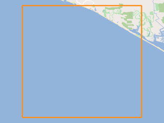
ERSTA-SANDEX 2008 Geophysical Campaign
The ERSTA project intended to study the seismogenic and tsunamigenic bodies and prepare an sismotectonic model for the Algarve region. For this project, in this campaign, was intend to carry out a geophysical survey that will contribute to a more detailed characterization, in the offshore region, of São Marcos-Quarteira and Carcavai faults. The SANDEX project aims to evaluate the physical impact from the extraction of sand and gravel in the coastal sediment balance and evolution of the coastline. The campaign aims to collect bathymetric data that will contribute to monitoring of the impact caused by the exploitation of sand deposits carried off the Quarteira as well as for the assessment of sediment budget of the study area.
|
|
Citation proposal
. ERSTA-SANDEX 2008 Geophysical Campaign. https://services.mspdata.eu:/geonetwork/srv/api/records/7c769c17-25a8-4fd7-ae03-2119860c27c3 |
Simple
- Date ( Revision )
- 2015-03-26
- Identifier
-
http://ipma.pt/observations/cruises/cdg
/bc84e59c-c49b-4635-aca2-ee56b3e60f4e
- Identifier
-
seadatanet_erstasandex2008
- Identifier
-
SeaDataNet
/urn:SDN:CSR:LOCAL:BSH20153075
- Credit
-
LNEG - Laboratório Nacional de Energia e Geologia
- Credit
-
IH - Instituto Hidrográfico
Point of contact
Rua C do Aeroporto s/n
Lisboa
1749-077
Portugal
- Maintenance and update frequency
- Conforme Necessário As needed
- GEMET - INSPIRE themes, version 1.0 ( Theme )
-
-
Características oceanográficas
-
- Thesaurus SNIMar v.1.0 ( instrument )
-
-
Sonar de varrimento lateral
-
- Thesaurus SNIMar v.1.0 ( instrument )
-
-
Ecobatímetro
-
- Thesaurus SNIMar v.1.0 ( Discipline )
-
-
Batimetria e Geomorfologia Marinha
-
- Thesaurus SNIMar v.1.0 ( parameter )
-
-
Batimetria
-
- Thesaurus SNIMar v.1.0 ( parameter )
-
-
Sísmica de reflexão
-
- Thesaurus SNIMar v.1.0 ( Discipline )
-
-
Geofísica marinha
-
- Keywords
-
-
IPMA, I.P.
-
- Use limitation
-
Sem restriçoes
- Access constraints
- Outras Restrições Other restrictions
- Use constraints
- Outras Restrições Other restrictions
- Other constraints
-
Licença SeaDataNet
- Spatial representation type
- Vetorial Vector
- Spatial representation type
- Matricial Grid
- Denominator
- -1
- Metadata language
- Português Portuguese
- Character set
- utf8 UTF8
- Topic category
-
- Geoscientific information
- Oceans
))
- Reference system identifier
-
EPSG
/
- Reference system identifier
-
EPSG
/
- Distribution format
-
-
SHP
(não se aplica
) -
SEGY
(não se aplica
) -
ASCII Grid
(não se aplica
)
-
- Hierarchy level
- Série Series
Extent
- Dataset
-
bc84e59c-c49b-4635-aca2-ee56b3e60f4e
- Dataset
-
seadatanet_erstasandex2008
- Dataset
-
urn:SDN:CSR:LOCAL:BSH20153075
Conformance result
- Date ( Publication )
- 2010-12-08
- Explanation
-
Ver a especificação citada.
- Pass
- false
- Statement
-
The data centres apply standard data quality control procedures on all data that the centres manage. Ask the data centre for details.
Metadata
- File identifier
- 7c769c17-25a8-4fd7-ae03-2119860c27c3 XML
- Metadata language
- Português Portuguese
- Character set
- utf8 UTF8
- Hierarchy level
- Série Series
- Date stamp
- 2017-04-10
- Metadata standard name
-
Perfil SNIMar
- Metadata standard version
-
v.0.9.3
Point of contact
Rua C do Aeroporto s/n
Lisboa
1749-077
Portugal