 Metadata catalogue
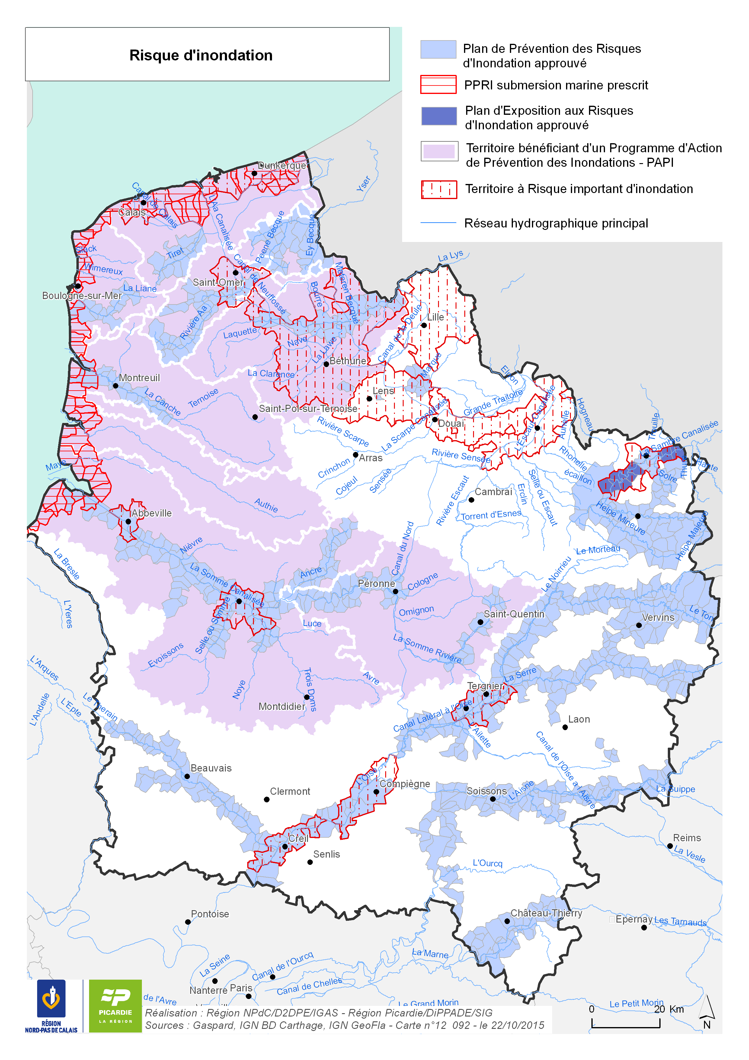
Risque d'inondation
Représentation des outils pour connaître et gérer le risque d'inondation :
- Le Plan de Prévention des Risques d'Inondation
- Territoires à Risque important d'Inondation (TRI)
- Programme d'Action de Prévention des Inondations (PAPI)
|
|
Citation proposal
(2016) . Risque d'inondation. https://services.mspdata.eu:/geonetwork/srv/api/records/602294d8-1b92-4bd9-820c-92dc975029a6 |
Simple
- Date ( Publication )
- 2016-01-15 14:32:54
- Date ( Creation )
- 2015-10-22T00:00:00
- Identifier
- 12092
- Presentation form
- Digital map
- Credit
Point of contact
- Keywords
-
- inondation
- Keywords ( Theme )
-
- Hydrographie
- GEMET - INSPIRE themes, version 1.0
-
- Hydrographie
- Denominator
- 1050000
- Metadata language
- French
- Topic category
-
- Inland waters
N
S
E
W
))
- Reference system identifier
- Lambert 93
- Distribution format
-
- PDF (1.7 )
- PNG ()
- OnLine resource
-
12092_risque_inondation.png
12092_risque_inondation.png
- OnLine resource
-
12092_risque_inondation.pdf
12092_risque_inondation.pdf
- Explanation
- Statement
Metadata
- File identifier
- 602294d8-1b92-4bd9-820c-92dc975029a6 XML
- Metadata language
- French
- Character set
- UTF8
- Hierarchy level
- Dataset
- Date stamp
- 2015-10-22T00:00:00
- Metadata standard name
- ISO 19115:2003/19139
- Metadata standard version
- 1.0

