 Metadata catalogue
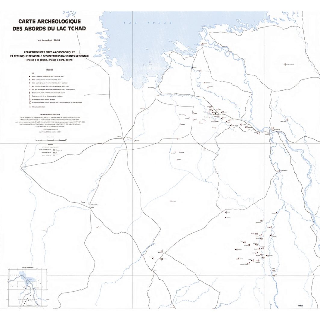
Répartition des sites archéologiques et technique principale des premiers habitants reconnus (chasse à la sagaie, chasse à l'arc, pêche). One map sheet. Scale of 1:300 000. Date of publication: 1981.
The map sheet:
1. Répartition des sites archéologiques et technique principale des premiers habitants reconnus (chasse à la sagaie, chasse à l'arc, pêche). Scale of 1:300 000. Date of publication: 1981.
|
|
Citation proposal
Zaiss, Rainer (Institut de recherche pour le développement (IRD)) (1981) . Répartition des sites archéologiques et technique principale des premiers habitants reconnus (chasse à la sagaie, chasse à l'arc, pêche). One map sheet. Scale of 1:300 000. Date of publication: 1981.. https://services.mspdata.eu:/geonetwork/srv/api/records/4c97874f-4b75-434c-beda-ce142a2c7e3e |
Simple
- Date ( Publication )
- 1981-01-01
- Identifier
-
IRD_TCD_ARCH_1981_300000
- Credit
-
The region Île-de-France, under the project NumeriSud, supported the action to transforme around 2800 maps that are conserved at the Institut de recherche pour le développement (IRD) library in Bondy into a standard coordinate system. The transformation of the images has been done by:
GMR (Global Mapping Resources)
P.O. Box 414113
Craighall 2024
South Africa
email: Maurizio@madmappers.com
www: http://www.madmappers.com
GRM has extensive international experience in this kind of work.
- Status
- Completed
Point of contact
Point of contact
- Maintenance and update frequency
- Not planned
- GEMET - INSPIRE themes, version 1.0 INSPIRE themes ( Theme )
-
-
Population distribution — demography
-
- GEMET - Concepts, version 2.4 ( Theme )
-
-
archaeology
-
- Geounits ( Place )
-
-
Africa
,Middle Africa
,Western Africa
,Cameroon
,Chad
,Nigeria
-
- Keywords ( Theme )
-
-
thematic map
-
- Keywords
-
-
project NumeriSud
,local coverage
-
- Use limitation
-
If you reuse this data you must cite this dataset as follows:
IRD (éditeur) (2014): Répartition des sites archéologiques et technique principale des premiers habitants reconnus (chasse à la sagaie, chasse à l'arc, pêche). One map sheet. Scale of 1:300 000. Date of publication: 1981. Project NumeriSud SPHAERA-GEO. Bondy, France.
Additionally, you must acknowledge the following resource:
Zaiss, R. (éditeur) (2014): Project NumeriSud SPHAERA-GEO, Géoréférencement et mosaïquage des cartes de l’IRD. Bondy, France.
- Access constraints
- licence
- Classification
- Unclassified
- Spatial representation type
- Grid
- Denominator
- 300000
- Metadata language
-
fre
- Character set
- UTF8
- Topic category
-
- Society
))
- Supplemental Information
-
Publication(s):
Lebeuf, J. P. (1981): Carte archéologique des abords du lac Tchad (Cameroun, Nigéria, Tchad) : texte. Paris (FRA) : CNRS, Centre national de la recherche scientifique ; [S.l.] : Laboratoire d'ethnologie et d'archéologie tchadiennes et camerounaises ; [S.l.] : Délégation générale à la recherche scientifique et technique [du Cameroun] ; Paris (FRA) : Ministère de la coopération ; Paris (FRA) : ORSTOM, Office de la recherche scientifique et technique outre mer, Service cartographique.
- Reference system identifier
-
EPSG
/WGS 84 (EPSG:4326)
/7.9
- Distribution format
-
-
ECW
(GlobalMapper 10
)
-
- Hierarchy level
- Dataset
- Statement
-
1. Scanning to tif format, 256 colors, 250dpi.
2. Georeferencing and if possible reprojection to WGS84 (Longitude / Latitude).
3. Clipping and mosaicing of map sheets(s).
4. Export ECW format.
Metadata
- File identifier
- 4c97874f-4b75-434c-beda-ce142a2c7e3e XML
- Metadata language
-
eng
- Character set
- UTF8
- Hierarchy level
- Dataset
- Hierarchy level name
-
dataset
- Date stamp
- 2016-01-01T12:04:21
- Metadata standard name
-
ISO 19115:2003/19139
- Metadata standard version
-
1.0
Point of contact
Resource provider
Resource provider
Overviews
Provided by
