 Metadata catalogue
EMODnet Bathymetry - Bathymetric Contours version 2024
The EMODnet Bathymetric Contours are available as a WFS service from EMODnet Bathymetry. Service URL is: https://ows.emodnet-bathymetry.eu/wfs
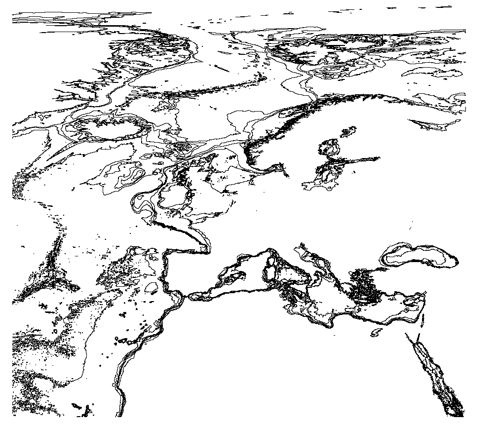
The bathymetric contours of this layer are generated automatically based on the EMODnet DTM. New contour sets will be available for each consecutive update of the EMODnet DTM. The contours are generated by GGSgc BV using the proprietary GGSgc software.
|
|
Citation proposal
(2023) . EMODnet Bathymetry - Bathymetric Contours version 2024. https://services.mspdata.eu:/geonetwork/srv/api/records/4a12d84b-b3fe-4b85-8d7f-96a9e7d659a8 |
Simple
- Date ( Publication )
- 2023-03-15
- Identifier
- EMODnet_Bathymetry_contours
- Credit
Point of contact
- Thèmes Sextant ( Theme )
-
- /Physical Environment/Bathymetry/Bathymetric Contours
- GEMET - INSPIRE themes, version 1.0 ( Theme )
-
- Oceanographic geographical features
- Ocean Hackathon - City and challenge ( Place )
-
- /Bournemouth , /Boulogne-sur-Mer , /Concepción/CON01 , /La Rochelle , /Cherbourg , /Peniche , /Plymouth , /Brest , /Toulon
- Use limitation
- Access constraints
- Creative Commons Attribution 4.0 International
- Use constraints
- Other restrictions
- Other constraints
- DO NOT USE FOR NAVIGATION
- Spatial representation type
- vector Vector
- Metadata language
- English
- Character set
- utf8 UTF8
- Topic category
-
- Oceans
))
- Distribution format
-
- ( )
- OnLine resource
- EMODnet Bathymetry WMTS service
- OnLine resource
- EMODnet viewer
- OnLine resource
-
EMODnet_Bathymetry_2024_contours
Contours layer 2024 (zip)
- Hierarchy level
- Dataset
Domain consistency
Conformance result
- Date ( Publication )
- 2010-12-08
- Explanation
- See the referenced specification
- Statement
-
Contours are generalized to appear cartographically correct at a product scale of 1:500000. Small closed contours (both deeps and shallows) are removed. The contour set is therefore not hydrographically correct and CAN NOT BE USED FOR NAVIGATION.
The following contour values are included in the set: 50|100|200|500|1000|2000|5000|7000 . Depth units are defined positive downwards in meters.
Metadata
- File identifier
- 4a12d84b-b3fe-4b85-8d7f-96a9e7d659a8 XML
- Metadata language
- English
- Character set
- UTF8
- Hierarchy level
- Dataset
- Date stamp
- 2025-05-15T22:15:43.164938Z
- Metadata standard name
- ISO 19115-3 - SEXTANT
- Metadata standard version
- 1.0
Point of contact
Overviews
Provided by
