 Metadata catalogue
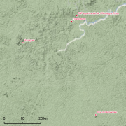
Guyadiv Nouragues: plot of forest inventory since 1985.
Guyadiv is a network of permanent forest plots set accross French Guiana. The Guyadiv plots in Nouragues cover 3ha included in the Parare permanent plots which are managed by CNRS. 18916 trees are being monitored. 8 campaigns of inventories were conducted in 1985, 1993, 1995, 2000, 2004, 2007, 2008, 2010. The bounding box of this metadata sheet represents only the extension of Parare plots.
|
|
Citation proposal
. Guyadiv Nouragues: plot of forest inventory since 1985.. https://services.mspdata.eu:/geonetwork/srv/api/records/33ff22b0-bbcc-4a36-8f17-762052c31f8b |
Simple
- Date ( Creation )
- 1985-01-01
- Date ( Revision )
- 1993-01-01
- Date ( Revision )
- 1995-01-01
- Date ( Revision )
- 2000-01-01
- Date ( Revision )
- 2004-01-01
- Date ( Revision )
- 2007-01-01
- Date ( Revision )
- 2008-01-01
- Date ( Revision )
- 2010-01-01
- Identifier
- CEBA_Guyadiv_Nouragues
- Credit
- Prévost, Marie-François
- Status
- Completed
Point of contact
- Maintenance and update frequency
- Irregular
- GEMET - INSPIRE themes, version 1.0 INSPIRE themes ( Theme )
-
- Environmental monitoring facilities
- Geounits ( Place )
-
- Americas , South America , France , French Guiana
- GEMET - Concepts, version 2.4 ( Theme )
-
- biodiversity , forest conservation , forest ecosystem , tropical forest , tropical forest ecosystem , primary forest , natural forest , inventory of forest damage , forest resource assessment
- Keywords
-
- local coverage , labex CEBA , dispositifs forestiers GUYADIV , portail Ca-SIF
- Keywords ( Theme )
-
- sampling plots , mesoscale plot network , forest structure , tropical forest types , forest composition , permanent plots , diameter measurements , tree community , tree flora
- Keywords ( Place )
-
- Nouragues
- Use limitation
- Please get in touch with a point of contact.
- Access constraints
- Other restrictions
- Other constraints
- Agreement between potential user and point of contact.
- Classification
- Unclassified
- Aggregate Datasetindentifier
- 1ceaa8d3-0a19-49d4-8071-f9a52ce95822
- Association Type
- Cross reference
- Initiative Type
- Collection
- Aggregate Datasetindentifier
- 69cf02e7-4d4f-447d-b2ff-45acf0196ab2
- Association Type
- Cross reference
- Initiative Type
- Collection
- Spatial representation type
- Text, table
- Denominator
- 5000
- Metadata language
- fre
- Character set
- UTF8
- Topic category
-
- Biota
N
S
E
W
))
- Supplemental Information
- Reference system identifier
- EPSG / WGS 84 (EPSG:4326) / 7.9
- Distribution format
-
- Shapefile (10.1 )
- OnLine resource
-
ceba_nouragues_plot_polys.kmz
Google Earth Nouragues plot polygones
- OnLine resource
-
ceba_nouragues_plot_polys.zip
Shapefile Nouragues plot polygones
- Hierarchy level
- Dataset
- Other
- Statement
- 1. According to the shapefile Parare plots covers an area of 6ha and not 3ha as mentioned in the Metadata ?
Metadata
- File identifier
- 33ff22b0-bbcc-4a36-8f17-762052c31f8b XML
- Metadata language
- eng
- Character set
- UTF8
- Parent identifier
- aa753fe1-0e16-46a5-9971-decadb97adb3
- Hierarchy level
- Dataset
- Hierarchy level name
- Date stamp
- 2016-02-12T12:27:11
- Metadata standard name
- ISO 19115:2003/19139
- Metadata standard version
- 1.0
Point of contact
Point of contact
Overviews
thumbnail

large_thumbnail
Provided by

Associated resources
Not available