 Metadata catalogue
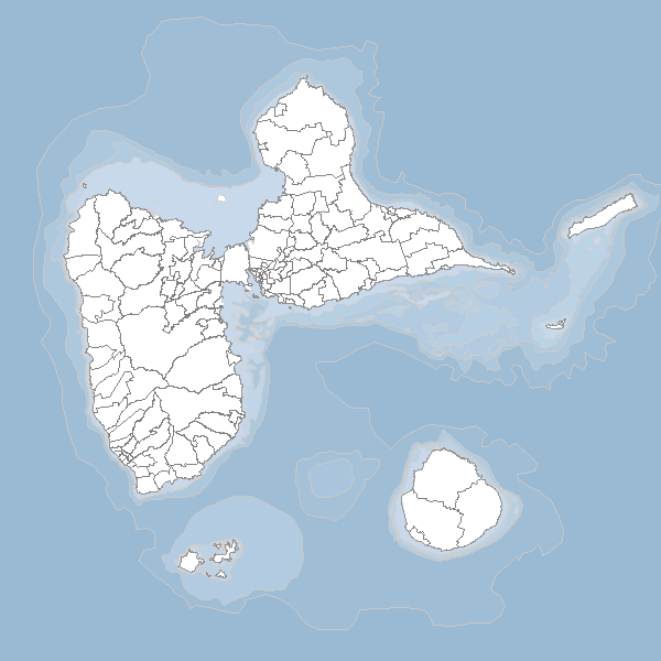
SHOM_Guadeloupe_bathymetrie_carte
Bathymétrie en périphérie de la Guadeloupe
|
|
Citation proposal
(2014) . SHOM_Guadeloupe_bathymetrie_carte. https://services.mspdata.eu:/geonetwork/srv/api/records/28829145-2f5e-4499-98eb-c38b0d6e2981 |
Simple
- Date ( Revision )
- 2014-09-30T18:40:00
- Date ( Publication )
- 2014-01-30T00:00:00
Distributor
- Keywords ( Theme )
-
- bathymetrie , guadeloupe
- Region ( Place )
-
- France
- theme.prodige.rdf ( Theme )
-
- France
- Use limitation
- Utilisation libre sous réserve de mentionner la source (a minima le nom du producteur) et la date de sa dernière mise à jour
- Access constraints
- Restricted
- Use constraints
- Copyright
- Other constraints
- Classification
- Unclassified
- User note
- Spatial representation type
- Vector
- Denominator
- 100000
- Metadata language
- fre
- Character set
- UTF8
- Topic category
-
- Elevation
- Description
- Guadeloupe
N
S
E
W
))
- Supplemental Information
- Hierarchy level
- Dataset
- Statement
- Description
Metadata
- File identifier
- 28829145-2f5e-4499-98eb-c38b0d6e2981 XML
- Metadata language
- French
- Character set
- UTF8
- Hierarchy level
- Dataset
- Date stamp
- 2014-09-30T18:59:40
- Metadata standard name
- ISO 19115:2003/19139
- Metadata standard version
- 1.0
Originator
Overviews
large_thumbnail
thumbnail
Provided by

Associated resources
Not available