Metadata catalogue
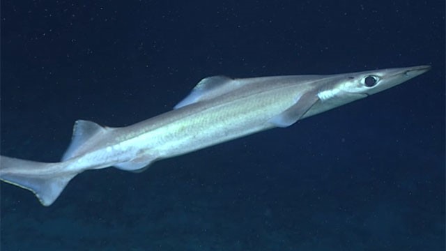
Outputs of predictive distribution models of deep-sea elasmobranchs in the Azores EEZ (down to 2,000m depth) using Generalized Additive Models
We developed predictive distribution models of deep-sea elasmobranchs for up to 2000 m depth in the Azores EEZ and neighboring seamounts, from approximately 33°N to 43°N and 20°W to 36°W. Georeferenced presence, absence, and abundance data were obtained from scientific surveys and commercial operations reporting at least one deep-sea elasmobranch capture. A 20-year 'survey dataset' (1996-2017) was compiled from annual scientific demersal surveys using two types of bottom longlines (types LLA and LLB), and an 'observer dataset' (2004-2018) from observer programs covering commercial fisheries operations using bottom longline (similar to type LLA) and vertical handline ('gorazeira').
|
|
Citation proposal
. Outputs of predictive distribution models of deep-sea elasmobranchs in the Azores EEZ (down to 2,000m depth) using Generalized Additive Models. https://services.mspdata.eu:/geonetwork/srv/api/records/257c59d1-579e-4a8e-8a49-fbaea8075812 |
Simple
- Date ( Creation )
- 2023-11-08
- Credit
- Institute of Marine Research (Portugal)
- Credit
- Institute of Marine Sciences - OKEANOS (Portugal)
- Credit
- Department of Oceanography and Fisheries, University of the Azores (Portugal)
Originator
Originator
Originator
- GEMET - INSPIRE themes, version 1.0 ( Theme )
-
- Species distribution
- Spatial scope
-
- Local
- INSPIRE priority dataset
-
- Natura 2000 sites (Habitats Directive)
- Mission Atlantic - Resources ( Theme )
-
- Data , MISSION ATLANTIC Results
- Mission Atlantic - Case Studies ( Theme )
-
- North Mid-Atlantic Ridge
- Mission Atlantic - Data type (DMP) ( Theme )
-
- Spatial data products , Biological data , Modelling data
- Mission Atlantic - Work Package ( Theme )
-
- WP3 Pelagic Mapping
- Mission Atlantic - Format ( Theme )
-
- Thèmes Sextant ( Theme )
-
- /Biological Environment/Species
- Mission Atlantic - BODC Parameters ( Theme )
-
- /Biological oceanography
- Use constraints
- Other restrictions
- Other constraints
- Attribution (CC BY)
- Access constraints
- Other restrictions
- Spatial representation type
- Grid
- Distance
- 1.2 km^2
- Metadata language
- No linguistic content No linguistic content
- Topic category
-
- Biota
N
S
E
W
))
- Distribution format
-
- GeoTIFF ()
- OnLine resource
- PANGAEA
- OnLine resource
- INSPIRE Download Service (WFS)
- OnLine resource
- INSPIRE WMS
- OnLine resource
- online instructions for transferring data from one storage device or system to another
- OnLine resource
- online instructions for transferring data from one storage device or system to another
- OnLine resource
- online instructions for transferring data from one storage device or system to another
- OnLine resource
- online instructions for transferring data from one storage device or system to another
- OnLine resource
- online instructions for transferring data from one storage device or system to another
- OnLine resource
- online instructions for transferring data from one storage device or system to another
- OnLine resource
- online instructions for transferring data from one storage device or system to another
- OnLine resource
- online instructions for transferring data from one storage device or system to another
- OnLine resource
- online instructions for transferring data from one storage device or system to another
- OnLine resource
- online instructions for transferring data from one storage device or system to another
- OnLine resource
- online instructions for transferring data from one storage device or system to another
- OnLine resource
- online instructions for transferring data from one storage device or system to another
- OnLine resource
- online instructions for transferring data from one storage device or system to another
- OnLine resource
- online instructions for transferring data from one storage device or system to another
- OnLine resource
- online instructions for transferring data from one storage device or system to another
- OnLine resource
- online instructions for transferring data from one storage device or system to another
- OnLine resource
- online instructions for transferring data from one storage device or system to another
- OnLine resource
- online instructions for transferring data from one storage device or system to another
- OnLine resource
- online instructions for transferring data from one storage device or system to another
- OnLine resource
- online instructions for transferring data from one storage device or system to another
- OnLine resource
- online instructions for transferring data from one storage device or system to another
- OnLine resource
- IMIS catalogue
- Hierarchy level
- Dataset
Domain consistency
Conformance result
- Date ( Publication )
- 2017-03-02
- Explanation
- This metadata set is conformant with the Technical Guidance for the implementation of INSPIRE dataset and service metadata based on ISO/TS 19139:2007
- Pass
- true
Conformance result
- Date ( Publication )
- 2010-12-08
- Explanation
- Conformance of this data set with the INSPIRE Implementing Rules for the interoperability of spatial data sets and services was not evaluated
- Statement
- Occurrence data: 38 fishery-independent surveys from R/V Arquipélago and on-board observer data surveys from PNRD collection, CoralFISH and Discardless/MERCES/SPONGES. Bathymetric Position Index derived from multibeam data for the Azores EEZ and bathymetry data extracted from EMODNET. To read the sources of nitrates, phosphates, silicates concentration, dissolved oxygen, % of oxygen saturation, temperature and current speed near the ocean bottom, see the Description.
Metadata
- File identifier
- 257c59d1-579e-4a8e-8a49-fbaea8075812 XML
- Metadata language
- English
- Character set
- UTF8
- Hierarchy level
- Dataset
- Date stamp
- 2024-09-03T07:36:30.788Z