Metadata catalogue
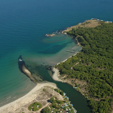
Horizontal spatial co-ordinates | Natura 2000 areas | Bern Convention Convention on the Conservation of European Wildlife and Natural Habitats | Spatial limits of MPAs; Map of Proteted Area (Kolkheti National Park)
|
|
Citation proposal
. Horizontal spatial co-ordinates | Natura 2000 areas | Bern Convention Convention on the Conservation of European Wildlife and Natural Habitats | Spatial limits of MPAs; Map of Proteted Area (Kolkheti National Park). https://services.mspdata.eu:/geonetwork/srv/api/records/1ffde652-f53c-48b0-b736-ac74fb624f97 |
Simple
- Alternate title
- Spatial limits of MPAs; Map of Proteted Area (Kolkheti National Park)
- Date
- Identifier
- Horizontal spatial co-ordinates | Natura 2000 areas | Bern Convention Convention on the Conservation of European Wildlife and Natural Habitats | Spatial limits of MPAs; Map of Proteted Area (Kolkheti National Park)
- Other citation details
- Spatial limits of MPAs; Map of Proteted Area (Kolkheti National Park)
- Purpose
- Spatial limits of MPAs; Map of Proteted Area (Kolkheti National Park)
- Credit
edmerp
edmo
- Maintenance and update frequency
- Unknown
- Used by challenges ( Theme )
-
- BlackSea - CH02 - Marine Protected Areas
- Environmental matrix ( Theme )
-
- Biota - Biology
- Production mode ( Theme )
-
- Delayed
- Visibility ( Theme )
-
- Use of open search engines, searching by name either the data provider or the characteristics
- Policy visibility ( Theme )
-
- There is detailed information provided to understand data policy
- Readyness ( Theme )
-
- Format not proprietary and content clearly specified (e.g. autodescriptive like ODV, NetCDF CF) or at least with appropriate document describing the content
- Parameter Discovery Vocabulary (P02) ( parameter )
-
- Horizontal spatial co-ordinates
- GEMET - INSPIRE themes, version 1.0 ( Theme )
-
- Area management/restriction/regulation zones and reporting units
- Processing level of characteristics ( Theme )
-
- Other
- Data delivery mechanisms ( Theme )
-
- Online downloading services
- Parameter Usage Vocabulary (P01) ( parameter )
-
- Parameter Usage Vocabulary (other) ( Theme )
-
- Natura 2000 areas
- Agreed Parameter Groups (P03) ( parameter )
-
- Administration and dimensions
- Service extent ( Theme )
-
- The datasets are referenced in a public national catalogue, in an international catalogue service
- Reliability ( Theme )
-
- Validation ( Theme )
-
- Access constraints
- Other restrictions
- Other constraints
- Unrestricted
- Use limitation
- Open and Free. No charge
- Spatial representation type
- vector Vector
- Metadata language
- French
- Character set
- utf8 UTF8
- Topic category
-
- Oceans
- Environment description
- MPA management, inclusion in maritime spatial planning
N
S
E
W
))
Vertical extent
- Minimum value
- 0
- Maximum value
- 50
- Supplemental Information
- Unique resource identifier
- Codespace
- Version
- Dimension name
- Time
- Transformation parameter availability
- true
- Checkpoint Availability
- true
- Distribution format
-
- PDF ()
- Hierarchy level
- Dataset
Domain consistency
- Name of measure
- Responsiveness
Quantitative result
- Value
- Online downloading (i.e. a few hours or less) for release
Domain consistency
- Name of measure
- Reliability
Quantitative result
- Statement
Metadata
- File identifier
- 1ffde652-f53c-48b0-b736-ac74fb624f97 XML
- Metadata language
- English
- Character set
- UTF8
- Hierarchy level
- Dataset
- Hierarchy level name
- BlackSea - CH02 - Marine Protected Areas
- Date stamp
- 2016-11-17T13:34:46
- Metadata standard name
- ISO 19115-3 - Emodnet Checkpoint - Upstream Data
- Metadata standard version
- 1.0