Metadata catalogue
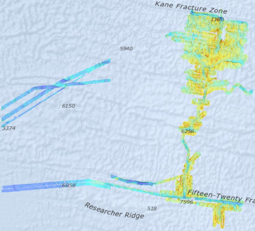
Bathymetry - Mid-Atlantic Ridge from N 13°30 to N 24° (synthesis, 2021)
Bathymetry - Mid-Atlantic Ridge from N 13°30 to N 24° (synthesis, 2021). Compilation of Ifremer multibeam data along the Mid-Atlantic Ridge. Grid resolution 1/16 arc minute.
Bibliography: Viellefon Priscille (2020). Cartographie – Compilation et analyses numériques de données bathymétriques sur la dorsale Atlantique Nord centrale. Rapport de stage technique. https://archimer.ifremer.fr/doc/00679/79153/
Ifremer multibeam database : cruises from 1991 to 2018.
Data sets acquired onboard Ifremer research vessels are processed according to a common flow :
- Time and acquisition lines selection
- Removing outliers by automatic filtering
- Manual cleaning and residual artefact removing
- Producing a digital terrain model (DTM). Depth layer is calculated as the average of soundings in each pixel. The grid resolution is 1/16 of arcminute. All DTMs are merged into a unique file.
Cruise list :
Fara-Seadma1, 1991, RV L’Atalante, https://doi.org/10.17600/91004411
Fara Sigma, 1991, RV L’Atalante, https://doi.org/10.17600/91004311
Faranaut/15N, 1992, RV L’Atalante, https://doi.org/10.17600/92000311
Dormasis, 1992, RV L’Atalante, https://doi.org/10.17600/92000411
Sudacores, 1998, RV L’Atalante, https://doi.org/10.17600/98010080
Bicose, 2014, RV Pourquoi Pas ?, https://doi.org/10.17600/14000100
Leve-SMF, 2016, RV Pourquoi Pas ?, https://doi.org/10.17600/16010800
Hermine, 2017, RV Pourquoi Pas ?, https://doi.org/10.17600/17000200
Transect, 2018, RV L’Atalante, https://doi.org/10.17600/18000513
|
|
Citation proposal
VIELLEFON Priscille (Ifremer) - LOUBRIEU Benoît (Ifremer). Bathymetry - Mid-Atlantic Ridge from N 13°30 to N 24° (synthesis, 2021). Ifremer https://services.mspdata.eu:/geonetwork/srv/api/records/1eeedd5d-6ba0-42e5-92e6-587efeb92548 |
Simple
- Date ( Creation )
- 2021-03-02T14:00:00
- Identifier
- FR-330715-368-00032-SynthesisIfr_MidAtlR_N1330N2400_1_16_BATHY
- Identifier
- DOI:10.12770/1eeedd5d-6ba0-42e5-92e6-587efeb92548
Point of contact
- Presentation form
- Digital map
- Credit
- Ifremer
Publisher
Point of contact
- Maintenance and update frequency
- As needed
- Keywords ( Discipline )
-
- Bathymetry , Geophysics
- Keywords ( Place )
-
- Atlantic ocean , Mid-Atlantic Ridge
- Keywords ( Temporal )
-
- 1991 , 2018
- GEMET - INSPIRE themes, version 1.0 ( Theme )
-
- Elevation
- GEMET - Concepts, version 3.1 ( Theme )
-
- Seafloor , Bathymetry , Seabed morphology
- Keywords
-
- Live Data and Maps
- Thèmes Sextant ( Theme )
-
- /Physical Environment/Bathymetry/Digital Terrain Model
- Use limitation
- Not to be used for navigation
- Access constraints
- Other restrictions
- Use constraints
- License
- Other constraints
- Open access
- Spatial representation type
- Grid
- Denominator
- 100
- Metadata language
- English English
- Character set
- UTF8
- Topic category
-
- Elevation
- Environment description
- Version 6.2 (Build 9200) ; Esri ArcGIS 10.8.1.14362
))
- Reference system identifier
- EPSG / 4326 / 6.14(3.0.1)
- Number of dimensions
- 2
- Dimension name
- Column
- Dimension size
- 11040
- Resolution
- 0.001042 Deg
- Dimension name
- Row
- Dimension size
- 10080
- Resolution
- 0.001042 Deg
- Cell geometry
- Area
- Transformation parameter availability
- true
- Checkpoint Availability
- false
Center point
- Point in Pixel
-
- Center
- Distribution format
-
- Jeu de données Raster (geotiff file )
- OnLine resource
- Data processing report
- Protocol
- FILE
- Name
- SynthesisIfr_MidAtlR_N1330N2400_1_16_BATHY
- Description
- OnLine resource
- SynthesisIfr_MidAtlR_N1330N2400_1_16_BATHY
- OnLine resource
- DOI of the dataset
- Hierarchy level
- Dataset
- Statement
-
Multibeam data have been acquired from 1991 to 2018.
Processing has been updated in 2020 : see student report https://archimer.ifremer.fr/doc/00679/79153/
Metadata
- File identifier
- 1eeedd5d-6ba0-42e5-92e6-587efeb92548 XML
- Metadata language
- English English
- Character set
- UTF8
- Hierarchy level
- Dataset
- Hierarchy level name
- dataset
- Date stamp
- 2021-08-27T10:15:28
- Metadata standard name
- ISO 19115:2003/19139 - SEXTANT
- Metadata standard version
- V. 1.2