Metadata catalogue
TAGUSDELTA 2013 Geophysical Campaign
The Tagusdelta campaign had technical and scientific objectives. The main technical objective was to make the proof of concept of the new proposed method for the acquisition of 3D very high resolution seismic reflection data. The accomplishment of this objective included: deployment and data acquisition systems tests; positioning uncertainty assessment; seismic and positioning data processing for the 3D seismic volume generation. From the scientific point of view the main objective was to acquire very high resolution seismic reflection data that allow the characterization of the frontal area of the Tagus ebb-tide delta seismic stratigraphic facies arquitecture. A special focus was placed in the: identification, characterization and mapping of mass wasting features, in order to allow a first trial of the Pleisto-Holocene mapping and chronostratigraphy of these features in the Tagus delta; imaging the morphologies of landslide structures with 3D seismic, particularly in what concerns the landslide already identified with the previous data, to allow the quantification and precise location of the events, to generate data of unprecedented realism that can be fed into the tsunamigenic mathematical models.
|
|
Citation proposal
. TAGUSDELTA 2013 Geophysical Campaign. https://services.mspdata.eu:/geonetwork/srv/api/records/170c72d9-44dc-42ba-a747-f48f679f9b7f |
Simple
- Date ( Revision )
- 2015-03-26
- Identifier
- http://ipma.pt/observations/cruises/cdg / c043c916-6dc9-40b4-b238-7bb0f03f910e
- Identifier
- seadatanet_tagusdelta2013
- Identifier
- SeaDataNet / urn:SDN:CSR:LOCAL:BSH20153076
- Purpose
- Estratigrafia sísmica de alta resolução 3D do delta do Tejo
- Credit
- IH - Instituto Hidrográfico
Point of contact
Instituto Português do Mar e da Atmosfera, I.P. (IPMA, I.P.)
-
Prof. Dr. Pedro Terrinha
Rua C do Aeroporto s/n
Lisboa
1749-077
Portugal
- Maintenance and update frequency
- Conforme Necessário As needed
- GEMET - INSPIRE themes, version 1.0 ( Theme )
-
- Características oceanográficas
- Thesaurus SNIMar v.1.0 ( instrument )
-
- Sondador multifeixe
- Thesaurus SNIMar v.1.0 ( parameter )
-
- Sísmica de reflexão
- Thesaurus SNIMar v.1.0 ( Discipline )
-
- Geofísica marinha
- Keywords
-
- IPMA, I.P. , Tsunami
- Use limitation
- Sem restrições
- Access constraints
- Outras Restrições Other restrictions
- Use constraints
- Outras Restrições Other restrictions
- Other constraints
- Licença SeaDataNet
- Spatial representation type
- Vetorial Vector
- Spatial representation type
- Matricial Grid
- Denominator
- -1
- Metadata language
- Português Portuguese
- Character set
- utf8 UTF8
- Topic category
-
- Geoscientific information
- Oceans
N
S
E
W
))
- Reference system identifier
- EPSG / http://www.opengis.net/def/crs/EPSG/0/4258
- Reference system identifier
- EPSG / http://www.opengis.net/def/crs/EPSG/0/4326
- Distribution format
-
- SHP (não se aplica )
- SEGY (não se aplica )
- Pdf (não se aplica )
- Hierarchy level
- Série Series
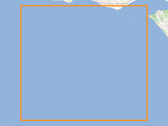
Extent
No information provided.
- Dataset
- c043c916-6dc9-40b4-b238-7bb0f03f910e
- Dataset
- seadatanet_tagusdelta2013
- Dataset
- urn:SDN:CSR:LOCAL:BSH20153076
Conformance result
- Date ( Publication )
- 2010-12-08
- Explanation
- Ver a especificação citada.
- Pass
- false
- Statement
- The data centres apply standard data quality control procedures on all data that the centres manage. Ask the data centre for details.
Metadata
- File identifier
- 170c72d9-44dc-42ba-a747-f48f679f9b7f XML
- Metadata language
- Português Portuguese
- Character set
- utf8 UTF8
- Hierarchy level
- Série Series
- Date stamp
- 2017-04-10
- Metadata standard name
- Perfil SNIMar
- Metadata standard version
- v.0.9.3
Point of contact
Instituto Português do Mar e da Atmosfera, I.P. (IPMA, I.P.)
Rua C do Aeroporto s/n
Lisboa
1749-077
Portugal