Metadata catalogue
ASTARTE 2014 Geophysical Campaign
The ASTARTE 2014 seismic campaign aims extending the area of previous seismic surveys to a distance of around 20 nautical miles from the coast till the edge of the continental shelf. The survey plan was made for acquisition of 24 profiles divided in two classes: the in-line class perpendicular to the coastline and the cross-line class orthogonal to the in-line lines. The main reason for selecting the offshore Quarteira region is because this region is a target for tsunami in prints on the continental shelf although the entire Algarve coast can be a repository of past tsunami geologic records.
|
|
Citation proposal
. ASTARTE 2014 Geophysical Campaign. https://services.mspdata.eu:/geonetwork/srv/api/records/0f8c32be-a879-427a-87ff-077bc4b2b08c |
Simple
- Date ( Revision )
- 2015-03-25
- Identifier
- http://ipma.pt/observations/cruises/cdg / cea2787f-2837-46c1-adce-51709ee6a3ef
- Identifier
- seadatanet_astarte2014
- Identifier
- SeaDataNet / urn:SDN:CSR:LOCAL:BSH20153073
- Purpose
- Assessment, STrategy And Risk Reduction for Tsunamis in Europe
- Credit
- IH - Instituto Hidrográfico
Point of contact
Instituto Português do Mar e da Atmosfera, I.P. (IPMA, I.P.)
-
Prof. Dr. Pedro Terrinha
Rua C do Aeroporto s/n
Lisboa
1749-077
Portugal
- Maintenance and update frequency
- Conforme Necessário As needed
- GEMET - INSPIRE themes, version 1.0 ( Theme )
-
- Características oceanográficas
- Thesaurus SNIMar v.1.0 ( instrument )
-
- Sondador multifeixe
- Thesaurus SNIMar v.1.0 ( instrument )
-
- Sondador de feixe simples
- Thesaurus SNIMar v.1.0 ( parameter )
-
- Sísmica de reflexão
- Thesaurus SNIMar v.1.0 ( Discipline )
-
- Geofísica marinha
- Keywords
-
- IPMA, I.P. , Tsunami
- Use limitation
- Sem restrições
- Access constraints
- Outras Restrições Other restrictions
- Use constraints
- Outras Restrições Other restrictions
- Other constraints
- Licença SeaDataNet
- Spatial representation type
- Vetorial Vector
- Spatial representation type
- Matricial Grid
- Denominator
- -1
- Metadata language
- Português Portuguese
- Character set
- utf8 UTF8
- Topic category
-
- Geoscientific information
- Oceans
N
S
E
W
))
- Reference system identifier
- EPSG / http://www.opengis.net/def/crs/EPSG/0/4258
- Reference system identifier
- EPSG / http://www.opengis.net/def/crs/EPSG/0/4326
- Distribution format
-
- SHP (não se aplica )
- SEGY (não se aplica )
- Hierarchy level
- Série Series
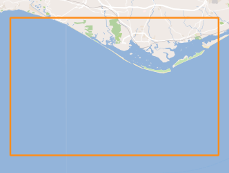
Extent
No information provided.
- Dataset
- cea2787f-2837-46c1-adce-51709ee6a3ef
- Dataset
- seadatanet_astarte2014
- Dataset
- urn:SDN:CSR:LOCAL:BSH20153073
Conformance result
- Date ( Publication )
- 2010-12-08
- Explanation
- Ver a especificação citada.
- Pass
- false
- Statement
- The data centres apply standard data quality control procedures on all data that the centres manage. Ask the data centre for details.
Metadata
- File identifier
- 0f8c32be-a879-427a-87ff-077bc4b2b08c XML
- Metadata language
- Português Portuguese
- Character set
- utf8 UTF8
- Hierarchy level
- Série Series
- Date stamp
- 2017-04-10
- Metadata standard name
- Perfil SNIMar
- Metadata standard version
- v.0.9.3
Point of contact
Instituto Português do Mar e da Atmosfera, I.P. (IPMA, I.P.)
Rua C do Aeroporto s/n
Lisboa
1749-077
Portugal