Metadata catalogue
Administrative units | Munition dumping areas | EMODnet Secretariat |
|
|
Citation proposal
. Administrative units | Munition dumping areas | EMODnet Secretariat |. https://services.mspdata.eu:/geonetwork/srv/api/records/ee18994b-4d11-400b-8df5-e2f59f5fd3bc |
Simple
- Alternate title
- Date
- Identifier
-
Administrative units | Munition dumping areas | EMODnet Secretariat |
- Other citation details
-
EMODnet Human Activities: Dredge dumping munition sites
- Purpose
-
Data on munition dumping areas in European seas
- Credit
edmerp
edmo
Originator
- Maintenance and update frequency
- Unknown
- Used by challenges ( Theme )
-
-
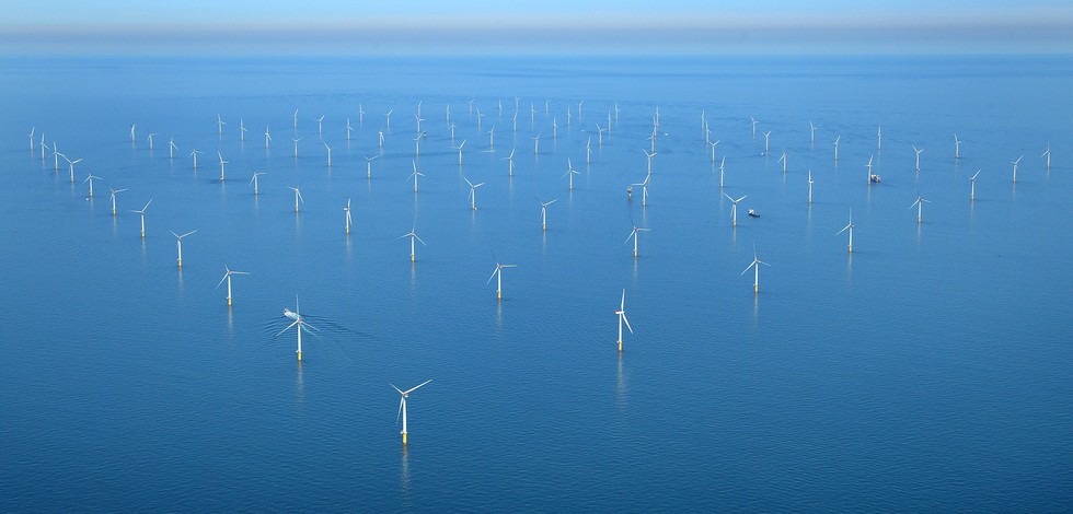
Atlantic - CH01 - Windfarm Siting
-
- Environmental matrix ( Theme )
-
-
Human activities
-
- Production mode ( Theme )
-
-
Delayed
-
- Visibility ( Theme )
-
-
Search via reference catalogue (e.g. MyOcean, GEOSS Geoportal…)
-
- Policy visibility ( Theme )
-
-
There is detailed information provided to understand data policy
-
- Readyness ( Theme )
-
-
Format proprietary but content clearly specified
-
- Parameter Discovery Vocabulary (P02) ( parameter )
-
-
Administrative units
-
- GEMET - INSPIRE themes, version 1.0 ( Theme )
-
-
Area management/restriction/regulation zones and reporting units
-
- Processing level of characteristics ( Theme )
-
-
High level analyzed
-
- Data delivery mechanisms ( Theme )
-
-
Online discovery + downloading + viewing services (Advanced services)
-
- Parameter Usage Vocabulary (P01) ( parameter )
-
- Parameter Usage Vocabulary (other) ( Theme )
-
-
Munition dumping areas
-
- Agreed Parameter Groups (P03) ( parameter )
-
-
Human activity
-
- Service extent ( Theme )
-
-
The datasets are provided through an EU Inspire catalogue service (OGC)
-
- Reliability ( Theme )
-
- Validation ( Theme )
-
-
Submitted
-
- Keywords
-
-
SIMNORAT
,SIMWESTMED
,
-
- MSP projects ( Theme )
-
-
SEANSE
-
- Access constraints
- Other restrictions
- Other constraints
-
Unrestricted
- Use limitation
-
Open and Free. No charge
- Spatial representation type
- Vector
- Metadata language
- French
- Character set
- UTF8
- Topic category
-
- Oceans
- Environment description
-
Munition dumping areas data intends to evaluate the areal conflict of OWF siting with other industries.
))
Vertical extent
- Supplemental Information
- Unique resource identifier
- Codespace
- Version
- Dimension name
- Time
- Resolution
- 1
- Transformation parameter availability
- true
- Checkpoint Availability
- true
- Distribution format
-
-
ESRI Shapefile
()
-
- OnLine resource
- Dumped Munitions
- OnLine resource
- Emodnet_Lot7_Waste_disposal_Dumped_munitions_WGS84.zip
- Hierarchy level
- Dataset
Domain consistency
- Name of measure
-
Responsiveness
Quantitative result
- Value
- Online downloading (i.e. a few hours or less) for release
- Hierarchy level
- datasetComponent
- Other
-
ATLANTIC_CH01_Product_1_17
))
Vertical extent
- Minimum value
- 0
- Maximum value
- 0
Completeness omission
- Name of measure
-
Horizontal Spatial Coverage
- Measure identification
-
AP.1.1
- Measure description
-
Horizontal coverage extent of product (eg : surface of the Mediterranean Sea)
Quantitative result
- Value type
- Real
- Value
- 0
gmd:DQ_DescriptiveResult
- Date / Time
- 2018-01-10
- Statement
-
No features inside the study zone
Completeness omission
- Name of measure
-
Vertical Spatial Coverage
- Measure identification
-
AP.1.2
- Measure description
-
Vertical coverage extent of product
Quantitative result
- Value type
- Real
gmd:DQ_DescriptiveResult
- Date / Time
- 2018-01-10
- Statement
-
NA
Completeness omission
- Name of measure
-
Temporal Coverage
- Measure identification
-
AP.1.3
- Measure description
-
Temporal coverage extent of product
Quantitative result
- Value type
- Integer
gmd:DQ_DescriptiveResult
- Date / Time
- 2018-01-10
- Statement
-
NA
Completeness omission
- Name of measure
-
Number of items
- Measure identification
-
AP.1.4
- Measure description
-
Count of all items in the dataset or sample. Describe the items which are counted. If the number is determined by sampling unit (density), define the sampling unit (eg size of mesh).
Quantitative result
- Value type
- Integer
- Value
- 1
gmd:DQ_DescriptiveResult
- Date / Time
- 2018-01-10
- Statement
-
Out of the 3 countries only France provides data to EMODnet Human Activities
Conceptual consistency
- Name of measure
-
Number of Characteristics
- Measure identification
-
AP.2.1
- Measure description
-
Number of characteristics in product
Quantitative result
- Value type
- Integer
gmd:DQ_DescriptiveResult
- Date / Time
- 2018-01-10
- Statement
-
1
Thematic classification correctness
- Name of measure
-
Horizontal resolution
- Measure identification
-
AP.3.1
- Measure description
-
Horizontal mesh size or equivalent value for the given scale of product (eg 50m for 1/50 000)
Quantitative result
- Value type
- Integer
gmd:DQ_DescriptiveResult
- Date / Time
- 2018-01-10
- Statement
-
No Scale or resolution was found in metadata
Thematic classification correctness
- Name of measure
-
Vertical resolution
- Measure identification
-
AP.3.2
- Measure description
-
Average vertical sampling
Quantitative result
- Value type
- Real
gmd:DQ_DescriptiveResult
- Date / Time
- 2018-01-10
- Statement
-
NA
Thematic classification correctness
- Name of measure
-
Temporal resolution
- Measure identification
-
AP.3.3
- Measure description
-
Temporal sampling interval of product
Quantitative result
- Value type
- Real
gmd:DQ_DescriptiveResult
- Date / Time
- 2018-01-10
- Statement
-
NA
Quantitative attribute accuracy
- Name of measure
-
Thematic accuracy
- Measure identification
-
AP.3.4
- Measure description
-
Percentage error of the product and description of error concept for the product (100 words max) provided by expert
Quantitative result
- Value type
- Percentage
- Statement
-
NA
Temporal validity
- Name of measure
-
Temporal validity
- Measure identification
-
AP.4.1
- Measure description
-
Max elapsed time between last input data records update and product creation date. Minimum value 1/24 day.
Quantitative result
- Value type
- Integer
- Value
- 915
gmd:DQ_DescriptiveResult
- Date / Time
- 2018-01-10
- Statement
-
15-05-2015
gmd:DQ_UsabilityElement
- Name of measure
-
Usability
- Measure identification
-
AP.5.1
- Measure description
- Value
- Limited
gmd:DQ_DescriptiveResult
- Date / Time
- 2018-01-10
- Statement
-
points has no spatial coverage.
- Hierarchy level
- datasetComponent
- Other
-
ATLANTIC_CH01_Product_2_17
))
Vertical extent
- Minimum value
- 0
- Maximum value
- 0
Completeness omission
- Name of measure
-
Horizontal Spatial Coverage
- Measure identification
-
AP.1.1
- Measure description
-
Horizontal coverage extent of product (eg : surface of the Mediterranean Sea)
Quantitative result
- Value type
- Real
- Value
- 219.4
gmd:DQ_DescriptiveResult
- Date / Time
- 2018-01-10
- Statement
Completeness omission
- Name of measure
-
Vertical Spatial Coverage
- Measure identification
-
AP.1.2
- Measure description
-
Vertical coverage extent of product
Quantitative result
- Value type
- Real
gmd:DQ_DescriptiveResult
- Date / Time
- 2018-01-10
- Statement
-
NA
Completeness omission
- Name of measure
-
Temporal Coverage
- Measure identification
-
AP.1.3
- Measure description
-
Temporal coverage extent of product
Quantitative result
- Value type
- Integer
gmd:DQ_DescriptiveResult
- Date / Time
- 2018-01-10
- Statement
-
NA
Completeness omission
- Name of measure
-
Number of items
- Measure identification
-
AP.1.4
- Measure description
-
Count of all items in the dataset or sample. Describe the items which are counted. If the number is determined by sampling unit (density), define the sampling unit (eg size of mesh).
Quantitative result
- Value type
- Integer
- Value
- 2
gmd:DQ_DescriptiveResult
- Date / Time
- 2018-01-10
- Statement
-
France and spain delivered data.
Conceptual consistency
- Name of measure
-
Number of Characteristics
- Measure identification
-
AP.2.1
- Measure description
-
Number of characteristics in product
Quantitative result
- Value type
- Integer
gmd:DQ_DescriptiveResult
- Date / Time
- 2018-01-10
- Statement
-
NA
Thematic classification correctness
- Name of measure
-
Horizontal resolution
- Measure identification
-
AP.3.1
- Measure description
-
Horizontal mesh size or equivalent value for the given scale of product (eg 50m for 1/50 000)
Quantitative result
- Value type
- Integer
gmd:DQ_DescriptiveResult
- Date / Time
- 2018-01-10
- Statement
-
No information was found concerning scale or resolution.
Thematic classification correctness
- Name of measure
-
Vertical resolution
- Measure identification
-
AP.3.2
- Measure description
-
Average vertical sampling
Quantitative result
- Value type
- Real
gmd:DQ_DescriptiveResult
- Date / Time
- 2018-01-10
- Statement
-
NA
Thematic classification correctness
- Name of measure
-
Temporal resolution
- Measure identification
-
AP.3.3
- Measure description
-
Temporal sampling interval of product
Quantitative result
- Value type
- Real
gmd:DQ_DescriptiveResult
- Date / Time
- 2018-01-10
- Statement
-
NA
Quantitative attribute accuracy
- Name of measure
-
Thematic accuracy
- Measure identification
-
AP.3.4
- Measure description
-
Percentage error of the product and description of error concept for the product (100 words max) provided by expert
Quantitative result
- Value type
- Percentage
- Statement
-
NA
Temporal validity
- Name of measure
-
Temporal validity
- Measure identification
-
AP.4.1
- Measure description
-
Max elapsed time between last input data records update and product creation date. Minimum value 1/24 day.
Quantitative result
- Value type
- Integer
- Value
- 915
gmd:DQ_DescriptiveResult
- Date / Time
- 2018-01-10
- Statement
gmd:DQ_UsabilityElement
- Name of measure
-
Usability
- Measure identification
-
AP.5.1
- Measure description
- Value
- Good
gmd:DQ_DescriptiveResult
- Date / Time
- 2018-01-10
- Statement
-
A mix of polygon and point location were collated. The component usability is limited where only point data exist because spatial coverage of sites would have been much more appropriate than point location, though we could implement exclusion buffers around points.
- Hierarchy level
- datasetComponent
- Other
-
ATLANTIC_CH01_Product_3_17
))
Vertical extent
- Minimum value
- 0
- Maximum value
- 0
Completeness omission
- Name of measure
-
Horizontal Spatial Coverage
- Measure identification
-
AP.1.1
- Measure description
-
Horizontal coverage extent of product (eg : surface of the Mediterranean Sea)
Quantitative result
- Value type
- Real
gmd:DQ_DescriptiveResult
- Date / Time
- 2018-01-10
- Statement
-
No features lay within the study area
Completeness omission
- Name of measure
-
Vertical Spatial Coverage
- Measure identification
-
AP.1.2
- Measure description
-
Vertical coverage extent of product
Quantitative result
- Value type
- Real
gmd:DQ_DescriptiveResult
- Date / Time
- 2018-01-10
- Statement
-
NA
Completeness omission
- Name of measure
-
Temporal Coverage
- Measure identification
-
AP.1.3
- Measure description
-
Temporal coverage extent of product
Quantitative result
- Value type
- Integer
gmd:DQ_DescriptiveResult
- Date / Time
- 2018-01-10
- Statement
-
NA
Completeness omission
- Name of measure
-
Number of items
- Measure identification
-
AP.1.4
- Measure description
-
Count of all items in the dataset or sample. Describe the items which are counted. If the number is determined by sampling unit (density), define the sampling unit (eg size of mesh).
Quantitative result
- Value type
- Integer
- Value
- 1
gmd:DQ_DescriptiveResult
- Date / Time
- 2018-01-10
- Statement
-
Spain delivered data.
Conceptual consistency
- Name of measure
-
Number of Characteristics
- Measure identification
-
AP.2.1
- Measure description
-
Number of characteristics in product
Quantitative result
- Value type
- Integer
gmd:DQ_DescriptiveResult
- Date / Time
- 2018-01-10
- Statement
-
NA
Thematic classification correctness
- Name of measure
-
Horizontal resolution
- Measure identification
-
AP.3.1
- Measure description
-
Horizontal mesh size or equivalent value for the given scale of product (eg 50m for 1/50 000)
Quantitative result
- Value type
- Integer
gmd:DQ_DescriptiveResult
- Date / Time
- 2018-01-10
- Statement
-
NA
Thematic classification correctness
- Name of measure
-
Vertical resolution
- Measure identification
-
AP.3.2
- Measure description
-
Average vertical sampling
Quantitative result
- Value type
- Real
gmd:DQ_DescriptiveResult
- Date / Time
- 2018-01-10
- Statement
-
NA
Thematic classification correctness
- Name of measure
-
Temporal resolution
- Measure identification
-
AP.3.3
- Measure description
-
Temporal sampling interval of product
Quantitative result
- Value type
- Real
gmd:DQ_DescriptiveResult
- Date / Time
- 2018-01-10
- Statement
-
NA
Quantitative attribute accuracy
- Name of measure
-
Thematic accuracy
- Measure identification
-
AP.3.4
- Measure description
-
Percentage error of the product and description of error concept for the product (100 words max) provided by expert
Quantitative result
- Value type
- Percentage
- Statement
-
NA
Temporal validity
- Name of measure
-
Temporal validity
- Measure identification
-
AP.4.1
- Measure description
-
Max elapsed time between last input data records update and product creation date. Minimum value 1/24 day.
Quantitative result
- Value type
- Integer
- Value
- 915
gmd:DQ_DescriptiveResult
- Date / Time
- 2018-01-10
- Statement
gmd:DQ_UsabilityElement
- Name of measure
-
Usability
- Measure identification
-
AP.5.1
- Measure description
- Value
- Limited
gmd:DQ_DescriptiveResult
- Date / Time
- 2018-01-10
- Statement
-
A mix of polygon and point locations were collated. The component usability is limited where only point data exist because polygon spatial coverage of sites would have been much more appropriate than point location. It is impossible to determine if the no feature inside the area is due to the actual absence of features or if it is a knowledge gap.
- Hierarchy level
- datasetComponent
- Other
-
ATLANTIC_CH01_Product_4_17
))
Vertical extent
- Minimum value
- 0
- Maximum value
- 0
Completeness omission
- Name of measure
-
Horizontal Spatial Coverage
- Measure identification
-
AP.1.1
- Measure description
-
Horizontal coverage extent of product (eg : surface of the Mediterranean Sea)
Quantitative result
- Value type
- Real
gmd:DQ_DescriptiveResult
- Date / Time
- 2018-01-10
- Statement
-
No features were found in the study area.
Completeness omission
- Name of measure
-
Vertical Spatial Coverage
- Measure identification
-
AP.1.2
- Measure description
-
Vertical coverage extent of product
Quantitative result
- Value type
- Real
gmd:DQ_DescriptiveResult
- Date / Time
- 2018-01-10
- Statement
-
NA
Completeness omission
- Name of measure
-
Temporal Coverage
- Measure identification
-
AP.1.3
- Measure description
-
Temporal coverage extent of product
Quantitative result
- Value type
- Integer
gmd:DQ_DescriptiveResult
- Date / Time
- 2018-01-10
- Statement
-
NA
Completeness omission
- Name of measure
-
Number of items
- Measure identification
-
AP.1.4
- Measure description
-
Count of all items in the dataset or sample. Describe the items which are counted. If the number is determined by sampling unit (density), define the sampling unit (eg size of mesh).
Quantitative result
- Value type
- Integer
- Value
- 0
gmd:DQ_DescriptiveResult
- Date / Time
- 2018-01-10
- Statement
-
Portugal did not deliver data
Conceptual consistency
- Name of measure
-
Number of Characteristics
- Measure identification
-
AP.2.1
- Measure description
-
Number of characteristics in product
Quantitative result
- Value type
- Integer
gmd:DQ_DescriptiveResult
- Date / Time
- 2018-01-10
- Statement
-
NA
Thematic classification correctness
- Name of measure
-
Horizontal resolution
- Measure identification
-
AP.3.1
- Measure description
-
Horizontal mesh size or equivalent value for the given scale of product (eg 50m for 1/50 000)
Quantitative result
- Value type
- Integer
gmd:DQ_DescriptiveResult
- Date / Time
- 2018-01-10
- Statement
-
No information in the metadata was found ou scale or resolution.
Thematic classification correctness
- Name of measure
-
Vertical resolution
- Measure identification
-
AP.3.2
- Measure description
-
Average vertical sampling
Quantitative result
- Value type
- Real
gmd:DQ_DescriptiveResult
- Date / Time
- 2018-01-10
- Statement
-
NA
Thematic classification correctness
- Name of measure
-
Temporal resolution
- Measure identification
-
AP.3.3
- Measure description
-
Temporal sampling interval of product
Quantitative result
- Value type
- Real
gmd:DQ_DescriptiveResult
- Date / Time
- 2018-01-10
- Statement
-
NA
Quantitative attribute accuracy
- Name of measure
-
Thematic accuracy
- Measure identification
-
AP.3.4
- Measure description
-
Percentage error of the product and description of error concept for the product (100 words max) provided by expert
Quantitative result
- Value type
- Percentage
- Statement
-
NA
Temporal validity
- Name of measure
-
Temporal validity
- Measure identification
-
AP.4.1
- Measure description
-
Max elapsed time between last input data records update and product creation date. Minimum value 1/24 day.
Quantitative result
- Value type
- Integer
- Value
- 915
gmd:DQ_DescriptiveResult
- Date / Time
- 2018-01-10
- Statement
gmd:DQ_UsabilityElement
- Name of measure
-
Usability
- Measure identification
-
AP.5.1
- Measure description
- Value
- Good
gmd:DQ_DescriptiveResult
- Date / Time
- 2018-01-10
- Statement
-
A mix of polygon and point location were collated. The component usability is limited where only point data exist because spatial coverage of sites would have been much more appropriate than point location, though we can implement exclusion buffers around points.
Completeness omission
- Name of measure
-
Horizontal spatial coverage compliance
- Measure identification
-
UD.APE.1.1
- Measure description
-
Percentage to which the extent of the horizontal spatial
coverage of the selected input data is not compliant with the DPS extent in km**2
(UD_AP_1_1 - DPS_AP_1_1)*100/DPS_AP_1_1
Quantitative result
- Value type
- Percentage
Completeness omission
- Name of measure
-
Horizontal spatial coverage fitness for use error
- Measure identification
-
UD.FU.1.1
- Measure description
-
Combination of the errors of the product
component Cn with the error of the selected input data set Ud Cn used for this component
Completeness omission
- Name of measure
-
Vertical spatial coverage compliance
- Measure identification
-
UD.APE.1.2
- Measure description
-
Percentage to which the vertical coverage of the selected
input data is not compliant with the DPS coverage extent in metres
(UD_AP_1_2 - DPS_AP_1_2)*100/DPS_AP_1_2
Quantitative result
- Value type
- Percentage
Completeness omission
- Name of measure
-
Vertical spatial coverage fitness for use error
- Measure identification
-
UD.FU.1.2
- Measure description
-
Combination of the errors of the product
component Cn with the error of the selected input data set Ud Cn used for this component
Completeness omission
- Name of measure
-
Temporal coverage compliance
- Measure identification
-
UD.APE.1.3
- Measure description
-
Percentage to which the time coverage of the selected input data is compliant with the DPS coverage extent in days
(UD_AP_1_3 - DPS_AP_1_3)*100/DPS_AP_1_3
Quantitative result
- Value type
- Percentage
Completeness omission
- Name of measure
-
Temporal coverage fitness for use error
- Measure identification
-
UD.FU.1.3
- Measure description
-
Combination of the errors of the product
component Cn with the error of the selected input data set Ud Cn used for this component
Completeness omission
- Name of measure
-
Number of items compliance
- Measure identification
-
UD.APE.1.4
- Measure description
-
Percentage to which the number of items of the selected input data is compliant with the DPS number of items in days
(UD_AP_1_4 - DPS_AP_1_4)*100/DPS_AP_1_4
Quantitative result
- Value type
- Percentage
- Value
- -66.66666666666667
Completeness omission
- Name of measure
-
Error count fitness for use error
- Measure identification
-
UD.FU.1.4
- Measure description
-
Combination of the errors of the product
component Cn with the error of the selected input data set Ud Cn used for this component
- Value
- -66.66666666666667
Thematic classification correctness
- Name of measure
-
Horizontal resolution compliance
- Measure identification
-
UD.APE.3.1
- Measure description
-
Percentage to which the horizontal resolution or equivalent scale value (eg 50 m for map scale of 1/50 000) data
or mean horizontal sampling interval of the selected input data is compliant not with the DPS horizontal
resolution
(DPS_AP_3_1 - UD_AP_3_1)*100/DPS_AP_3_1
Quantitative result
- Value type
- Percentage
Thematic classification correctness
- Name of measure
-
Horizontal resolution fitness for use error
- Measure identification
-
UD.FU.3.1
- Measure description
-
Combination of the errors of the product
component Cn with the error of the selected input data set Ud Cn used for this component
Thematic classification correctness
- Name of measure
-
Vertical resolution compliance
- Measure identification
-
UD.APE.3.2
- Measure description
-
Percentage to which the vertical sampling interval of the selected input data is not compliant with the DPS
vertical resolution
(DPS_AP_3_2 - UD_AP_3_2)*100/DPS_AP_3_2
Quantitative result
- Value type
- Percentage
Thematic classification correctness
- Name of measure
-
Vertical resolution fitness for use error
- Measure identification
-
UD.FU.3.2
- Measure description
-
Combination of the errors of the product
component Cn with the error of the selected input data set Ud Cn used for this component
Thematic classification correctness
- Name of measure
-
Temporal resolution compliance
- Measure identification
-
UD.APE.3.3
- Measure description
-
Percentage to which the temporal sampling interval
is not compliant with the DPS temporal sampling interval
(DPS_AP_3_3-UD_AP_3_3)*100/DPS_AP_3_3
Quantitative result
- Value type
- Percentage
Thematic classification correctness
- Name of measure
-
Temporal resolution fitness for use error
- Measure identification
-
UD.FU.3.3
- Measure description
-
Combination of the error of the product
component Cn with the error of the selected input data set Ud Cn used for this component
Quantitative attribute accuracy
- Name of measure
-
Thematic accuracy compliance
- Measure identification
-
UD.APE.3.4
- Measure description
-
Compliance of the value domain of
the accuracy of the selected input data with the value domain of the accuracy defined in DPS (% extracted from
thematic accuracy description)
UD_AP_3_4
Quantitative result
- Value type
- Percentage
Quantitative attribute accuracy
- Name of measure
-
Thematic accuracy fitness for use error
- Measure identification
-
UD.FU.3.4
- Measure description
-
Combination of the error of the product
component Cn with the error of the selected input data set Ud Cn used for this component
Temporal validity
- Name of measure
-
Temporal validity compliance
- Measure identification
-
UD.APE.4.1
- Measure description
-
Percentage to which the elapsed time between last selected input data record update is not compliant with the max
elapsed time specified in DPS
(DPS_AP_4_1 - UD_AP_4_1)*100/DPS_AP_4_1
Quantitative result
- Value type
- Percentage
- Value
- 49.863013698630134
Temporal validity
- Name of measure
-
Temporal validity fitness for use error
- Measure identification
-
UD.FU.4.1
- Measure description
-
Combination od errors of extent to which
the elapsed time between last selected input data record update and the product creation date is compliant with
the max elapsed time specified in DPS
- Value
- 49.863013698630134
Completeness omission
- Name of measure
-
Horizontal spatial coverage compliance
- Measure identification
-
UD.APE.1.1
- Measure description
-
Percentage to which the extent of the horizontal spatial
coverage of the selected input data is not compliant with the DPS extent in km**2
(UD_AP_1_1 - DPS_AP_1_1)*100/DPS_AP_1_1
Quantitative result
- Value type
- Percentage
Completeness omission
- Name of measure
-
Horizontal spatial coverage fitness for use error
- Measure identification
-
UD.FU.1.1
- Measure description
-
Combination of the errors of the product
component Cn with the error of the selected input data set Ud Cn used for this component
Completeness omission
- Name of measure
-
Vertical spatial coverage compliance
- Measure identification
-
UD.APE.1.2
- Measure description
-
Percentage to which the vertical coverage of the selected
input data is not compliant with the DPS coverage extent in metres
(UD_AP_1_2 - DPS_AP_1_2)*100/DPS_AP_1_2
Quantitative result
- Value type
- Percentage
Completeness omission
- Name of measure
-
Vertical spatial coverage fitness for use error
- Measure identification
-
UD.FU.1.2
- Measure description
-
Combination of the errors of the product
component Cn with the error of the selected input data set Ud Cn used for this component
Completeness omission
- Name of measure
-
Temporal coverage compliance
- Measure identification
-
UD.APE.1.3
- Measure description
-
Percentage to which the time coverage of the selected input data is compliant with the DPS coverage extent in days
(UD_AP_1_3 - DPS_AP_1_3)*100/DPS_AP_1_3
Quantitative result
- Value type
- Percentage
Completeness omission
- Name of measure
-
Temporal coverage fitness for use error
- Measure identification
-
UD.FU.1.3
- Measure description
-
Combination of the errors of the product
component Cn with the error of the selected input data set Ud Cn used for this component
Completeness omission
- Name of measure
-
Number of items compliance
- Measure identification
-
UD.APE.1.4
- Measure description
-
Percentage to which the number of items of the selected input data is compliant with the DPS number of items in days
(UD_AP_1_4 - DPS_AP_1_4)*100/DPS_AP_1_4
Quantitative result
- Value type
- Percentage
- Value
- 0
Completeness omission
- Name of measure
-
Error count fitness for use error
- Measure identification
-
UD.FU.1.4
- Measure description
-
Combination of the errors of the product
component Cn with the error of the selected input data set Ud Cn used for this component
- Value
- 0
Thematic classification correctness
- Name of measure
-
Horizontal resolution compliance
- Measure identification
-
UD.APE.3.1
- Measure description
-
Percentage to which the horizontal resolution or equivalent scale value (eg 50 m for map scale of 1/50 000) data
or mean horizontal sampling interval of the selected input data is compliant not with the DPS horizontal
resolution
(DPS_AP_3_1 - UD_AP_3_1)*100/DPS_AP_3_1
Quantitative result
- Value type
- Percentage
Thematic classification correctness
- Name of measure
-
Horizontal resolution fitness for use error
- Measure identification
-
UD.FU.3.1
- Measure description
-
Combination of the errors of the product
component Cn with the error of the selected input data set Ud Cn used for this component
Thematic classification correctness
- Name of measure
-
Vertical resolution compliance
- Measure identification
-
UD.APE.3.2
- Measure description
-
Percentage to which the vertical sampling interval of the selected input data is not compliant with the DPS
vertical resolution
(DPS_AP_3_2 - UD_AP_3_2)*100/DPS_AP_3_2
Quantitative result
- Value type
- Percentage
Thematic classification correctness
- Name of measure
-
Vertical resolution fitness for use error
- Measure identification
-
UD.FU.3.2
- Measure description
-
Combination of the errors of the product
component Cn with the error of the selected input data set Ud Cn used for this component
Thematic classification correctness
- Name of measure
-
Temporal resolution compliance
- Measure identification
-
UD.APE.3.3
- Measure description
-
Percentage to which the temporal sampling interval
is not compliant with the DPS temporal sampling interval
(DPS_AP_3_3-UD_AP_3_3)*100/DPS_AP_3_3
Quantitative result
- Value type
- Percentage
Thematic classification correctness
- Name of measure
-
Temporal resolution fitness for use error
- Measure identification
-
UD.FU.3.3
- Measure description
-
Combination of the error of the product
component Cn with the error of the selected input data set Ud Cn used for this component
Quantitative attribute accuracy
- Name of measure
-
Thematic accuracy compliance
- Measure identification
-
UD.APE.3.4
- Measure description
-
Compliance of the value domain of
the accuracy of the selected input data with the value domain of the accuracy defined in DPS (% extracted from
thematic accuracy description)
UD_AP_3_4
Quantitative result
- Value type
- Percentage
Quantitative attribute accuracy
- Name of measure
-
Thematic accuracy fitness for use error
- Measure identification
-
UD.FU.3.4
- Measure description
-
Combination of the error of the product
component Cn with the error of the selected input data set Ud Cn used for this component
Temporal validity
- Name of measure
-
Temporal validity compliance
- Measure identification
-
UD.APE.4.1
- Measure description
-
Percentage to which the elapsed time between last selected input data record update is not compliant with the max
elapsed time specified in DPS
(DPS_AP_4_1 - UD_AP_4_1)*100/DPS_AP_4_1
Quantitative result
- Value type
- Percentage
- Value
- 49.863013698630134
Temporal validity
- Name of measure
-
Temporal validity fitness for use error
- Measure identification
-
UD.FU.4.1
- Measure description
-
Combination od errors of extent to which
the elapsed time between last selected input data record update and the product creation date is compliant with
the max elapsed time specified in DPS
- Value
- 49.863013698630134
Completeness omission
- Name of measure
-
Horizontal spatial coverage compliance
- Measure identification
-
UD.APE.1.1
- Measure description
-
Percentage to which the extent of the horizontal spatial
coverage of the selected input data is not compliant with the DPS extent in km**2
(UD_AP_1_1 - DPS_AP_1_1)*100/DPS_AP_1_1
Quantitative result
- Value type
- Percentage
Completeness omission
- Name of measure
-
Horizontal spatial coverage fitness for use error
- Measure identification
-
UD.FU.1.1
- Measure description
-
Combination of the errors of the product
component Cn with the error of the selected input data set Ud Cn used for this component
Completeness omission
- Name of measure
-
Vertical spatial coverage compliance
- Measure identification
-
UD.APE.1.2
- Measure description
-
Percentage to which the vertical coverage of the selected
input data is not compliant with the DPS coverage extent in metres
(UD_AP_1_2 - DPS_AP_1_2)*100/DPS_AP_1_2
Quantitative result
- Value type
- Percentage
Completeness omission
- Name of measure
-
Vertical spatial coverage fitness for use error
- Measure identification
-
UD.FU.1.2
- Measure description
-
Combination of the errors of the product
component Cn with the error of the selected input data set Ud Cn used for this component
Completeness omission
- Name of measure
-
Temporal coverage compliance
- Measure identification
-
UD.APE.1.3
- Measure description
-
Percentage to which the time coverage of the selected input data is compliant with the DPS coverage extent in days
(UD_AP_1_3 - DPS_AP_1_3)*100/DPS_AP_1_3
Quantitative result
- Value type
- Percentage
Completeness omission
- Name of measure
-
Temporal coverage fitness for use error
- Measure identification
-
UD.FU.1.3
- Measure description
-
Combination of the errors of the product
component Cn with the error of the selected input data set Ud Cn used for this component
Completeness omission
- Name of measure
-
Number of items compliance
- Measure identification
-
UD.APE.1.4
- Measure description
-
Percentage to which the number of items of the selected input data is compliant with the DPS number of items in days
(UD_AP_1_4 - DPS_AP_1_4)*100/DPS_AP_1_4
Quantitative result
- Value type
- Percentage
- Value
- -50
Completeness omission
- Name of measure
-
Error count fitness for use error
- Measure identification
-
UD.FU.1.4
- Measure description
-
Combination of the errors of the product
component Cn with the error of the selected input data set Ud Cn used for this component
- Value
- -50
Thematic classification correctness
- Name of measure
-
Horizontal resolution compliance
- Measure identification
-
UD.APE.3.1
- Measure description
-
Percentage to which the horizontal resolution or equivalent scale value (eg 50 m for map scale of 1/50 000) data
or mean horizontal sampling interval of the selected input data is compliant not with the DPS horizontal
resolution
(DPS_AP_3_1 - UD_AP_3_1)*100/DPS_AP_3_1
Quantitative result
- Value type
- Percentage
Thematic classification correctness
- Name of measure
-
Horizontal resolution fitness for use error
- Measure identification
-
UD.FU.3.1
- Measure description
-
Combination of the errors of the product
component Cn with the error of the selected input data set Ud Cn used for this component
Thematic classification correctness
- Name of measure
-
Vertical resolution compliance
- Measure identification
-
UD.APE.3.2
- Measure description
-
Percentage to which the vertical sampling interval of the selected input data is not compliant with the DPS
vertical resolution
(DPS_AP_3_2 - UD_AP_3_2)*100/DPS_AP_3_2
Quantitative result
- Value type
- Percentage
Thematic classification correctness
- Name of measure
-
Vertical resolution fitness for use error
- Measure identification
-
UD.FU.3.2
- Measure description
-
Combination of the errors of the product
component Cn with the error of the selected input data set Ud Cn used for this component
Thematic classification correctness
- Name of measure
-
Temporal resolution compliance
- Measure identification
-
UD.APE.3.3
- Measure description
-
Percentage to which the temporal sampling interval
is not compliant with the DPS temporal sampling interval
(DPS_AP_3_3-UD_AP_3_3)*100/DPS_AP_3_3
Quantitative result
- Value type
- Percentage
Thematic classification correctness
- Name of measure
-
Temporal resolution fitness for use error
- Measure identification
-
UD.FU.3.3
- Measure description
-
Combination of the error of the product
component Cn with the error of the selected input data set Ud Cn used for this component
Quantitative attribute accuracy
- Name of measure
-
Thematic accuracy compliance
- Measure identification
-
UD.APE.3.4
- Measure description
-
Compliance of the value domain of
the accuracy of the selected input data with the value domain of the accuracy defined in DPS (% extracted from
thematic accuracy description)
UD_AP_3_4
Quantitative result
- Value type
- Percentage
Quantitative attribute accuracy
- Name of measure
-
Thematic accuracy fitness for use error
- Measure identification
-
UD.FU.3.4
- Measure description
-
Combination of the error of the product
component Cn with the error of the selected input data set Ud Cn used for this component
Temporal validity
- Name of measure
-
Temporal validity compliance
- Measure identification
-
UD.APE.4.1
- Measure description
-
Percentage to which the elapsed time between last selected input data record update is not compliant with the max
elapsed time specified in DPS
(DPS_AP_4_1 - UD_AP_4_1)*100/DPS_AP_4_1
Quantitative result
- Value type
- Percentage
- Value
- 49.863013698630134
Temporal validity
- Name of measure
-
Temporal validity fitness for use error
- Measure identification
-
UD.FU.4.1
- Measure description
-
Combination od errors of extent to which
the elapsed time between last selected input data record update and the product creation date is compliant with
the max elapsed time specified in DPS
- Value
- 49.863013698630134
Completeness omission
- Name of measure
-
Horizontal spatial coverage compliance
- Measure identification
-
UD.APE.1.1
- Measure description
-
Percentage to which the extent of the horizontal spatial
coverage of the selected input data is not compliant with the DPS extent in km**2
(UD_AP_1_1 - DPS_AP_1_1)*100/DPS_AP_1_1
Quantitative result
- Value type
- Percentage
Completeness omission
- Name of measure
-
Horizontal spatial coverage fitness for use error
- Measure identification
-
UD.FU.1.1
- Measure description
-
Combination of the errors of the product
component Cn with the error of the selected input data set Ud Cn used for this component
Completeness omission
- Name of measure
-
Vertical spatial coverage compliance
- Measure identification
-
UD.APE.1.2
- Measure description
-
Percentage to which the vertical coverage of the selected
input data is not compliant with the DPS coverage extent in metres
(UD_AP_1_2 - DPS_AP_1_2)*100/DPS_AP_1_2
Quantitative result
- Value type
- Percentage
Completeness omission
- Name of measure
-
Vertical spatial coverage fitness for use error
- Measure identification
-
UD.FU.1.2
- Measure description
-
Combination of the errors of the product
component Cn with the error of the selected input data set Ud Cn used for this component
Completeness omission
- Name of measure
-
Temporal coverage compliance
- Measure identification
-
UD.APE.1.3
- Measure description
-
Percentage to which the time coverage of the selected input data is compliant with the DPS coverage extent in days
(UD_AP_1_3 - DPS_AP_1_3)*100/DPS_AP_1_3
Quantitative result
- Value type
- Percentage
Completeness omission
- Name of measure
-
Temporal coverage fitness for use error
- Measure identification
-
UD.FU.1.3
- Measure description
-
Combination of the errors of the product
component Cn with the error of the selected input data set Ud Cn used for this component
Completeness omission
- Name of measure
-
Number of items compliance
- Measure identification
-
UD.APE.1.4
- Measure description
-
Percentage to which the number of items of the selected input data is compliant with the DPS number of items in days
(UD_AP_1_4 - DPS_AP_1_4)*100/DPS_AP_1_4
Quantitative result
- Value type
- Percentage
- Value
- -100
Completeness omission
- Name of measure
-
Error count fitness for use error
- Measure identification
-
UD.FU.1.4
- Measure description
-
Combination of the errors of the product
component Cn with the error of the selected input data set Ud Cn used for this component
- Value
- -100
Thematic classification correctness
- Name of measure
-
Horizontal resolution compliance
- Measure identification
-
UD.APE.3.1
- Measure description
-
Percentage to which the horizontal resolution or equivalent scale value (eg 50 m for map scale of 1/50 000) data
or mean horizontal sampling interval of the selected input data is compliant not with the DPS horizontal
resolution
(DPS_AP_3_1 - UD_AP_3_1)*100/DPS_AP_3_1
Quantitative result
- Value type
- Percentage
Thematic classification correctness
- Name of measure
-
Horizontal resolution fitness for use error
- Measure identification
-
UD.FU.3.1
- Measure description
-
Combination of the errors of the product
component Cn with the error of the selected input data set Ud Cn used for this component
Thematic classification correctness
- Name of measure
-
Vertical resolution compliance
- Measure identification
-
UD.APE.3.2
- Measure description
-
Percentage to which the vertical sampling interval of the selected input data is not compliant with the DPS
vertical resolution
(DPS_AP_3_2 - UD_AP_3_2)*100/DPS_AP_3_2
Quantitative result
- Value type
- Percentage
Thematic classification correctness
- Name of measure
-
Vertical resolution fitness for use error
- Measure identification
-
UD.FU.3.2
- Measure description
-
Combination of the errors of the product
component Cn with the error of the selected input data set Ud Cn used for this component
Thematic classification correctness
- Name of measure
-
Temporal resolution compliance
- Measure identification
-
UD.APE.3.3
- Measure description
-
Percentage to which the temporal sampling interval
is not compliant with the DPS temporal sampling interval
(DPS_AP_3_3-UD_AP_3_3)*100/DPS_AP_3_3
Quantitative result
- Value type
- Percentage
Thematic classification correctness
- Name of measure
-
Temporal resolution fitness for use error
- Measure identification
-
UD.FU.3.3
- Measure description
-
Combination of the error of the product
component Cn with the error of the selected input data set Ud Cn used for this component
Quantitative attribute accuracy
- Name of measure
-
Thematic accuracy compliance
- Measure identification
-
UD.APE.3.4
- Measure description
-
Compliance of the value domain of
the accuracy of the selected input data with the value domain of the accuracy defined in DPS (% extracted from
thematic accuracy description)
UD_AP_3_4
Quantitative result
- Value type
- Percentage
Quantitative attribute accuracy
- Name of measure
-
Thematic accuracy fitness for use error
- Measure identification
-
UD.FU.3.4
- Measure description
-
Combination of the error of the product
component Cn with the error of the selected input data set Ud Cn used for this component
Temporal validity
- Name of measure
-
Temporal validity compliance
- Measure identification
-
UD.APE.4.1
- Measure description
-
Percentage to which the elapsed time between last selected input data record update is not compliant with the max
elapsed time specified in DPS
(DPS_AP_4_1 - UD_AP_4_1)*100/DPS_AP_4_1
Quantitative result
- Value type
- Percentage
- Value
- 49.863013698630134
Temporal validity
- Name of measure
-
Temporal validity fitness for use error
- Measure identification
-
UD.FU.4.1
- Measure description
-
Combination od errors of extent to which
the elapsed time between last selected input data record update and the product creation date is compliant with
the max elapsed time specified in DPS
- Value
- 49.863013698630134
Metadata
- File identifier
- ee18994b-4d11-400b-8df5-e2f59f5fd3bc XML
- Metadata language
- English
- Character set
- UTF8
- Hierarchy level
- Dataset
- Hierarchy level name
-
Atlantic - CH01 - Windfarm Siting
- Date stamp
- 2019-11-27T16:47:56
- Metadata standard name
-
ISO 19115-3 - Emodnet Checkpoint - Upstream Data
- Metadata standard version
-
1.0