 Metadata catalogue
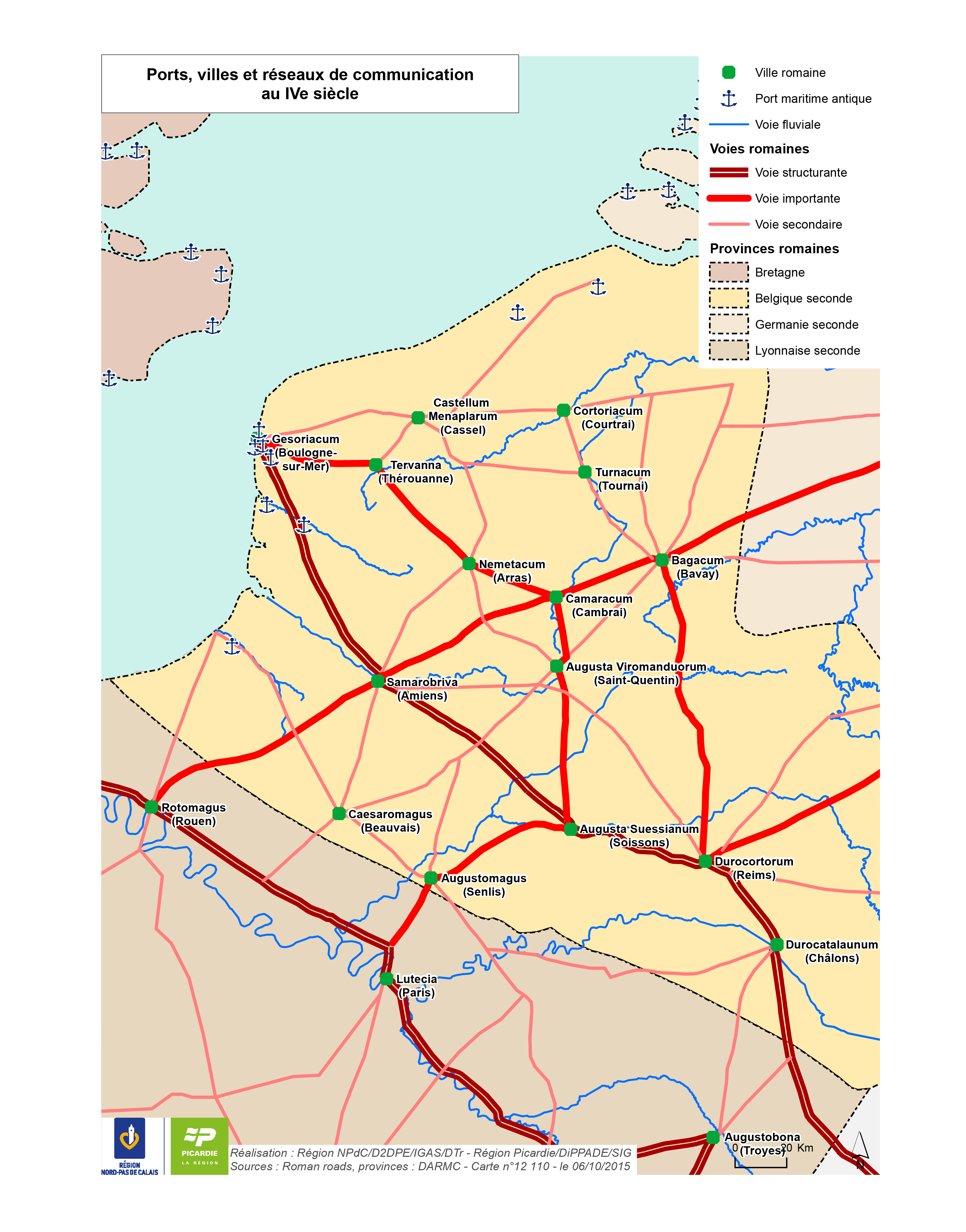
Ports, villes et réseaux de communication au IVe siècle
Cette carte présente les principales voies romaines ainsi que les limites de provinces romaines au IVe siècle.
Elle démontre l'importance et la densité du réseau historique et l'influence de ce dernier sur l’organisation spatiale actuelle.
|
|
Citation proposal
(2016) . Ports, villes et réseaux de communication au IVe siècle. https://services.mspdata.eu:/geonetwork/srv/api/records/c80b8b01-9c84-4034-a705-29e57b163389 |
Simple
- Date ( Publication )
- 2016-01-13 10:39:51
- Date ( Creation )
- 2015-10-06T00:00:00
- Identifier
- 12110
- Presentation form
- Digital map
- Credit
Point of contact
- Keywords
-
- Keywords ( Theme )
-
- Réseaux de transport
- GEMET - INSPIRE themes, version 1.0
-
- Mobilité, transport
- Denominator
- 200000
- Metadata language
- French
- Topic category
-
- Transportation
N
S
E
W
))
- Reference system identifier
- Lambert 93
- Distribution format
-
- PDF (1.7 )
- PNG ()
- OnLine resource
-
12110_ports_villes_reseau_communication_IV_siecle.png
12110_ports_villes_reseau_communication_IV_siecle.png
- OnLine resource
-
12110_ports_villes_reseau_communication_IV_siecle.pdf
12110_ports_villes_reseau_communication_IV_siecle.pdf
- Explanation
- Statement
Metadata
- File identifier
- c80b8b01-9c84-4034-a705-29e57b163389 XML
- Metadata language
- French
- Character set
- UTF8
- Hierarchy level
- Dataset
- Date stamp
- 2015-10-06T00:00:00
- Metadata standard name
- ISO 19115:2003/19139
- Metadata standard version
- 1.0

