Metadata catalogue
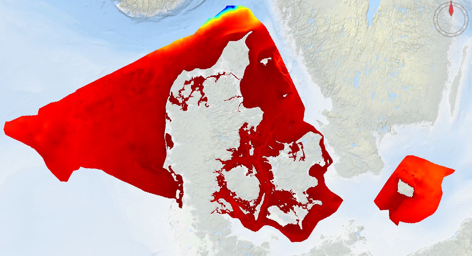
Denmark's Depth Model 2022 50m
Denmark’s Depth Model (DDM) is a depth-averaged digital bathymetric model, covering Denmark’s Exclusive Economic Zone (EEZ). The model has a grid resolution of 50 meters and is based on a collection of hydrographic survey datasets and historical sources.
|
|
Citation proposal
Danish Geodata Agency, Danish Hydrographic Office. Denmark's Depth Model 2022 50m. https://services.mspdata.eu:/geonetwork/srv/api/records/SDN_CPRD_4669_DDM2022_50m |
Simple
- Alternate title
- Date ( Creation )
- 2022-11-11
- Date ( Revision )
- Identifier
- DDM2022_50m
Originator
- Website
- web site
Custodian
- Website
- web site
- Project name ( Theme )
-
- EMODNet Bathymetry
- SeaDataNet device categories ( Theme )
-
- single-beam echosounders , multi-beam echosounders
- http://vocab.ndg.nerc.ac.uk/ ( Stratum )
-
- Parameter Discovery Vocabulary (P02) ( parameter )
-
- Bathymetry and Elevation
- GEMET - INSPIRE themes, version 1.0 ( Theme )
-
- Hydrography
- SeaDataNet depth measurement reference planes ( Theme )
-
- Use limitation
- Access constraints
- Creative Commons Attribution 4.0 International
- Use constraints
- Other restrictions
- Other constraints
- DO NOT USE FOR NAVIGATION
- Use limitation
- Not targeted for safety of navigation.
- Spatial representation type
- Grid
- Denominator
- 100000
- Distance
- 50 meter
- Metadata language
- English
- Character set
- UTF8
- Topic category
-
- Oceans
N
S
E
W
))
- Unique resource identifier
- Description
-
Map projection parameters, values and units :
Axes units :
- Unique resource identifier
- Codespace
- EPSG
- Version
- 7.4
- Number of dimensions
- 3
- Dimension name
- Column
- Dimension size
- 15798
- Dimension name
- Row
- Dimension size
- 8324
- Dimension name
- Time
- Dimension size
- 1
- Cell geometry
- Point
- Transformation parameter availability
- false
- Checkpoint Availability
- false
- Point in Pixel
-
- Distribution format
-
-
GeoTIFF
(1.0 )
- Specification
-
GeoTIFF
(1.0 )
Distributor
- OnLine resource
- EMODnet Bathymetry WMTS service
- OnLine resource
- EMODNET_DDM.JPG
- OnLine resource
- EMODnet viewer
- Hierarchy level
- Dataset
Vertical extent
- Maximum value
- -480
Vertical CS
Vertical datum
- Statement
- no information
- Hierarchy level
- Feature
- Dataset
- accuracy
Gridded data positional accuracy
- Name of measure
- horizontal accuracy
- Measure identification
- horizontal accuracy of coordinate
- Measure description
- Varying survey methods has been used over the years and hence it is impossible to set one value of the accuracy.
- Evaluation method description
Quantitative result
- Value type
- horizontal accuracy
Quantitative attribute accuracy
- Name of measure
- depth
- Measure identification
- depth accuracy
- Measure description
- Varying survey methods has been used over the years and hence it is impossible to set one value of the accuracy.
- Evaluation method description
Quantitative result
- Value
- not defined
Conformance result
- Date
- Explanation
- Hierarchy level
- Software
- Description
- Other
- software
- Hierarchy level
- Property type
- Description
- parameters of data processing
- Attributes
- Statement
- Description of data processing: The model was created using a regularly-spaced grid with the resolution of 50 meters. The horizontal datum of the model is ETRS89. The vertical datum is a combination of Mean Low Water Spring (MLWS), Lowest Astronomical Tide (LAT) and Dansk Vertikal Reference 1990 (DVR90). The extent of the model is constrained between the Danish EEZ and the coastline, generalized at 1:100,000 scale.
- Description
- Description of processed data sources :
- Hierarchy level
- Dataset
Absolute external positional accuracy
- Name of measure
- emodnet-bathymetry.QI.Horizontal
- Value
- 2 - Between 50 m and 20 m
Absolute external positional accuracy
- Name of measure
- emodnet-bathymetry.QI.Vertical
- Value
- -1 - Multisources
Domain consistency
- Name of measure
- emodnet-bathymetry.QI.Purpose
- Value
- 2 - Bathymetric/morphologic survey
Metadata
- File identifier
- SDN_CPRD_4669_DDM2022_50m XML
- Metadata language
- English
- Character set
- UTF8
- Hierarchy level name
- Product record
- Date stamp
- 2025-03-07T15:17:15.315287Z
- Metadata standard name
- ISO 19115:2003/19139 - EMODNET - BATHYMETRY
- Metadata standard version
- 1.0