Metadata catalogue
Altimeter product global Mean and Climatologies - Heights (multimission, level 4)
Ssalto/Duacs multimission gridded sea surface heights products. From January 1993 to the last extension of the Delayed-time products, the long delayed-time dataset allows to compute statistical means of Maps of Sea Level Anomalies (MSLA) over different periods of time.
Computed with respect to a twenty-year mean profile [1993-2012], and including the seasonal variability (no annual cycle is removed).
|
|
Citation proposal
. Altimeter product global Mean and Climatologies - Heights (multimission, level 4). https://services.mspdata.eu:/geonetwork/srv/api/records/9c243ca3-a567-462a-86a3-f4f34c5f1da3 |
Simple
- Date ( Creation )
- 2020-01-08
- Unique resource identifier
- Credit
-
AVISO+
Point of contact
- Centre de données ODATIS Centre de données ODATIS ( Theme )
-
-
CDS-SAT-AVISO
-
- Variables ODATIS Variables ODATIS ( Theme )
-
-
/Physical Oceanography/SSH (Sea surface height)
-
- Keywords
-
- Type de jeux de donnée ODATIS Type de jeux de donnée ODATIS ( Theme )
-
-
/Remote sensing
-
- Thèmatiques ODATIS Thèmatiques ODATIS ( Theme )
-
-
Remote sensing
-
- Use limitation
- Licence Licence
- Access constraints
- Other restrictions
- Use constraints
- Other restrictions
- Other constraints
-
Conditions of use are described in the Licence : https://www.aviso.altimetry.fr/fileadmin/documents/data/License_Aviso.pdf ,
Users should keep in mind that these products are experimental products. Notably, they are not produced on an operational basis.
- Spatial representation type
- Grid
- Distance
- 0.25 degree
- Metadata language
- French
- Character set
- UTF8
- Topic category
-
- Oceans
))
- Geometric object type
- Surface
- Distribution format
-
- ()
- OnLine resource
- Further information on AVISO+
- OnLine resource
- Accès authentifié aux données via FTP
- OnLine resource
- TDS fileserver Monthly Clim.
- OnLine resource
-
sla
sea_surface_height_above_sea_level
- OnLine resource
- TDS fileserver Monthly mean
- OnLine resource
- TDS fileserver Seasonal clim.
- Hierarchy level
- Dataset
- Statement
-
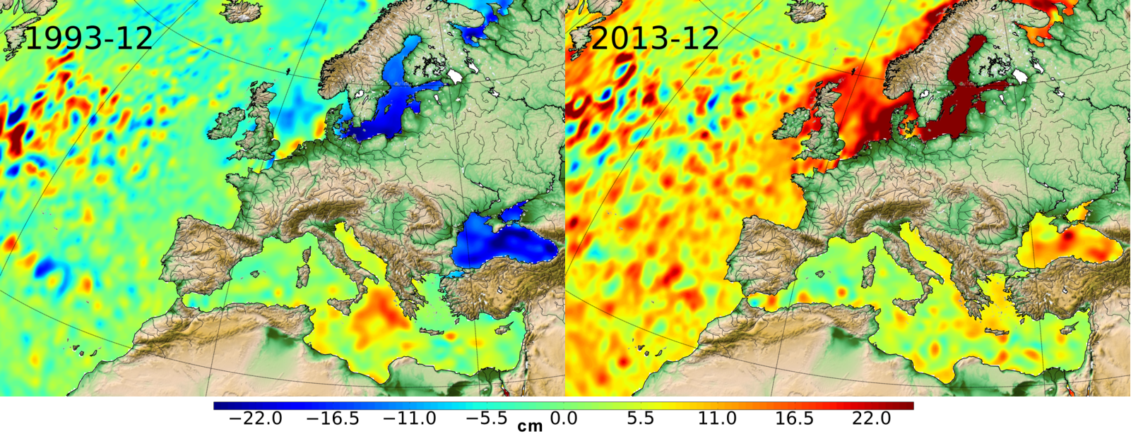
Averaged MSLA and Climatological MSLA are created from daily Ssalto/Duacs - DT MSLA - Merged Product - best sampling available in time (i.e. "all-sat-merged" serie, see Global Ocean gridded L4 Sea Surface Heights and derived variables reprocessed (1993- ongoing) and NRT for further information).
Three kinds of means are proposed:
* Monthly averaged MSLA corresponds to the weekly maps of delayed-time sea level anomalies averaging month by month from January 1993. We obtain one file and one map per month since January 1993.
* Seasonal mean of MSLA corresponds to the daily maps of delayed-time sea level anomalies averaging season by season. We obtain one file and one map per season (JFM - AMJ - JAS- OND).
* Climatological monthly MSLA are calculated by averaging the daily maps of delayed-time sea level anomalies over a same month from January 1993 up to the last extension of the Delayed-time products. We obtain one data file and one map for each month.
Metadata
- File identifier
- 9c243ca3-a567-462a-86a3-f4f34c5f1da3 XML
- Metadata language
- French
- Character set
- UTF8
- Hierarchy level
- Dataset
- Date stamp
- 2021-07-26T15:54:42
- Metadata standard name
-
ISO 19115:2003/19139 - SEXTANT
- Metadata standard version
-
1.0