Metadata catalogue
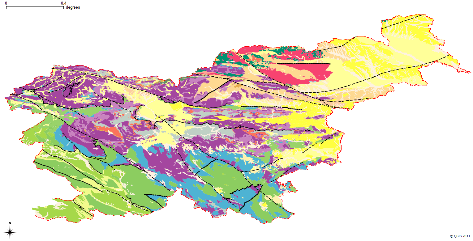
1GE GeoZS 1M surface geology WMS services
The harmonized geological map of Slovenia is a simplified version of the 1:250 000 scale Geological Map of Slovenia (Buser, 2009), which was compiled using the Basic Geological Map of Slovenia at a scale of 1: 100.000 (compiled by various authors during the 1960's to 1980's) with the addition of new information by Buser. It is primarily a lithostratigraphic map.The faults were selected for portrayal using two criteria; regional extent and tectonic importance. The map presented here was edited specifically for the purpose of the OneGeology-Europe project by M. Bavec, M. Novak, M. Poljak, M. Trajanova and D. Skaberne.
|
|
Citation proposal
Geološki zavod Slovenije (2008) . 1GE GeoZS 1M surface geology WMS services. https://services.mspdata.eu:/geonetwork/srv/api/records/8eecd24a-3f67-4dfe-a06d-7078b3fe0249 |
Simple
Identification info
- Date ( Creation )
- 2008-01-01
- Date ( Publication )
- 2008-01-01
- Date ( Revision )
- 2008-01-01
- Identifier
-
2b5119e9-c63b-4e31-a477-4e8449258e98
- Purpose
-
OneGeology
Owner
Point of contact
Custodian
- Keywords ( Theme )
-
-
WFS
,WMS
,GEOSERVER
,OSGeo
-
- GEMET - INSPIRE themes, version 1.0 GEMET - INSPIRE themes, version 1.0
-
-
Geology
-
- Keywords ( Place )
-
-
Slovenia
-
- Keywords ( Theme )
-
-
geology
,stratigraphy
,surface geology
,onegeology
,onegeology - Europe
,harmonized geology
,harmonized age
,harmonized data
,harmonized genesis
,harmonized structure
,Structural geology
,fault
,structure
-
- Keywords ( Theme )
-
-
INSPIRE
,EGDI
-
- ISO - 19119 geographic services taxonomy ISO - 19119 geographic services taxonomy
-
-
infoMapAccessService
-
- Keywords ( Theme )
-
-
regionalna geologija
-
- Spatial scope ( Theme )
-
-
National
-
- Use limitation
-
a. Dataset is not suitable for: This map has been produced at the country scale, mainly fo rscientific and educational purposes, and cannot be used when detailed geological information is needed. b. Charges applied: no c. Other conditions: yes d. More info URL: http://one.geology.cz/conditions/conditions_eng.pdf
- Use limitation
-
Data is available under a Creative Commons - Attribution 4.0 International (CC BY 4.0) license. ( https://creativecommons.org/licenses/by/4.0 )
- Access constraints
- otherRestrictions Other restrictions
- Use constraints
- copyright Copyright
- Other constraints
-
The 1:1M geologic map is available for free download for your personal, teaching, research or non-commercial use. Further use of any information provided by the Geological Survey of Slovenia (GeoZS) is at your own responsibility. GeoZS gives no warranty, condition or representation as to the quality, accuracy or completeness of the information or its suitability for any use or purpose. All implied conditions relating to the quality or suitability of the information, and all liabilities arising from the supply of the information (including any liability arising in negligence) are excluded to the fullest extent permitted by law
- Other constraints
-
Data is available under a Creative Commons - Attribution 4.0 International (CC BY 4.0) license. ( https://creativecommons.org/licenses/by/4.0 )
- Service Type
- view
))
- Coupling Type
- Tight
Contains Operations
- Operates On
- Reference system identifier
-
EPSG
/
- Reference system identifier
-
EPSG
/
- Reference system identifier
-
EPSG
/
- Reference system identifier
-
EPSG
/MGI 1901 / Slovene National Grid (EPSG:3912)
/7.9
- Reference system identifier
-
EPSG
/WGS 84 (EPSG:4326)
/7.9
- Distribution format
-
-
WMS
(1.3.0
) -
WFS
(2.0.0
)
-
- OnLine resource
- GE.GeologicUnit
- OnLine resource
-
gsmlp:SVN_GeoZS_1M_SGL_INSP
lithology
- OnLine resource
-
gsmlp:SVN_GeoZS_1M_SGA_INSP
age
- OnLine resource
- ge:GeologicUnit
- OnLine resource
- WFS GetCapabilities
- OnLine resource
-
ge:MappedFeature
WFS GetFeature
- Hierarchy level
- Service
- Other
-
service
Conformance result
- Date ( Publication )
- 2009-10-19
- Explanation
-
See the referenced specification
- Pass
- true
Metadata
- File identifier
- 8eecd24a-3f67-4dfe-a06d-7078b3fe0249 XML
- Metadata language
- slv Slovenian
- Character set
- utf-8 UTF8
- Hierarchy level
- service Service
- Hierarchy level name
-
infoMapAccessService
- Date stamp
- 2021-12-03
- Metadata standard name
-
ISO 19115:2003/19139
- Metadata standard version
-
1.0