 Metadata catalogue
Experimental altimetry products ocean MIOST Multiscale Interpolation (- Sea Surface Heights and Currents - delayed-time - (multimissions - level 4)
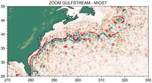
The MIOST (Multiscale Interpolation Ocean Science Topography) experimental altimeter product provides grids at delayed-time, at global scale, 1/10° spatial resolution, the sea surface height (MSLA and MADT) as well as the geostrophic currents, resulting from specific processing. Use for regional studies, ocean variability (mesoscale circulation,...).
|
|
Citation proposal
(2021) . Experimental altimetry products ocean MIOST Multiscale Interpolation (- Sea Surface Heights and Currents - delayed-time - (multimissions - level 4). https://services.mspdata.eu:/geonetwork/srv/api/records/6101834f-7733-449f-9a75-ef027578baf1 |
Simple
- Date ( Publication )
- 2021-01-01
- Date
- Unique resource identifier
- Credit
-
AVISO+
Point of contact
- Centre de données ODATIS Centre de données ODATIS ( Theme )
-
-
CDS-SAT-AVISO
-
- Variables ODATIS Variables ODATIS ( Theme )
-
-
/Physical Oceanography/Currents
,/Physical Oceanography/SSH (Sea surface height)
-
- Keywords
-
- Type de jeux de donnée ODATIS Type de jeux de donnée ODATIS ( Theme )
-
-
/Processed data/Composite products
,/Remote sensing
-
- Thèmatiques ODATIS Thèmatiques ODATIS ( Theme )
-
-
Added-value products
-
- Processing level Processing level ( processing-level )
-
-
Level 4
-
- Use limitation
- Licence ouverte Licence ouverte
- Access constraints
- Other restrictions
- Use constraints
- License
- Other constraints
-
Conditions of use are described in the Licence : https://www.aviso.altimetry.fr/fileadmin/documents/data/License_Aviso.pdf ,
Users should keep in mind that these products are experimental products. Notably, they are not produced on an operational basis.
Citations : "Those products were processed by SSALTO/DUACS and distributed by CDS-SAT-AVISO ( https://www.aviso.altimetry.fr ) with support from CNES”.
- Spatial representation type
- Grid
- Metadata language
- French
- Character set
- UTF8
- Topic category
-
- Oceans
))
- Geometric object type
- Complex
- Distribution format
-
-
()
-
()
- OnLine resource
-
Authenticated access to MIOST
Authenticated access to MIOST
- OnLine resource
- Further information on AVISO+
- OnLine resource
-
Handbook
Handbook
- OnLine resource
-
TDS fileserver data MIOST
TDS fileserver data MIOST
- Hierarchy level
- Dataset
- Statement
-
The input data used to compute the gridded products obtained with Multiscale Interpolation Ocean Science Topography (MIOST) are the along-track (or Level-3) SEA LEVEL products delivered by the Copernicus Marine Service (CMEMS, http://marine.copernicus.eu/ ) for satellites OSTM/Jason-2, Jason-3, SARAL/AltiKa, Cryosat-2, HaiYang-2A, Copernicus Sentinel-3A&B.
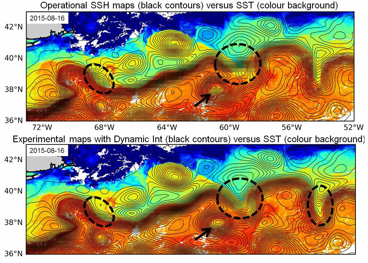
The Multiscale Interpolation (MIOST) merges along-track ocean altimetry data into continuous maps in time and space. Like the DUACS mapping system, it is based on a linear optimal interpolation scheme, with a different level of covariance function definitions. For this experimental product, we have only considered covariance functions representative of the mesoscale geostrophic variability.
References for gridded computed with Multiscale Interpolation (MIOST):
- Ubelmann et al, 2021: Reconstructing Ocean Surface Current Combining Altimetry and Future Spaceborne Doppler Data, JGR Oceans, DOI: https://doi.org/10.1029/2020JC016560
- Ubelmann, C. et al. : Simultaneous estimation of Ocean mesoscale and coherent internal tide Sea Surface Height signatures from the global Altimetry record, Ocean Sci. Discuss. [preprint], https://doi.org/10.5194/os-2021-80 in review, 2021.
Metadata
- File identifier
- 6101834f-7733-449f-9a75-ef027578baf1 XML
- Metadata language
- French
- Character set
- UTF8
- Hierarchy level
- Dataset
- Date stamp
- 2021-12-08T13:54:37
- Metadata standard name
-
ISO 19115:2003/19139 - SEXTANT
- Metadata standard version
-
1.0
Overviews


Provided by
