Metadata catalogue
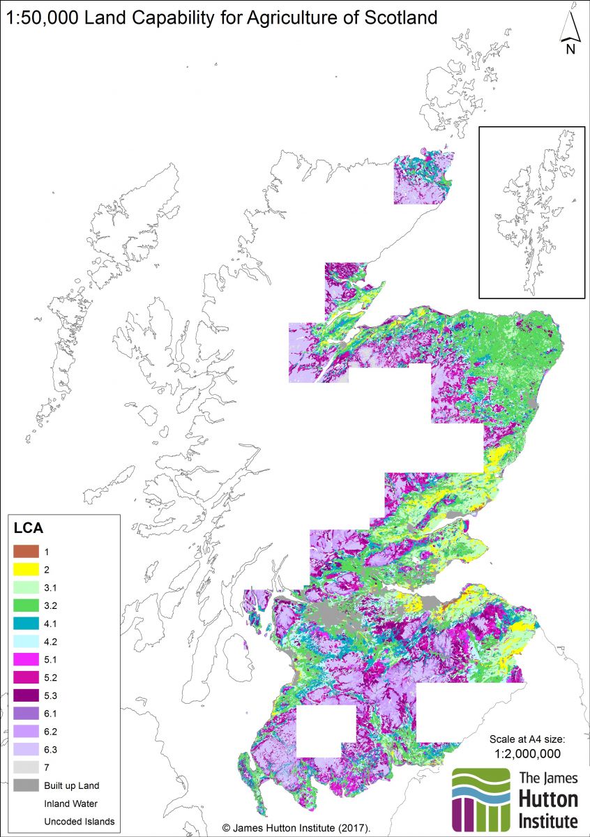
1:50,000 Land Capability for Agriculture WMS. (Land capability for agriculture, partial cover)
This service is the digital (vector) version of the Land Capability for Agriculture of Scotland 1:50,000 maps. Also known as "Land capability for agriculture (partial cover)". Refer to the datasets for more information.
|
|
Citation proposal
The James Hutton Institute (2014) . 1:50,000 Land Capability for Agriculture WMS. (Land capability for agriculture, partial cover). https://services.mspdata.eu:/geonetwork/srv/api/records/51658af8-3eb4-4a44-aea6-0e5520e3e6d2 |
Simple
Identification info
- Date ( Publication )
- 2014-02-13
- Identifier
- LCA_Scotland_50K
Custodian
Distributor
- Maintenance and update frequency
- irregular Irregular
- GEMET - INSPIRE themes, version 1.0 ( Theme )
-
- Land use , Soil
- INSPIRE Service taxonomy ( Theme )
-
- infoMapAccessService
- Access constraints
- otherRestrictions Other restrictions
- Other constraints
- no limitations on public access
- Use limitation
- This data was produced at a scale of 1:50,000. Smaller scale data is available for the whole of Scotland. Use is permitted under the terms of the Open Data licence included in the download.
- Service Type
- view
N
S
E
W
))
Contains Operations
No information provided.
- Reference system identifier
- EPSG / OSGB 1936 / British National Grid (EPSG:27700) / 7.9
- Distribution format
-
- ESRI Shapefile (1.0 )
- OnLine resource
- 1:50,000 Land Capability for Agriculture View Service
- Hierarchy level
- service Service
- Other
- Service
Metadata
- File identifier
- 51658af8-3eb4-4a44-aea6-0e5520e3e6d2 XML
- Metadata language
- eng English
- Hierarchy level
- service Service
- Hierarchy level name
- Service
- Date stamp
- 2018-02-06
- Metadata standard name
- ISO 19115:2003/19139
- Metadata standard version
- 1.0