 Metadata catalogue
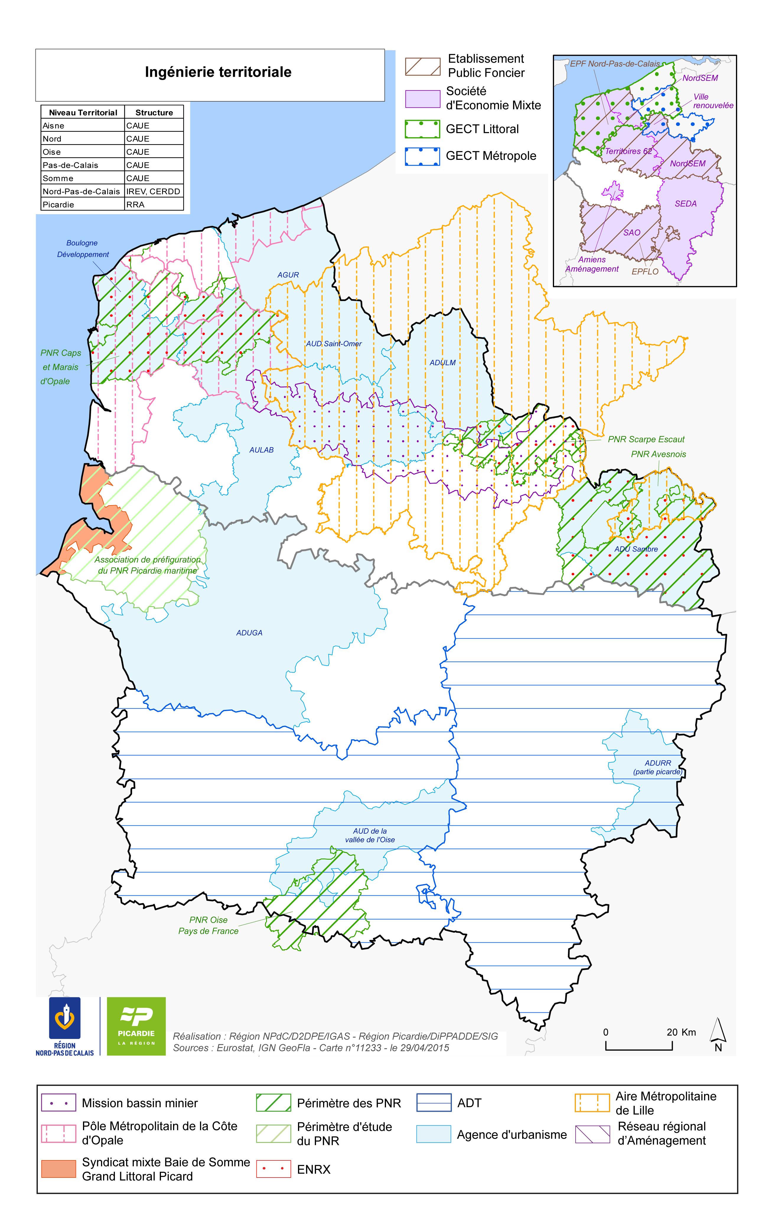
Ingénierie territoriale
L’ingénierie territoriale peut être définie comme « l’ensemble des moyens humains et des missions concourant à l’élaboration et la conduite d’un projet territorial, et à la définition, au montage et la mise en œuvre d’actions ».
Les structures d'ingénierie territoriale sont réparties de façon hétérogène sur les territoires de la nouvelle région, avec des espaces très bien dotés, et d’autres moins outillés, en matière d’appui à l’ingénierie tant au niveau stratégique qu’opérationnel.
|
|
Citation proposal
(2016) . Ingénierie territoriale. https://services.mspdata.eu:/geonetwork/srv/api/records/50bc4313-d39a-4d8b-b1ad-a69c28773fe6 |
Simple
- Date ( Publication )
- 2016-01-14 16:25:11
- Date ( Creation )
- 2015-04-29T00:00:00
- Identifier
- 11233
- Presentation form
- Digital map
- Credit
- Keywords
-
- ingénierie , aménagement du territoire , EPF , SEM , GECT , urbanisme , pôle métropolitain , aire métropolitaine , ENRX , ADT
- Keywords ( Theme )
-
- Usage des sols
- GEMET - INSPIRE themes, version 1.0
-
- Urbanisme et foncier , Zonages divers
- Denominator
- 1050000
- Metadata language
- French
- Topic category
-
- Planning cadastre
N
S
E
W
))
- Reference system identifier
- Lambert 93
- Distribution format
-
- PDF (1.7 )
- PNG ()
- OnLine resource
-
11233_ingenierie_territoriale_2015.png
11233_ingenierie_territoriale_2015.png
- OnLine resource
-
11233_ingenierie_territoriale_2015.pdf
11233_ingenierie_territoriale_2015.pdf
- Explanation
- Statement
Metadata
- File identifier
- 50bc4313-d39a-4d8b-b1ad-a69c28773fe6 XML
- Metadata language
- French
- Character set
- UTF8
- Hierarchy level
- Dataset
- Date stamp
- 2015-04-29T00:00:00
- Metadata standard name
- ISO 19115:2003/19139
- Metadata standard version
- 1.0

